Tuesday, October 18, 2022

Skitchewaug's Fertile Intervale


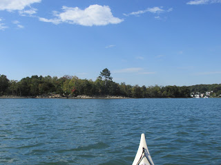
I wasn't planning another trip to Vermont this fall...but then I came across A Prehistoric Inventory of the Upper Connecticut River Valley by Daniel Cassedy.  One of the sites he listed in his inventory was the Skitchewaug Site alongside the Connecticut River where Native American corn found in storage pits was radiocarbon-dated back 1100 years. Because of this he wrote that the site was "...one of the most significant sites currently known in the Northeast."  After reading this it took only a few weeks until I found myself looking upriver from the Skitchewaug Site shoreline this past Sunday morning (above photo).

I'd launched at the confluence of the Black and Connecticut rivers at about 8am.  The air temperature was about 40 degrees whereas the water being much warmer resulted in considerable fog ...

The Skitchewaug Site is located where a fertile floodplain stretches from the mountain's base over to the Connecticut River...


In a paper for the Journal of Vermont Archaeology (Vol. 12, 2011) titled Western Abenaki of the Upper Connecticut River Basin: Preliminary Notes on Native American Pre-Contact Culture in Northern New England  R. Duncan Mathewson III states "Quite clearly Skitchewaug Site represents a major village settlement on the west bank of the Connecticut River some 500 hundred years before Contact times and into the Protohistoric Period."  Hard for me to wrap my head around the fact that Native Americans planted and harvested corn in these fields for eleven hundred years.  That's more than 13,000 full moon cycles!

Further upriver the floodplain widens out even more and these few remaining corn stalks...

...speak to one of Mathewson's conclusions: "The presence of corn in all seven storage pit features at Skitchewaug has been interpreted by Heckenberger et al. (1992) as indicating that corn was an important diet staple rather than simply a diet supplement."

Returning to my boat I found the sun finally breaking through the fog and the day was improving by the minute.  I followed the river bank up as far as the now submerged (I guess) Glidden Island before heading back downriver.  The view of Skitchewaug Mountain from near where Glidden Island used to be...

The person having the best view of Skitchewaug Mountain and the river alongside it was this guy...


On the way and about a half mile below Skitchewaug I thought about the Wentworth Ferry and the role it played in linking sections of the Crown Point Road which connected the Fort at No. 4 in present-day Charlestown, NH and the fort at Crown Point on Lake Champlain.  Soldiers beginning the trip from the Fort at No. 4 on the New Hampshire side would march about 2 miles to a point where the ferry would take them across the Connecticut to the Vermont side.  The only spot I could find on the river's west side where the riverbank looked suitable for a ferry landing was this one...


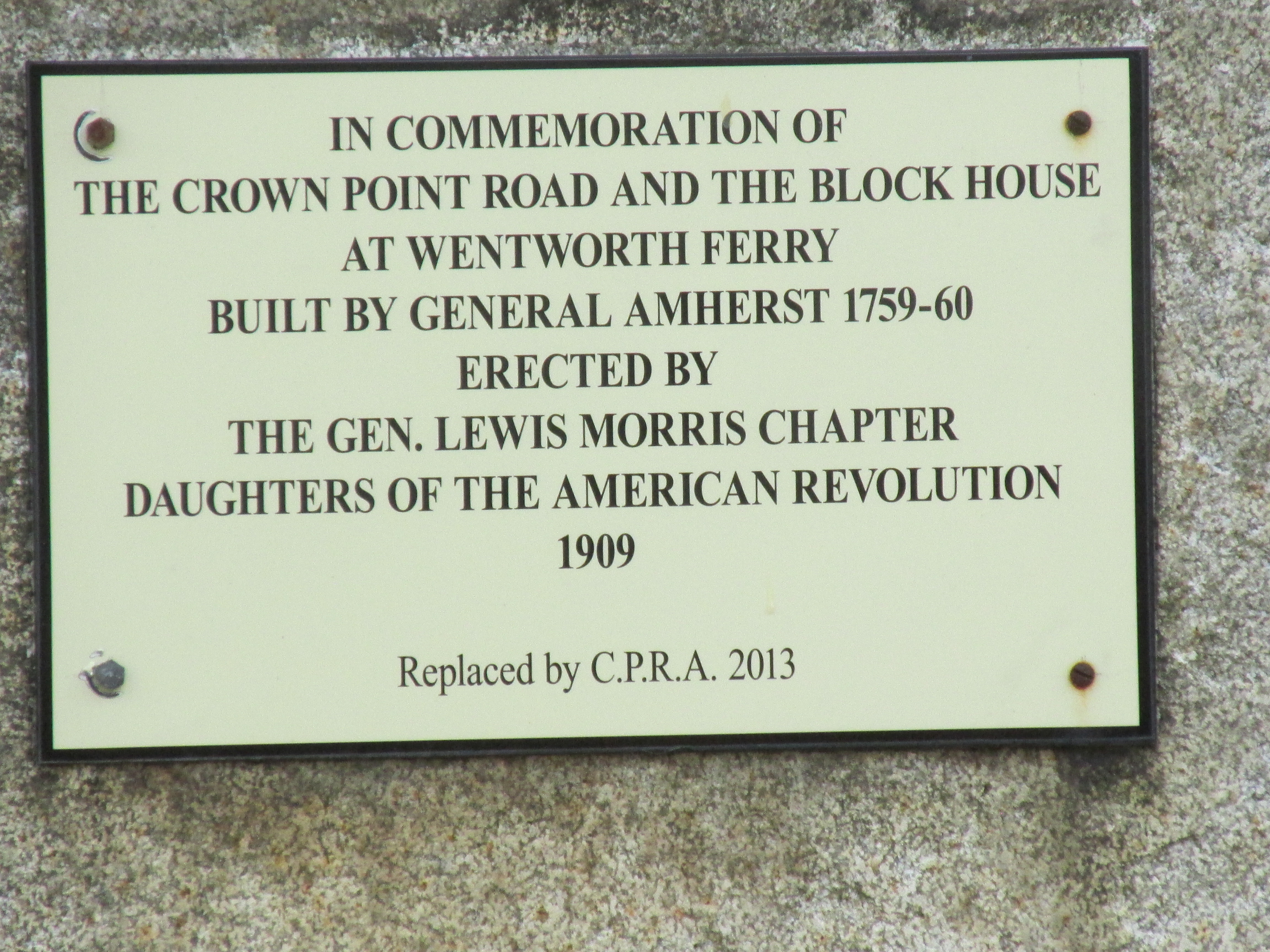
It's approximately 900' south from these two historical markers:

A plaque on a large stone pertains to both the ferry and the Crown Point Road...


...and an additional marker for the road...

According to the Crown Point Road Association the road was built per the order of British General Jeffery Amherst upon his having gained possession of both Ticonderoga and Crown Point, both key forts on Lake Champlain during the French and Indian Wars.  In order to advance further north towards French controlled Canada he needed a reliable supply route to and from the Fort at No. 4 some 70 miles to the southeast.  Part of his order for building the road stated "...the most direct line possible to No. 4 clearing the forest all the way you go and widening it in every part to at least 20 feet....".  On the association's website, crownpointroad.org, there are GPS coordinates for the road's remaining stone markers.  The coordinates were recorded by Hunter Melville and are a great help to those looking to locate them. 

On my drive home I visited some related historical markers in Charlestown, NH near the spot where the Crown Point Road terminated at the original Fort at No. 4...


Fort at No. 4 was actually located about a mile and a half south of the fort's present-day replica.

This additional marker mentions Gen. John Stark's 1777 march to the Battle of Bennington...

His route to Bennington is known to have taken him through Manchester VT leaving me to wonder if he and his men crossed the Connecticut via Wentworth's Ferry and followed the Crown Point Road for part of the way.  If so, it would have been fitting as he'd played a role in building the Crown Point Road some 18 years earlier.


Earlier last week I got out on the Sudbury and Assabet rivers. The Route 27 Bridge over the Sudbury in Wayland showed some fall colors...

...and an osprey did some fishing...


My paddle on the Assabet River in Stow provided additional fall foliage at the Assabet Overlook...

...and the Assabet showed plenty of wildlife with swans, ducks, geese, as well as this hawk...

 ...this bald eagle...

...and this white-tailed deer wearing its darker winter coat...

My photo of trash from the Sudbury River was accidentally deleted but consisted of the usual culprits... half a dozen or so plastic bottles.


Trash from the Assabet...


Sunday's trash from the Connecticut River also known as the "Kwenitekw" to the Abenaki people...


Sunday, October 9, 2022

Slate, Grape, and Stodder's Neck


This past Friday's fleeting taste of summer weather provided perfect conditions for paddling some of  Boston Harbor Islands National and State Park.  The above looks across Hingham Bay towards the distant Boston skyline.

I launched from Hingham Harbor and paddled by little Button Island just after sunrise...


While paddling past Crow Point and towards Slate Island the unexpected cry of a loon was heard and drew my attention...

I know loons winter in the ocean but it seemed more than a little early to me.

Upon making landfall at Slate Island the many broken bits of slate explained the island's name...


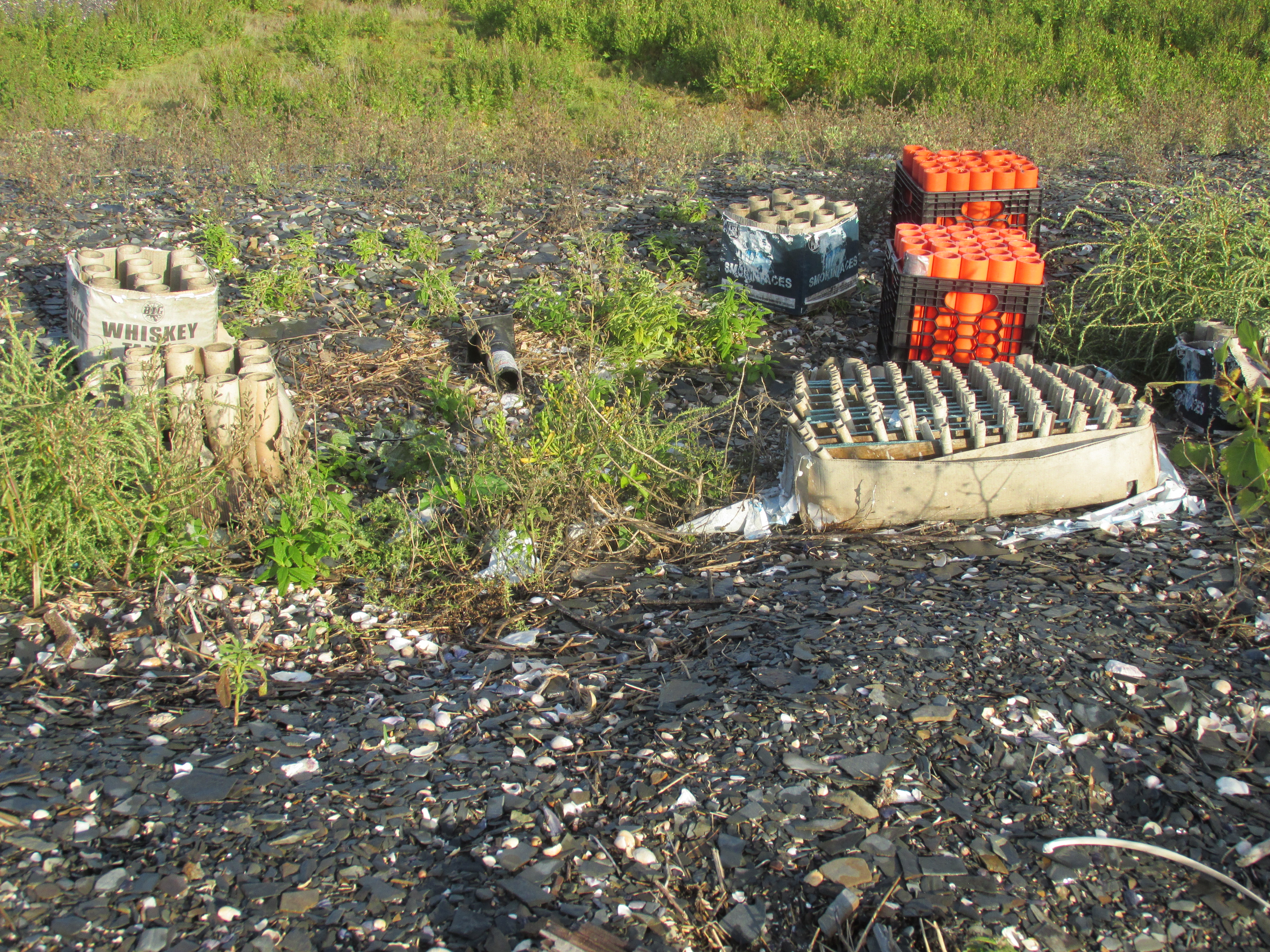
One spot on the island had been used as a launching spot for fireworks...
...with names such as Whiskey Tango and Smokin' Aces.

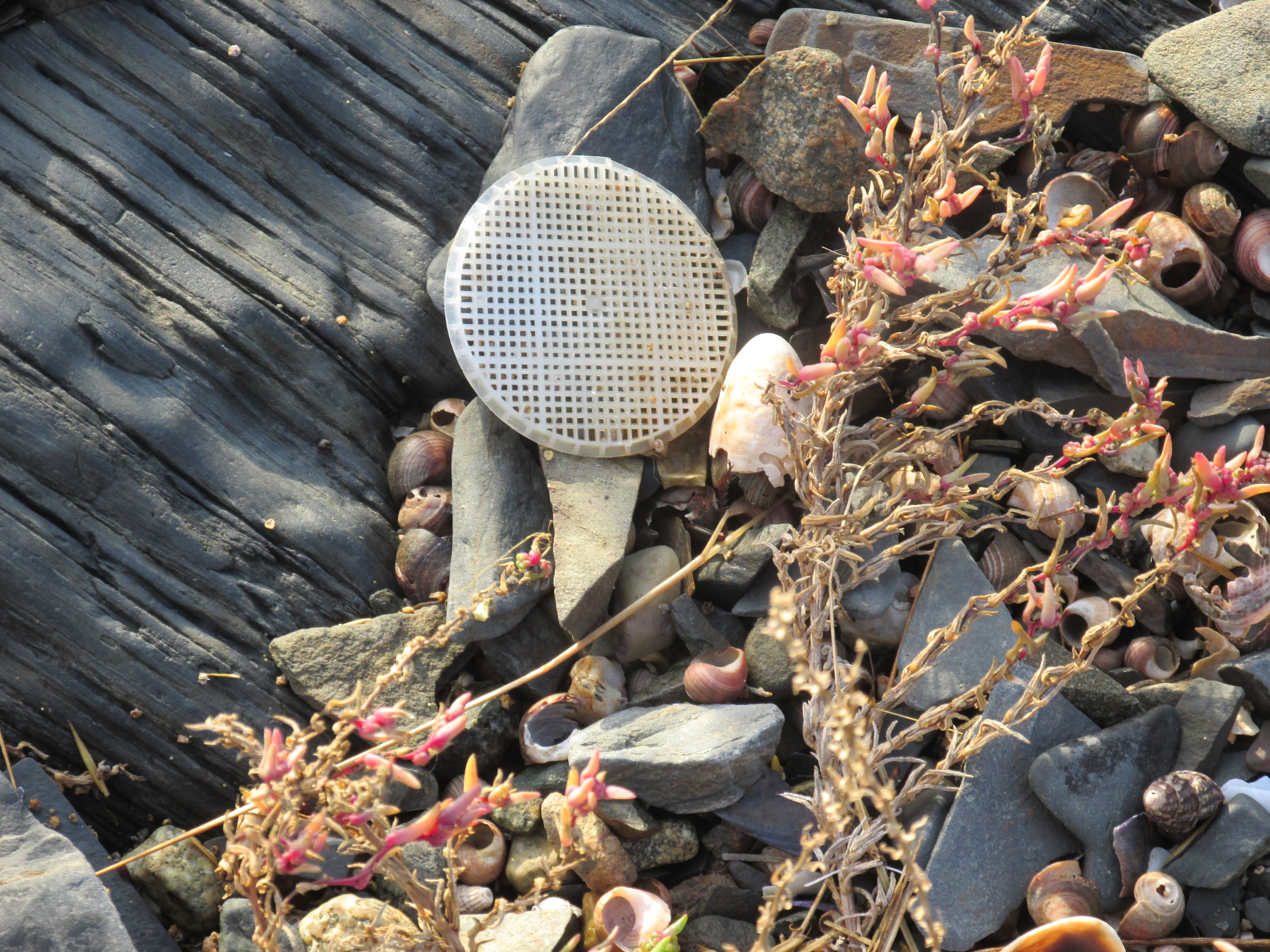
Also seen was this lone-wandering wafer from a wastewater treatment plant located some 40 miles inland from the Merrimack River's mouth at Newburyport...

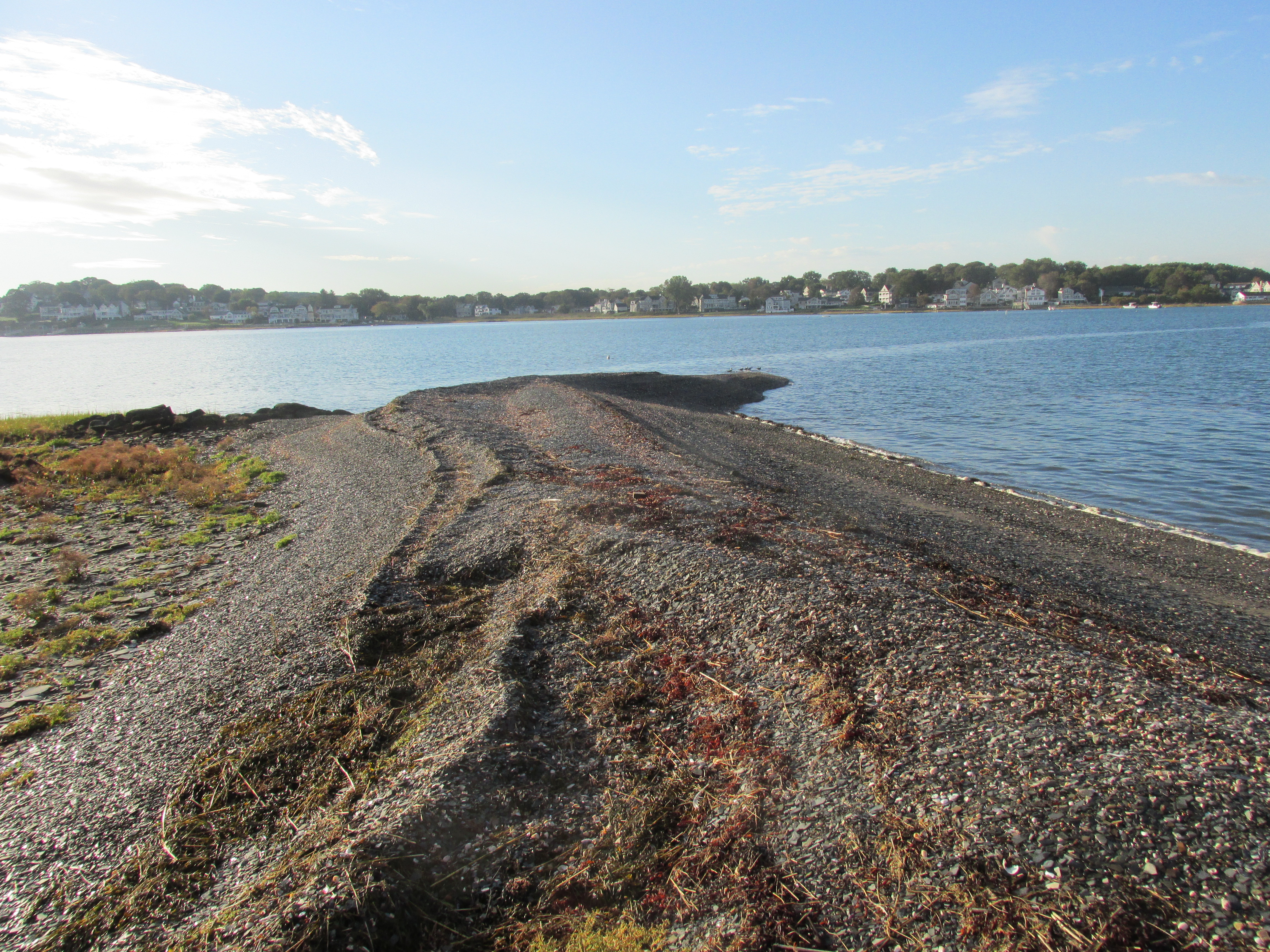
A wave-sculpted spit stretched from the island...

Leaving Slate Island I headed over to the 101-acre Grape Island and was greeted by this welcoming committee on the way...

Landed on the grassy ocean side of the island made easy by the high tide and sea grass...

Later I re-launched and paddled around the island to its more official landing spot.  On the way paddled past this interesting rock which may be an example of Roxbury Puddingstone...
...which I recently learned is the Massachusetts state rock.  Who knew?

Approaching the Grape Island landing...

...with its pier and dock built to accommodate boats much bigger than mine...
As far as I could tell I had the whole island to myself.

A stone foundation remains on the island and is explained...


Near the island's highpoint were several primitive campsites...

View of Boston from one of the benches...

According to bostonharborislands.com: "Since it was never used for industry or defense Grape Island has retained its serenity and natural beauty".

Upon leaving Grape I gave thought to paddling to the presumed site of a 1622 settlement known as Wessagusset near Weymouth's Fore River.  However reaching the entrance to the Fore River would require crossing a channel fairly busy with ferry boats and other commercial traffic...
So instead I opted for the Back River which was relatively mellow by comparison.  Stayed close to the Hingham side of the river while passing Hewtitt's Cove...
...which was the point where most of the ferry boats were stopping for passengers.


Beyond Hewitt's Cove I approached Stodder's Neck where many folks and their dogs were enjoying the day...

Crossing under the Route 3A bridge area I was about a mile or so east from where the Wessagusset Plantation site is presumed to have been located between the Fore and Back rivers.  Thomas Weston established this English settlement 2 years after the Plymouth Colony, and Wessagusset was intended to be a commercial enterprise rather than a religion-based settlement.  Unlike the Plymouth Colony there were no women and children...only 60 men.  The Englishmen of the Wessagusset Plantation were ill-suited to farming and hunting and unable to conserve their food supplies.  Because of this they frequently resorted to stealing from the Native Americans.  The situation deteriorated to the point where the Plymouth Colony felt their intervention was required.  Plymouth officials had heard rumors from the Native American, Hobbamock, of there being a Native American conspiracy involving the Massachusett and 7 other tribes.  Hobbamock attributed the rumors to his friend Massasoit and claimed the aforementioned tribes were in agreement and planning to attack the Wessagusset settlement.  Based upon this information Plymouth Colony sent Myles Standish and 7 of his soldiers along with Hobbamock to save the Wessagusset settlers from such an attack.  According to Edward Winslow's Good Newes from New England (1624), Standish and his men found the plantation's ship Swan at anchor and unguarded.  Fearing the worst they fired a gunshot which resulted in the Wessagusset settlers emerging from the adjacent woods where they'd been gathering ground-nuts and other food.  Standish asked them why the ship was unguarded and they replied that all was fine and they had no reason to fear the Indians.  Standish then convinced them otherwise and shortly thereafter lured several members of the Massachusetts Tribe into a room for a meal and some supposed trading.  Once in the confines of the room he and his men killed Peskuot, Wituwamat, and a third man.  Witawamat's teenage son was taken outside and hanged.  Standish then ordered that any other Native Americans should be killed as well.  When Standish left he took the severed head of Wituwamat with him to Plymouth where it was mounted on a pole for all to see.  This marked the end of the original Wessagusset Plantation.  So, with this being the day before Indigenous People's Day, I'm left to wonder if such brutal measures by Standish were justified considering they were based only upon rumors of a conspiracy.  Was there really such a plot?...or was it concocted by rivals of the Massachusetts Tribe who stood to gain?  I suspect only Hobbamock and Myles Standish knew the real truth.  Wonder if either of them ever lost any sleep over it.  Guess we'll never know for sure.   


All food for thought as I crossed under the Route 3A bridge.  Here the gathering pace of the outgoing tide persuaded me to turn back despite the inviting view further upriver...

My trip back to Hingham Harbor was made easy with a southwest breeze at my back. It was an incredible day to be out on the water.  The course I paddled is marked in red on this map from a 1995 Massachusetts Coast Guide produced by the Massachusetts Coastal Zone Management Office...


Earlier in the week, on Tuesday, I paddled the Nashua River from the Oxbow NWR in Harvard, MA where glimpses of fall color are starting to appear...

Trash for Tuesday...
...included another 68 nip bottles from this stretch of river where they seem to grow on trees.


Trash of a saltier nature from Friday...


Saturday, October 1, 2022

Lost Lake and Two Regular Haunts

Sandwiched between paddles on two familiar haunts, this past week was my first visit to Lost Lake/Knops Pond in Groton, MA, a Massachusetts Great Pond.  The lake is described by Mass Fisheries and Wildlife: "This 204-acre impoundment is actually three ponds that were bound into one when water levels were raised by a dam."   Two of those ponds were Knops Pond and Springy Pond.  I chose to visit the lake on an early-morning weekday in the shoulder season when it would be less busy and I found it serene...  

Finding Lost Lake wasn't a problem...it was the boat launch that proved a bit elusive.  Though maps don't provide an address with a street name for the public boat launch I finally found it at the end of a short road bearing a street sign "Paul Revere".  The kiosk's many warnings...

...pertain to nuisance aquatic plants that can be brought in from other waterways via boats and trailers.   These invasive plants have plagued the lake in the past and are presently controlled with aquatic herbicides. 

After launching near the lake's north end I worked my way around the lake in a counter-clockwise direction and soon found the lake's outlet to Cow Pond which, in turn, flows into Cow Pond Brook leading to Massapoag Pond and eventually the Merrimack River.


The shores of the lake are mostly developed with a variety of cottages and year-round homes.  My attention was drawn to some of the older cottages such as this one which has seen better days...

Probably the wildest part of the lake was the cove where Martin's Brook, a tributary, enters...
...and where this blue heron had the place to itself...

Grotonwoods Camp and Conference Center owns 247 acres along the lake and has its own beach...

At the narrowest part of the lake red and green buoys try to channel the boat traffic...


Saw this shoreside home that its owner could paddle right into (sweet!)...

Just as I was finishing my loop around the lake the sun emerged...
...and persuaded me to extend my paddle...as I had nowhere to go and all day to get there.  Saw only 3 other boats over the course of the morning.

Earlier in the week, on Sunday, I got out on the Sudbury River and headed up to Fairhaven Bay...

At the Egg Rock inscription it was noted that water levels are slowly being replenished...


On Thursday I paddled a sun-splashed Nashua River from Petapawag in Groton, MA...

Saw some early fall color...
...and a bald eagle watching over some ducks...

Not too far from where the eagle was perched was this large nest...
Speaking of bald eagles I was saddened to read this morning of noted wildlife photographer Maury Eldridge having passed away.  Maury was a fellow paddler and he and I would occasionally encounter each other on the Sudbury River.  He graciously shared incredible photographs he'd captured of eagles as well as locations of nests and the fate of eaglets.  If I recall correctly the last time we talked he shared some photographs of the wayward Steller's Sea Eagle that showed up this past winter on the Maine coast.  Rest in peace Maury.

On the Nashua a male wood duck in full regalia was seen...


The day was a beauty and this pine-needle covered spot proved perfect for taking lunch...


Sunday's trash...


Tuesday's trash which included my 1,000th nip bottle of the year...


Thursday's trash...