Friday, August 30, 2013

In Search of the Otter's Mouth

Prior to yesterday, the Otter River's confluence with the Millers River was just a remote-looking spot on a map and some scribbled directions in the back of my date book.  That all changed when a work assignment brought me to the general area and, once done, left me a good chunk of the afternoon for aquatic explorations.  I followed my directions to New Boston Road in Winchendon, and from the bridge on that dirt road looked down the Millers River in my intended direction (photo at left).
Cloudy skies and an occasional light mist combined to create ideal conditions for exploring such ancient waterways.  At the launchsite another kayaker was encountered...
...Gary of Clinton, MA had camped nearby the previous night and was exploring the same general area.  Our paths crossed several times when we shared tips on overcoming obstacles such as the numerous beaver dams and blowdowns.   Downpours overnight had disrupted his sleep and forced an emergency tent relocation.  At least the rains had raised water levels a bit which helped with the beaver dam assaults.

At a bend in the Millers, King Philip Rock loomed on the river's bank...
Upon closer inspection it was apparent that the overhanging section has sheltered more than a few impromptu campfires over the eons...
The rock is named for Metacomet (whom the Colonists called King Philip) of the Pokanoket tribe of Native Americans.  Metacomet's father was Massasoit, leader of the Wampanoag Federation and friend to the Plymouth Colony.

After paddling only a short distance beyond the large rock, and making one portage around a downed tree, my objective came into view...
..the mouth of the Otter River.

Landing near this point I ascended a hill to about 15 feet above the confluence and enjoyed this view looking westward towards Birch Hill...
...would have been a nice spot for a few wigwams.

The silence was soon broken by the not too distant rumbling of a freight train.  If not for obstacles such as this...
...I might have seen the tail-end of the train cross over the river.  However, by the time I reached the bridge both the train and the tracks were gone...
Of course if I'd arrived prior to 1941 the train would have passed here, but in that year the US Army Corps of Engineers built the Birch Hill Dam flood control project. This necessitated the relocation of the Fitchburg Railroad's tracks and bridge further to the south where I ultimately turned around...
 
This bridge still sees several trains per day.

In this area were seen belted kingfishers, blue herons, as well as discarded freshwater clam shells where perhaps raccoons had dined.  Cardinal flowers were also plentiful in spots...

The waters of both the Otter and Millers looked very clean and it is said the Nipmuck peoples called the Millers River Payqueage  meaning "clear water" in their language.  The two rivers reminded me of the Squannacook in many ways.

The distance travelled from New Boston Road to the active railroad bridge on the Otter was less than 2 miles.  It also looks possible to continue down the Millers River another 2 miles + to the Birch Hill Dam location.

My trip back to the takeout required overcoming the same obstacles in reverse (but still paddling forward) and soon the New Boston Road bridge came into view...

 My trash haul was small...
Only 8 recyclable containers (4 redeemable) and 12 pieces of miscellaneous rubbish such as plastic bags etc.  YTD = 4182

This one piece of trash served as testament to just how high these waters can get...

Anyone wanting to paddle this area should take Rt. 202 north out of Templeton and take a left at this sign...
...go past the parking area and the lake's SW side to the unpaved New Boston Road which leads  to the river. So long as beaver dams don't easily deter you, some nice paddling awaits.

Wednesday, August 28, 2013

Serenity in Cochituate

Not far from the hustle and bustle of Natick's Routes 9, 30, and 90 is a serene little spot at the end of a short dirt road. The parking area is in a shady grove where some folks just relax in their cars while others go closer to the water's edge to fish or enjoy the breeze from their lawn chairs.  It's a very tranquil place.  I sought refuge there after completing my morning work-related chores and within 20 minutes of arriving found myself contemplating this little island...
My time on the water today was confined to the North Lake which seems more peaceful than the Middle of South Lakes.

I visited the lake's outlet which wasn't letting out much in the way of water to Cochituate Brook and the Sudbury River beyond...

Enroute to this spot I'd come across 24 empty beer bottles that had been left in the woods alongside the lake, all within 10 feet of each other.

Heading north I came across a heron who'd commandeered a boat and may have been trying to enlist some ducks as crew...

Before ending my relaxing time on the lake, this day's trash haul got in a little beach-time...
There were 32 recyclable containers (30 redeemable) and 9 pieces of miscellaneous rubbish. 
YTD = 4162

Later my car, boat, and I crept slowly out onto a busy route 30.

Sunday, August 25, 2013

Up the Merrimack to Nashua

Upon finishing some morning work in Bedford yesterday I was hoping to get my boat into water a little deeper and wider than my local rivers have been of late.  Shortly I was driving up Route 3 to Tyngsborough where I launched into the Merrimack River.  That's when it occurred to me that closing a loop, so to speak, was within my reach.  Paddling the stretch of the Merrimack between Tyngsborough and the Nashua River confluence would put another 6 miles of this river under my boat's hull.  The photo at left shows my approach to the Circumferential Highway Bridge in Nashua,NH.  At that point I was bound and determined to reach the Merrimack's confluence with the Nashua River after another 3 miles of upriver paddling.

On my way I encountered only one other paddler...

...Tony Foley, a singer enjoying some downtime on the river before performing Caribbean themed songs at the Bahama Breeze Island Grille in Tyngsborough.

A variety of power boats were seen including one towing a water-skier.

At last I passed under the Route 111 bridge and the Nashua/Merrimack confluence was reached...
I poked into the Nashua River just enough to pickup 2 bait tubs and a couple of empty beer cans which topped off my ship's hold for trash.  My boat and I rested briefly on the tongue of the confluence...
...bow pointing towards the Merrimack while stern floats in the Nashua.

On the trip downriver I hugged the west side and was able to briefly enter Salmon Brook where it drops over a small dam.  This is the view one has from Salmon Brook just before passing under the railroad tracks and into the Mighty Merrimack...

A little further downriver, also on the west side, was this geyser of sorts...
I believe it was the treated effluent from the City of Nashua Wastewater Treatment Facility.

Once back in Tyngsborough I poked around the bend in the river just far enough to get this glimpse of the elegant bridge spanning the river there...

Returning to the takeout this gaping gator was seen...

My trash haul had assembled earlier on a safer sandy beach...
Most of this trash was found near spots where ropes allow folks to take the plunge.  Aside from these spots the river was relatively clean.
Nonetheless, today's haul included 88 recyclable containers and 29 pieces of miscellaneous rubbish such as plastic bags and cardboard packaging.  YTD = 4121

This stretch of river saw another small boat heading upriver some 174 years ago at the beginning of September.  John and Henry Thoreau were on the third day of their Concord and Merrimack journey in 1839 when they passed through the same area.  Henry would later, in his book A Week on the Concord and Merrimack Rivers, make this comparison of the two rivers: "Unlike the Concord, the Merrimack is not a dead but a living stream, though it has less life within its waters and on its banks.  It has a swift current, and, in this part of its course, a clayey bottom, almost no weeds, and comparatively few fishes."  His words still ring true.

Thursday, August 22, 2013

Dog Day on the Assabet

Yesterday was definitely a classic Dog Day out on the Assabet River in Hudson.  Air temperatures in the mid-nineties seemed to be no big deal.  My guess is that we all get acclimated to such warmth by this stage of summer...similar to the way we shrug off cold days in late winter.
I launched from behind the Fire Station in Hudson where I encountered OARS' board member Don Burn who was making an assessment of river access points.
The river was fairly stagnant upstream of the Hudson dam and has resulted in considerable aquatic plant growth, but the cursed dam does at least hold back enough water depth for continued paddling in late summer.

The photo above shows the serene-looking straightaway above Chapin Road (as seen while heading downriver).

Most of the trash encountered today was dealt with while heading upriver and was located where shore-fishermen access the river.  These recently discarded cans rest on top of the plant growth...
 ...and this ghostly lure hangs from a nearby tree...

Approaching Route 495 the strange dike-like structure is encountered.  With river levels low I was expecting to portage here.  However, the middle opening proved just adequate in depth and width for my boat to pass through.  Here's a photo of the opening taken on the downriver passage...

Next loomed Rt. 495...

...and to drown out the traffic noise I turned to my trusty shuffle which randomly selected Creedance Clearwater Revival's Green River for my listening pleasure...a perfect choice.

On a sandbar beyond the highway my trash haul posed before being packed away...
There were 43 recyclable containers (21 redeemable) and 35 pieces of miscellaneous rubbish such as plastic and Styrofoam.  YTD = 4004

The trip back to Hudson was a slow one coinciding with the dwindling afternoon.  The footbridge at Riverside Park...

And finally my takeout behind the Fire Station...

Tuesday, August 20, 2013

Sudbury River Above Sherman's Bridge

There was a calmness about yesterday afternoon that made being out on the river even more relaxing than usual.  Both the clouds and what little there was in the way of a breeze were welcome.  Water levels continue to drop thus shrinking the river's main channel and creating more extensive mud flats.  I had launched at Sherman's Bridge Road and was heading upriver to Rt. 27.  This section of the Sudbury River has no real riverbank as such, but rather slowly winds its way through the middle of a large marsh.  Only one other paddler was encountered on the trip upriver and that was Lesley...
 ...paddling a kayak weighing only 20 lbs. 

Further upriver an adult killdeer was encountered...
...who seemed intent on watching over these little killdeer?...
With all the exposed mud flats killdeers and sandpipers were enjoying the bounty.
A pair of American woodcocks were seen but not in time to get a photo.
Blue herons were also enjoying a bounty as fish had fewer places to hide from them.

As I returned downriver several boats of fishermen were heading up for the late day action.

At the end of the old causeway my trash haul leapt from my boat and became a flash mob...
There were 17 recyclable containers (8 redeemable) and 13 pieces of miscellaneous rubbish such as a folding chair, 5-gallon plastic bucket, plastic bags including one which previously held "GRUBEX".
YTD = 3926

Sunday, August 18, 2013

Fixing Our Broken Bottle Bill


Here in Massachusetts empty plastic containers keep sprouting up all over the place.  The ones pictured above were encountered this past Thursday along a suburban bike path, but they can be seen pretty much anywhere one walks or pedals or paddles.  Unlike similar containers that once held carbonated beverages, these have no 5-cent redemption value.  This year our Massachusetts legislature had another opportunity to fix this discrepancy and help our state raise much needed additional revenue.  The Massachusetts Senate overwhelmingly passed an updated bottle bill that would finally include small containers of non-carbonated beverages.  Governor Patrick supported it.  Municipal leaders throughout the Commonwealth supported it.  Polls showed the majority of citizens support it.  So how, one might ask, could it not clear the final hurdle in the Massachusetts House of Representatives where a majority of representatives "say" they support it?   The answer: Just don't allow it to come to a recorded vote (key word being "recorded").  Voila! The proposed bill to update the bottle bill disappears behind closed doors and won't be heard of for another year.  The bottled water industry is ecstatic and we all know how important that is.  Do you suppose they can see all those empty plastic water bottles from up there in Poland Springs?  Do you think they really give a hoot?  They did, after all, print the message "Please recycle this container" on the flimsy label of each and every container.  Shouldn't that be enough?
 
So, if our Massachusetts legislature refuses to remedy the situation, what other options do we have?
We could take the bull by the horns and file for an Initiative Petition for a Law.  This would place the issue on the 2014 ballot where voters can either approve or reject the initiative.  However, when I looked at the rules for creating such intiatives I noted that the deadline for the 2014 election had already passed on August 7.  This would mean waiting until 2016. Yuk! 
 
But wait! Just in the nick of time the group Massachusetts Coalition to Update the Bottle Bill beat the deadline and set the wheels in motion to finally fix our broken bottle bill.  Check out the list of distinguished petitioners.  However, in order to get the job done they will need thousands of us to sign our names as well. If you would like to see our bottle bill function as originally intended again, please consider adding your John Hancock to the petition.


Friday, August 16, 2013

Assabet Shallow and Clear


Spent a few hours on the Assabet River this afternoon and by the time I returned downriver to the Leaning Hemlocks (photo at left) my work week concerns had mostly evaporated.  While the river's water level has dropped quite a bit, the clarity of the water was impressive allowing objects on the bottom to be readily seen.
This resulted in a fair number of bottles and beer cans being recovered from the (un)deep.


The trip upriver was a pleasant one with numerous blowdowns offering boaters simple satisfaction in finding a way through or around.

Passing by one rather nice riverside home, these recently erected tents caught my eye...
Looked like I arrived at the soiree on the early side.  I frantically looked through my stuff in hopes of finding my invitation...
...no invitation but there were 32 recyclable containers (6 redeemable) and 41 pieces of miscellaneous rubbish such as an empty bag of "ice a way", plastic bags, bait tubs, and another plastic milk crate.  The milk crate bore the name of Guida's Dairy in New Britain, CT.  YTD = 3896 

Monday, August 12, 2013

Concord River Desalting

Any remaining salt crystals from yesterday's outing in Buzzards Bay were soon dissolved by the Concord River this afternoon.  By the time I took the photo at left and was returning back downriver from Saw Mill Brook the salty taste was just a memory.

The Bedford Boat Launch where I'd put-in was found to be very clean and free of trash.

Most of the trash that was encountered today looked as though it had been in the river for awhile.  Fresher more recent trash (with a fishing theme) was found around the abutments of the Rt. 225 bridge connecting the towns of Bedford and Carlisle...

A modest day's catch posed on dry land...
...yet another plastic milk crate and half of a trash barrel lid joined 13 recyclable containers (5 redeemable) and 14 other pieces of miscellaneous rubbish. YTD = 3823 

Sunday, August 11, 2013

Bird Island or Bust

It was a splendiferous day for a paddle to Bird Island in Buzzards Bay.  Not a cloud in the sky as participants in this year's Bird Island Challenge headed out into the bay from Zecco Marine into the Wareham River.  The event is a fundraiser for the Gleason Family YMCA in Wareham and offers entrants a choice of three different turnaround points: Long Beach, Great Hill, or Bird Island.  The previous two years conditions didn't allow participants to round Bird Island.  However on this near perfect morning there was little doubt the island could be encircled.

All Bird Island participants started their journeys near this retired Nantucket Lightship in the Wareham River...

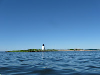
As I reached the closest point in my Bird Island orbit, I snapped this photo of some of the island's namesakes...most of them terns...
 

The island serves as a major nesting site for both common and the more rare roseate terns.  Not sure if these are common or roseate.

Then it was time to paddle back to the Wareham River into a very pleasant breeze out of the northwest. And not a piece of trash to be seen!