Saturday, April 27, 2024

Earth Week Afloat

On Earth Day I got out on the Merrimack River launching from Cashman Park in Newburyport, MA just upstream from the Route 1 Bridge...


Crossed-over to the Salisbury side of the river in search of shelter from the stiff westerly breeze.  An eagle on Ram Island watched from his perch...

Behind the island entered Town Creek...


A deer watched my approach into one of the side channels...


This saltwater tolerant turtle paid me no mind...


On Wednesday a stretch of the Assabet River was paddled in Stow, MA...
 

Plenty of activity at the riverside eagles nest:
One adult eagle in the nest (hopefully with an eaglet or two)...
...and the other adult "Dark Eyes" on a tree nearby...


Post-paddle made a short hike to this historical marker on a hillside overlooking the river...
It serves as testament to how badly things were going between the settlers and the Native Americans in early 1676.


On Thursday I drove to Harvard, MA where this view of Mount Wachusett was seen on the road leading to the boat launch at Oxbow N.W.R...


Once launched I headed downriver...

Passed by this evidence of someone's probably bad day on the river...

Also saw clusters of trash such as this one caught behind downed trees at bends in the river...
...left behind by the receding water levels.

The week's flotsam:

From the Merrimack River on Earth Day...
...which included 17 "nip" bottles and 3 Hooksett Disks.

From the Assabet River on Wednesday... 
...which included 6 "nip" bottles and a 1-gallon plastic (PET) jug on the riverbank that disintegrated into many small pieces as soon as I touched it.  There was also a paper bag full of trash someone left behind a tree at the launch site.

From the Nashua River on Thursday...
...which included 105 "nip" bottles.

At one point in my paddle on the Assabet River a helicopter circled overhead several times...

I believe it was WCVB-TV possibly filming some of the apple orchards that were facing possible freeze damage over the last few days. 
 

At Earth Week's conclusion I'm left to wonder if a more targeted 'Bottle Bill' might solve much of the litter/microplastics problem.  With many folks having access to curbside recycling programs at their homes these days their empty beverage containers don't usually end up as litter.  On the other hand, it's becoming more and more apparent to me that most of the litter that I encounter comes from folks out and about and "on the go".  Beverages are purchased "cold" and consumed away from home...and subsequently many of these containers end up on the ground, in the shrubbery, or in the river.
  
Therefore, how about having a 10-cent deposit on only those non-alcoholic beverage containers sold "cold" from refrigerated cabinets...exempting containers sold non-refrigerated.   

All "nip" bottles would have a 10-cent deposit regardless of temperature.

Is such a program feasible?  Implementing such a plan would require the cooperation of manufacturers and merchants.  Would they do so in an effort to help stem the proliferation of litter/microplastics?  Would consumers also be willing to cooperate?  I sure would.  Just my 2-cents.


Sunday, April 21, 2024

Long Wharf to Wachusett, and Beyond

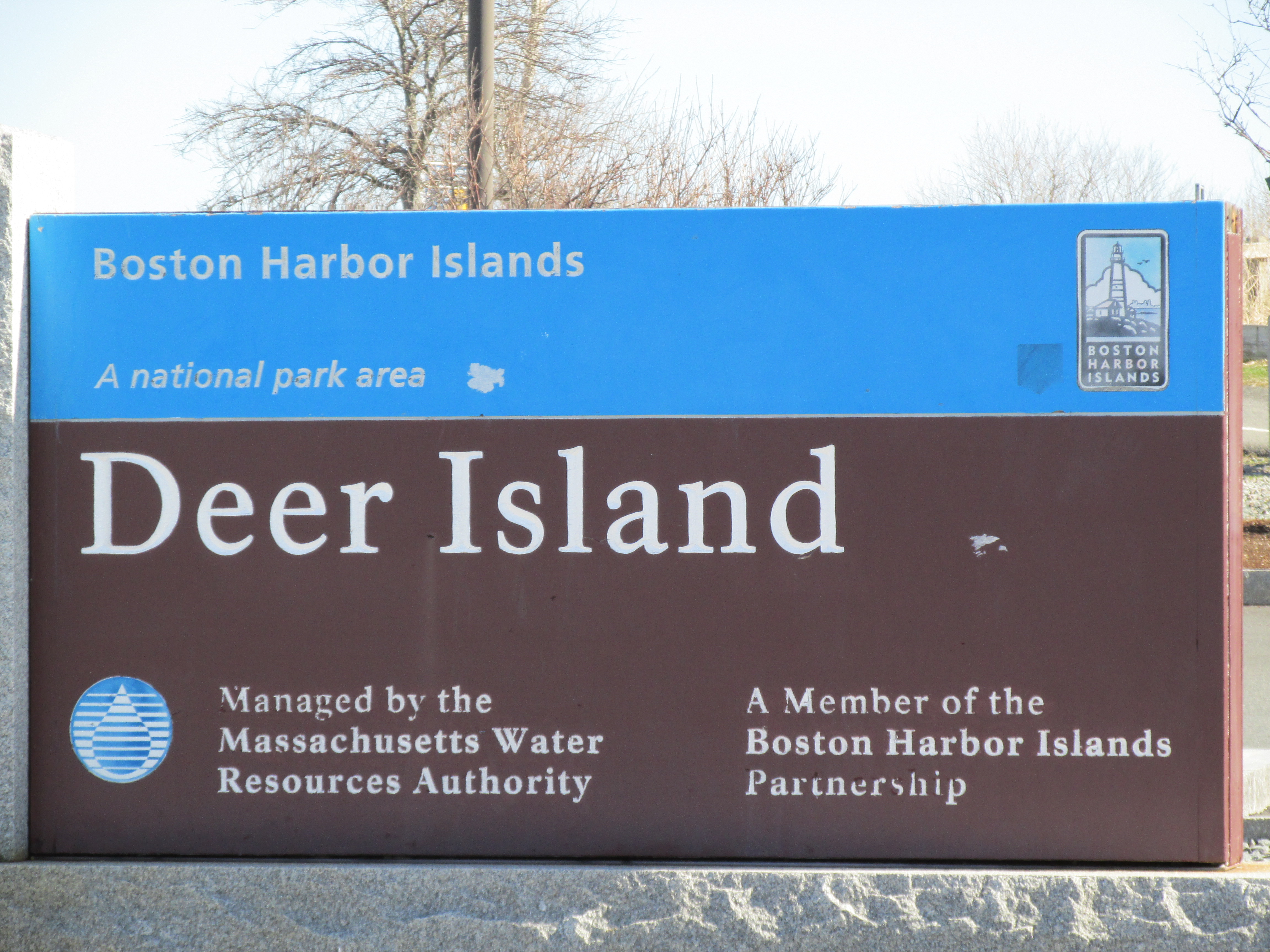
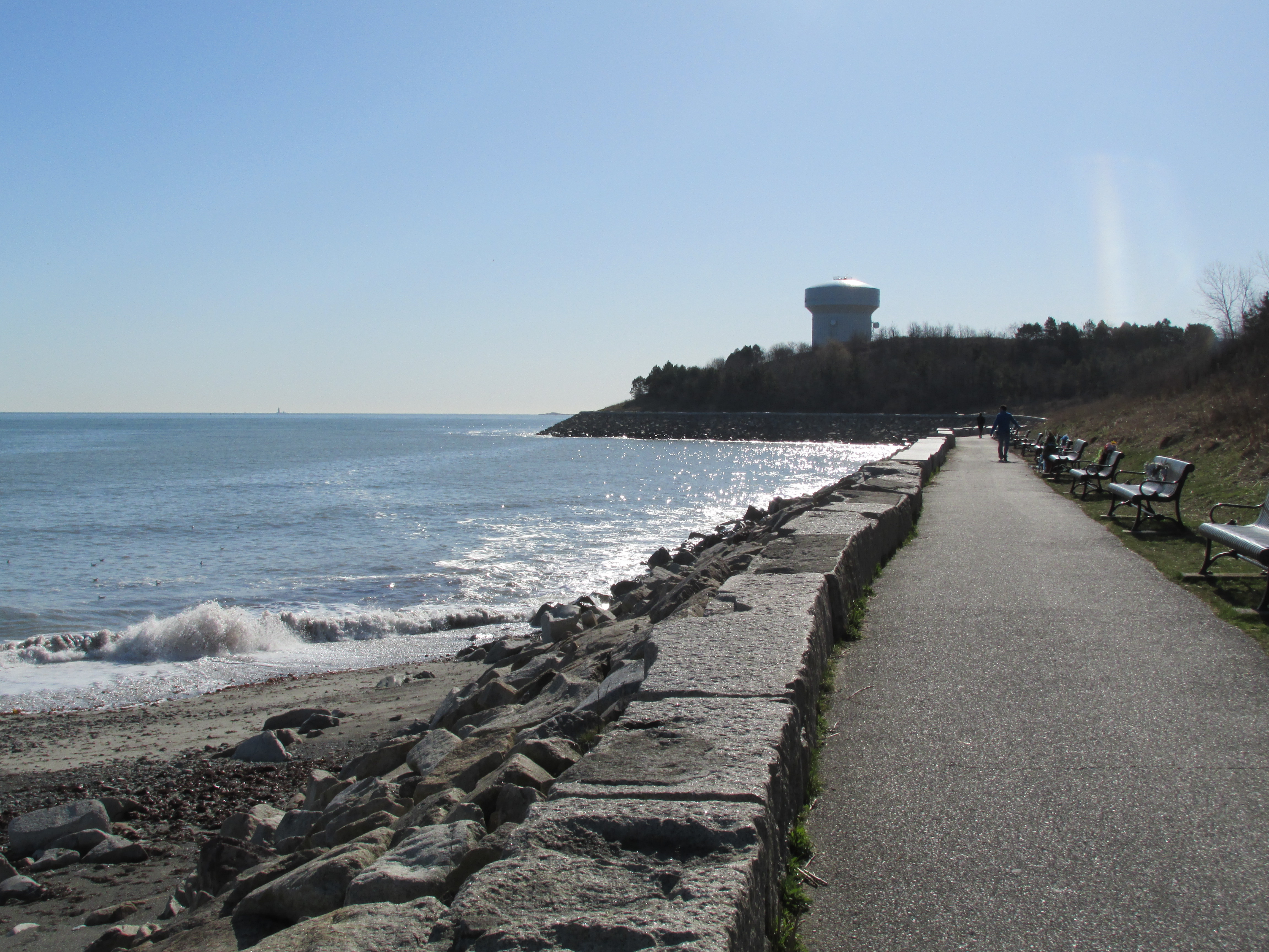
Picked up this week where my last post ended by visiting more sites related to the internment of Native Americans, aka Praying Indians, on Boston Harbor's Deer Island.  Over the course of the week I walked from where the Massachusetts Bay Colony's General Council held court to the tip of Boston's Long Wharf; paddled the Charles River to where the Natick Praying Village was once centered; paddled the Sudbury River to where one of the earliest bridges (dating to 1640s) was located on the road to Lancaster, MA; walked around the Redemption Rock area near Mount Wachusett; and paddled Asnacomet Pond in Hubbardston, MA.  Most of these locales were visited by the Praying Indian, Tom Doublet, who was allowed to leave internment on Deer Island in order to carry letters to and from the the parties engaged in King Philip's War.  

Started on Sunday morning with a paddle from Bridge St. in Dover, MA down the Charles River to where the Natick Praying Village was located in present-day South Natick situated about 40 miles by river from Boston Harbor...

...with a side trip up Indian Brook along the way...
According to Ron McAdow in his Charles River guidebook, a mill for grinding grain was built on the brook by Englishman Thomas Sawin at the invitation of the Natick Praying Indians around 1692.  Thus Sawin became the first non-Indian resident of Natick.  The brook "became know as Sawin Brook, but is now called Indian Brook."  The mill was located within the Broadmoor Wildlife Sanctuary.

Further downriver I passed under the arched pedestrian bridge...
...before reaching where the Praying Village was located.  The view across the falls to where the village was centered (their church once stood to the right of the brick building)...
It was from here that the Praying Indians were removed from their homes and sent overland to Watertown on October 30, 1675.  According to Daniel Gookin, they waited there until midnight when the tide allowed for their being transferred by boat to Deer Island.  The Natick Praying Indians were later joined there by other Indians from other praying villages, including Ponkapoag and Nashoba.  When the English authorities needed someone to find and deliver a letter to the hostile Indian forces at Mount Wachusett it was Tom Doublet (aka Nepanit), a Nashoba Indian, who stepped forward.  With the council's approval Gookin brought Tom to his house in Cambridge, MA.  On Monday April3,1676 Tom left from there and journeyed to Wachusett.


On Tuesday, thinking of Tom's journey, I paddled a stretch of the Sudbury River in Wayland where I suspect he may have passed.  Launched at Sherman's Bridge and headed upriver...

With the water levels so high it was possible to take short-cuts through the woods and pass by a hunter's unoccupied deer stand...
The water level was high enough to allow my paddling over to the Haynes Garrison House location...
...where colonists were under attack on April 21, 1676...this battle occurring only a few weeks either side of Tom's passing through the area.

The abandoned bridge over the river's original course...
...where an earlier structure allowed carts to pass.  Tom may have used the earlier bridge...

Eight men from Concord died there on April 21,1676 and are buried near the bridge's east end...


A train trip into Boston on Wednesday allowed for a visit to the Long Wharf...
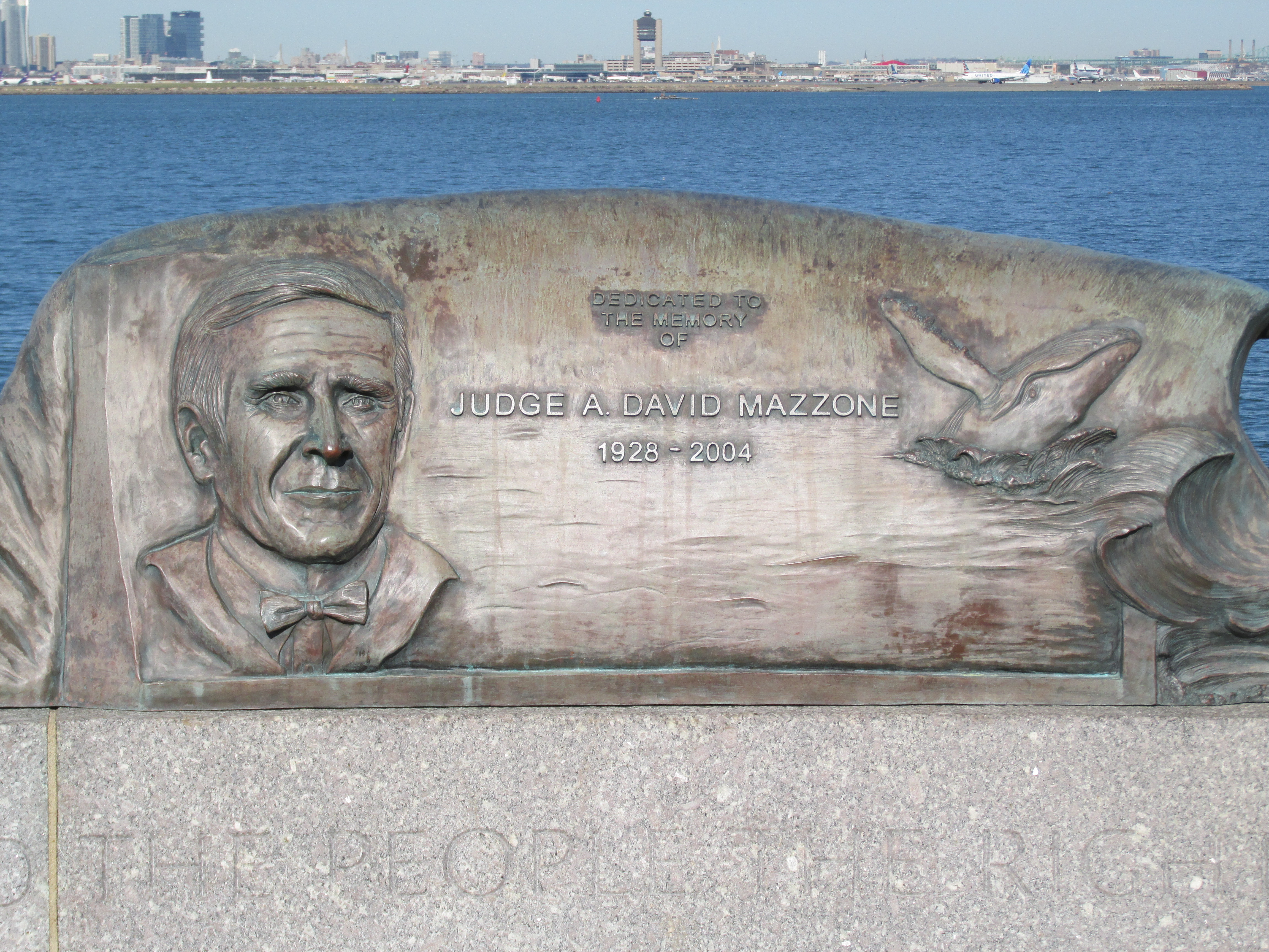
....where from its tip one can see Deer Island some 4 miles out (to the right center behind the yellow airplane)...

Turning about one can look up State Street from the Long Wharf to the Old State House...

A closer look at the spot where in 1676 stood the Town House where the General Court held session...

The plan to start negotiations with the warring tribes at Wachusett was most likely devised here.

On Friday, a visit was paid to Mount Wachusett where remnants of winter can still be seen...
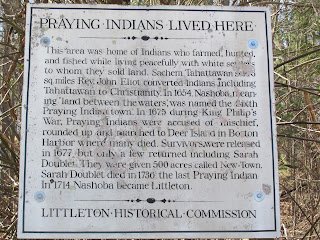
...and nearby the locale known as Redemption Rock...
...where the inscription tells of how the negotiations (that started with Tom Doublet's delivery of that first letter) came to fruition...
Tom made three trips to Wachusett: two in April -the first was solo; the second with fellow Praying Indian, Peter Conway (aka Tataquinea).  A third trip in early May included John Hoar of Concord, a man friendly towards the Indians, who paid the ransom for Mrs. Rowlandson's redemption. Tom later made additional trips to secure the release of other hostages.

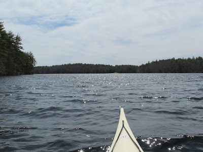
Before leaving the Wachusett area I paddled Asnacomet Pond in Hubbardston, MA.  I'd driven past the pond on many occasions and enjoyed finally getting out on it.  Its outlet flows into the East Branch of the Ware River...


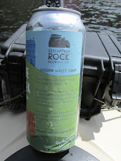
Imagine my surprise in coming across a floating beer can named for the historical site I'd just visited...


Some wildlife encountered during the week included this pair of buffleheads on the Charles River...
...and this solitary mushquash on the Sudbury River...

Trash included a floating emoji on the Charles...

Trash from the Charles...

Trash from the Sudbury...

Trash from Asnacomet Pond...

In May of 1676 the General Court issued an order ending the internment of the Praying Indians, but not supplying any funds to help in their transport back to the mainland.  Daniel Gookin and John Eliot used their own money in paying those costs.  Most of the survivors went to Natick while some 50 or so returned to Nashoba where, according to Gookin, "were living there quietly and unmolested".

So, what happened to Tom Doublet?  In searching for more information regarding this Native American man I found the following:
In Charles H. Wolcott's Concord in the Colonial Period (1884) there was this Oct. 2, 1660 court record Walcott referenced in showing the colonists' bad disposition towards Indians: "Thomas Dublet, a Concord Indian, was convicted of an assault upon one of the English, and sentenced to pay a fine of 20 lbs, in default whereof he was 'to be sold to such as would buy him'. This man was subsequently of great service in procuring the release of Mrs. Rowlandson from captivity."  I'm guessing Tom might have been a young man in 1660.
 
Another mention of Tom was found in a Littleton Historical Society Volume 1 essay The Indians of Nashoba by Herbert Joseph Harwood: "For all this important service for the state in which Dublet proved himself brave, faithful, and discreet, after waiting eight years and petitioning for compensation, the council voted him the munificent reward of two coats!"  

At some point, either on Deer Island or perhaps after leaving the island, in either 1675 or 1676, Tom married Wunnuhhew (Sarah) the daughter of Sagamore John).  According to Freedomsway.org Sarah grew up in Wamesit at the confluence of the Merrimack and Concord rivers and following custom first married the son of Nashoba sachem Tahattawan, John Tahattawan.  John died young in 1770.  Her second husband was the Okommakamesit sachem Oonamog and he also died young around 1674.  Upon marrying her third husband Tom Doublet she became known as Sarah Doublet.  Perhaps they knew each other from their earlier years at Nashoba.  Today a forest in the town of Littleton, MA bears her name and speaks of her and Tom spending their remaining years there...
...

After Tom passed away Sarah ultimately became the last of her people living at Nashoba.  Her final days were spent in South Acton, MA about 1.5 miles from my home.  She died in 1736.  My guess is they're both buried somewhere in the Nashoba area.


Thursday, April 11, 2024

An Island of Refuge or Misery?

I closed my last post mentioning the need for visiting an airport and finding a small island.  On Eclipse Day morning I did just that by driving to a Massachusetts coastal town I'd not previously visited...


 ...and launched my kayak from Winthrop Town Landing into the waters of Boston Harbor.
  
Just across from where I launched is Logan International Airport where this plane was set for take off...

However, rather than envying those aboard the airplane I was very happy to be enjoying my first salt water paddle of 2024.   Conditions for early April couldn't have been better with abundant sunshine, warming temperatures, lessening wind, and a rising tide.  My goal was to paddle out to one of Boston Harbor's more infamous islands...

...which on this Boston Harbor Islands map (partial) is shown in green.  The island's proximity to Winthrop, Boston, and Logan International Airport can be seen...

Additionally NOAA Chart 13272 was useful.  Despite it being such a beautiful morning there were only a handful of other boats encountered as most boats are still in winter storage.
 
Arriving at Deer Island I landed at its north tip about a mile from where I'd launched in Winthrop...

 A small park there welcomes visitors including those who reach the island by car via the short causeway that, since the early 1940s, connects the island to Winthrop. 
The view looking north from the park...

The view to the south from the park...
A paved pathway runs around the island's shoreline. 

Numerous kiosks provide information about the island's history and its many uses over the years...

This kiosk attests to what happened here in 1675-1676...
..."One of the saddest chapters in Deer Island's long history was the internment of Native Americans during King Philip's War. In 1675, Metacomet, who was known to the English as King Philip, was incensed with the jurisdiction imposed over his domain by the Massachusetts Bay Council.  He, along with other sovereign Indian Tribes in Massachusetts, retaliated with an armed assault upon Colonial villages. The Colonists responded by rounding up Native Americans from Natick and other "praying towns" around Boston on October 31st.  They were hurried into boats along the Charles River in Watertown and ferried to Deer Island.  Those interned on Deer Island were given few provisions and suffered great hardships during a brutal winter. Incarcerated too late to plant corn - and with few other food staples on this desolate island - many starved.  They lacked adequate shelter from the bitter cold, but were not allowed to cut firewood. Colonial settlers were authorized to kill any Native Americans found off Deer Island not accompanied by an English guard.  As the conflict continued more Indians of various tribes were incarcerated on Deer Island, Long Island, and other islands within the Bay of Boston.  Although it is unknown how many Indians were incarcerated on these islands during the harsh winter months of 1675-76 it is known that many perished.  Since 1991, descendants of those Indians, along with others of like mind, gather to commemorate this sorrowful episode of America's history.  They retrace the journey of their innocent ancestors; from Natick to the Charles River and here, to Deer Island.  They gather for prayers and reflection.  The event takes place the last weekend of October each year."

A Celtic Cross commemorates the hundreds of Irish immigrants who died on Deer Island during Ireland's "Great Potato Famine" in the late 1840s...
For some of them, Deer Island was as close as they would make it to the refuge they sought. 

These days while some spots on the island have a natural look...
...there's no denying the island's main task is protecting the waters of Boston Harbor by housing the Massachusetts Water Resources Authority's wastewater treatment facility.  This large and complex facility receives wastewater from the greater Boston area that is treated before ultimately being discharged 9 miles out to sea..  To most folks the island's most recognizable feature is the cluster of digesters that are often referred to as "dinosaur eggs"...

Another kiosk pays tribute to the federal judge who helped to nudge along the harbor's cleanup...


 A memorial to the Hon. A. David Mazzone stands at water's edge...
...on which his ruling is noted "the law secures to the people the right to a clean harbor."


Below is the view across the harbor to Boston proper some 4-miles westward...
...where in 1675 the Massachusetts Bay Colonial Council convened in the Town House. The Custom House building with its clockface helps to locate the general  area where the Town House once stood and today's Old State House currently stands...

In April of 1676 at the height of  King Philip's War there was a nearly month long window where negotiations for a peaceful resolution and exchange of hostages was attempted.  In early April the Colonial Council enlisted one of the Native Americans interned on Deer Island to act as an emissary to the Sachems gathered at Mount Wachusett, a Native American stronghold.  This emissary was known as Tom Doublet (Nepanet was his Native American name) and he would ultimately make three trips from Deer Island to Mount Wachusett (located 48 miles to the west) carrying letters between the Colonial Council and the Sachems.  Thus, three distinct locations played a role during this pregnant moment in time: Deer Island where the "Praying Indians" were interned, the Massachusetts Bay Colony's Town House where the Colonial Council convened, and Mount Wachusett where the Nipmuc, Wampanoag, and Narragansett Sachems at war with the colony were encamped.


Some additional photos from Monday's time on the water:
What I believe is Great Blue Hill (12 miles southwest) said to be the source of our state's name "Massachusetts"...
...and where near its base was the Praying Village Ponkapoag.

The Boston Harbor Hotel's archway...

Deer Island Light at the island's south tip...

Loons and the Dorchester Gas Tank's "Rainbow Swash"...

A closer look at one of the loons...

Other ducks seen, included buffleheads...

...and what I think are eiders...


Trash was gathered up from where I landed and launched and included 11 "nip" bottles found nestled in the seaweed...

The last thing I did before leaving Winthrop was to stop at Belle Isle Seafood and enjoy my first fresh seafood meal of the season.  It was a nice precursor to the period of eclipse-induced eerie twilight I'd witness on the drive home.

As to Nepanet and his three journeys to and from Wachusett, I'm left to wonder how he made the trip...on foot or on horseback?  Would the Colonial Council have provided him a horse?...or just expect him to walk the 48 miles?  What route might he have followed?  I'm guessing it took him two days to cover the distance.  Was he required to return to Deer Island after each trip?  How did he get back and forth from the island? 

One other thought concerns another island in the harbor, Noddles Island (now part of East Boston), where Baptists were banished to by the intolerant Puritans.  In December 1675 one such Baptist, William Turner, was being detained there until his release sometime in January 1676 conditioned upon his raising a troop of fellow Baptists to fight Native Americans.  Turner would later play a pivotal role in extinguishing any and all possibilities of a peaceful resolution.  Seems all these people and places were on a collision course.  Who among them were the genuine seekers of peace?