I closed my last post mentioning the need for visiting an airport and finding a small island. On Eclipse Day morning I did just that by driving to a Massachusetts coastal town I'd not previously visited...

...and launched my kayak from Winthrop Town Landing into the waters of Boston Harbor.
Just across from where I launched is Logan International Airport where this plane was set for take off...


Additionally NOAA Chart 13272 was useful. Despite it being such a beautiful morning there were only a handful of other boats encountered as most boats are still in winter storage.

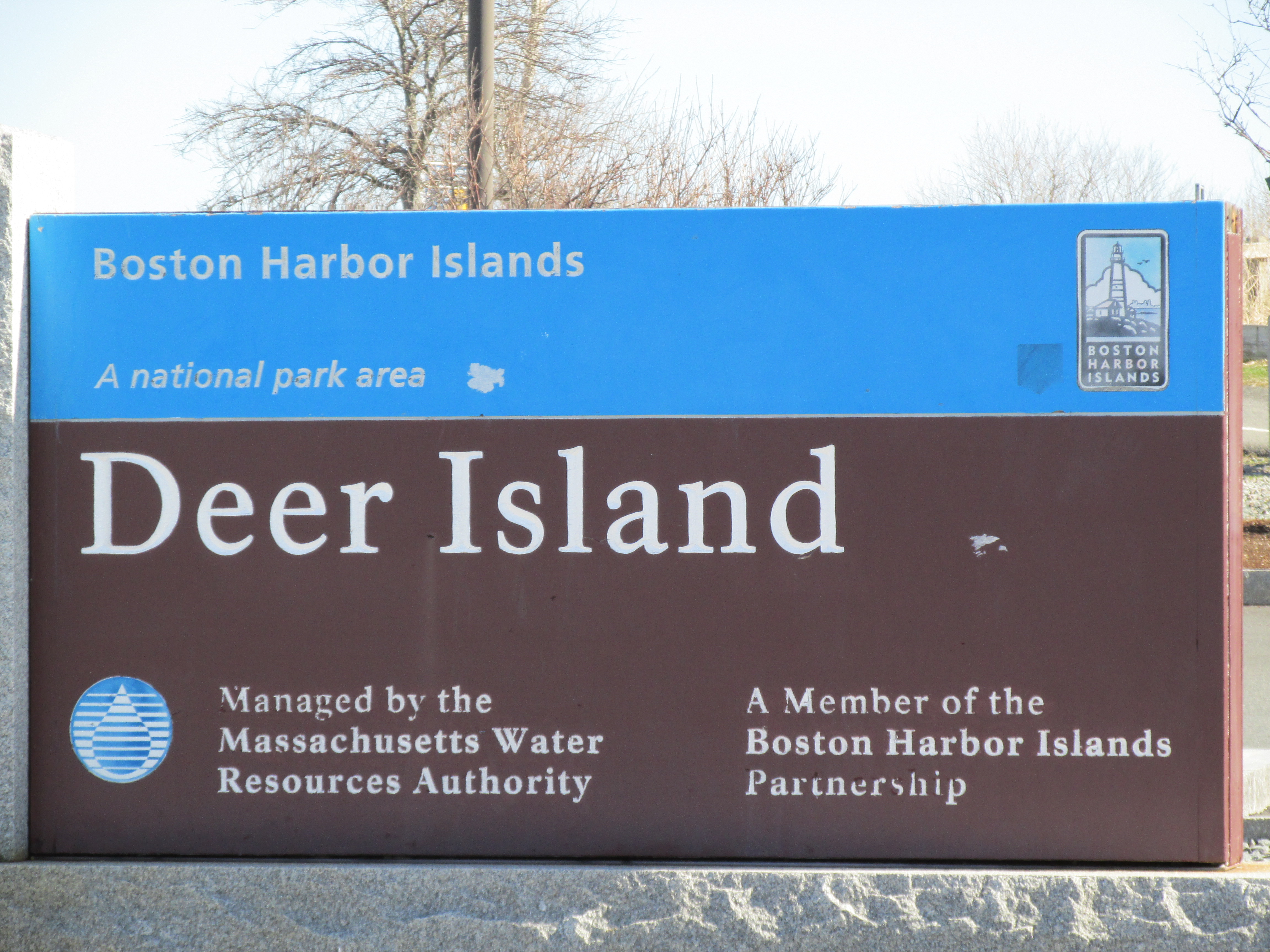
A small park there welcomes visitors including those who reach the island by car via the short causeway that, since the early 1940s, connects the island to Winthrop.
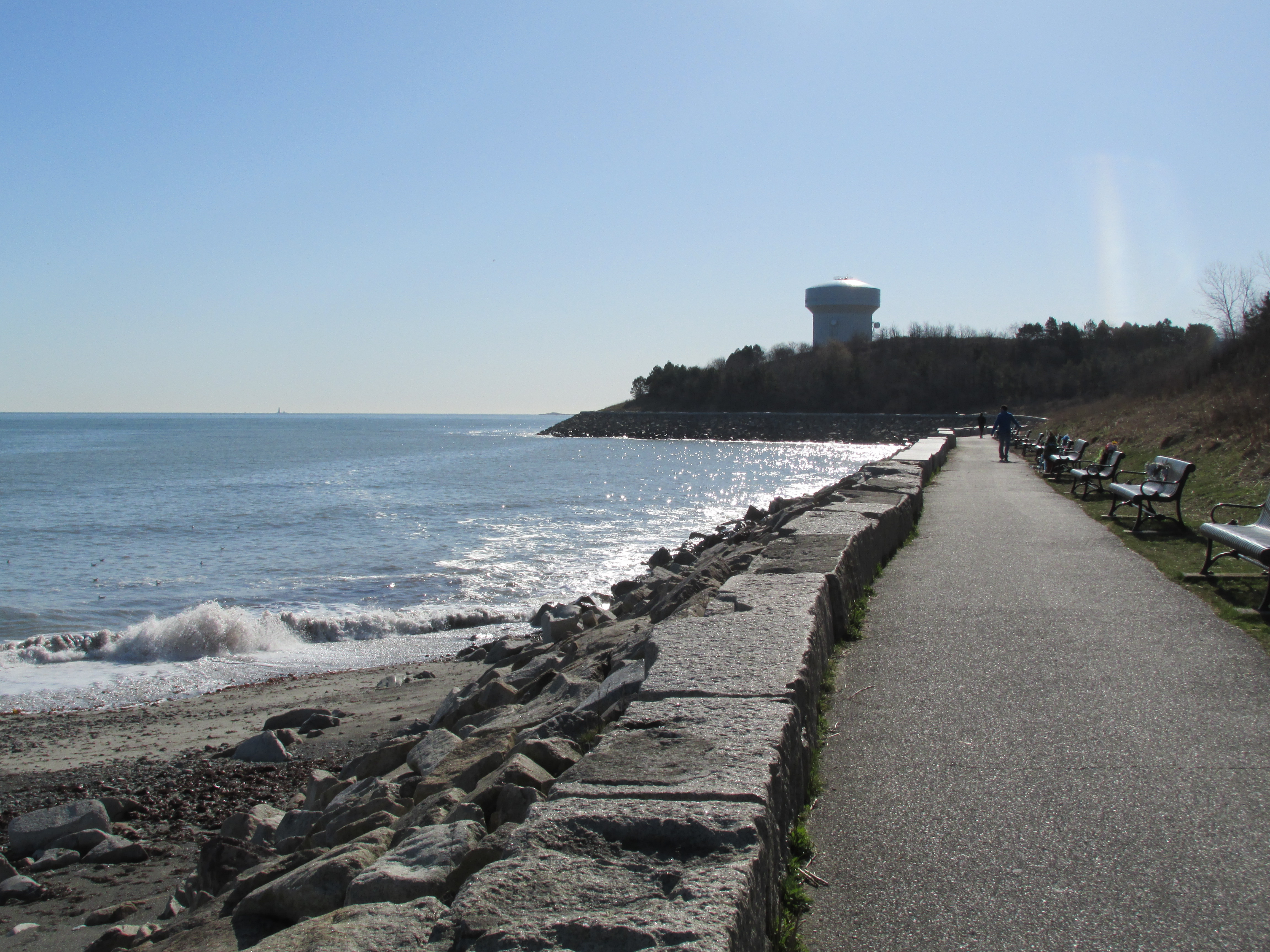
 A paved pathway runs around the island's shoreline.

This kiosk attests to what happened here in 1675-1676...

However, rather than envying those aboard the airplane I was very happy to be enjoying my first salt water paddle of 2024. Conditions for early April couldn't have been better with abundant sunshine, warming temperatures, lessening wind, and a rising tide. My goal was to paddle out to one of Boston Harbor's more infamous islands...
...which on this Boston Harbor Islands map (partial) is shown in green. The island's proximity to Winthrop, Boston, and Logan International Airport can be seen...

Arriving at Deer Island I landed at its north tip about a mile from where I'd launched in Winthrop...

A small park there welcomes visitors including those who reach the island by car via the short causeway that, since the early 1940s, connects the island to Winthrop.
The view looking north from the park...

The view to the south from the park...
Numerous kiosks provide information about the island's history and its many uses over the years...


A Celtic Cross commemorates the hundreds of Irish immigrants who died on Deer Island during Ireland's "Great Potato Famine" in the late 1840s...

These days while some spots on the island have a natural look...


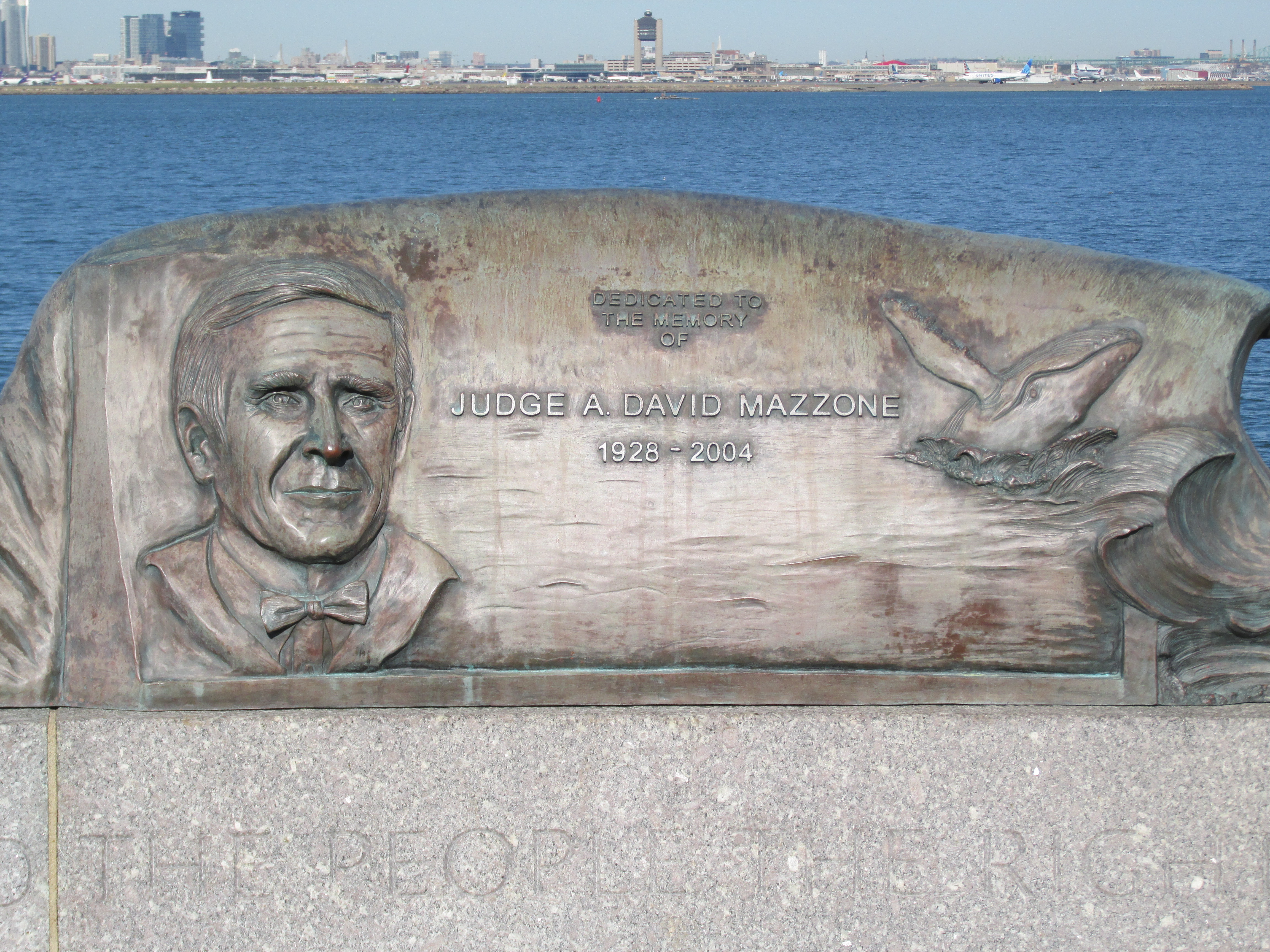
A memorial to the Hon. A. David Mazzone stands at water's edge... ...on which his ruling is noted "the law secures to the people the right to a clean harbor."
 ...where in 1675 the Massachusetts Bay Colonial Council convened in the Town House. The Custom House building with its clockface helps to locate the general area where the Town House once stood and today's Old State House currently stands...
In April of 1676 at the height of King Philip's War there was a nearly month long window where negotiations for a peaceful resolution and exchange of hostages was attempted. In early April the Colonial Council enlisted one of the Native Americans interned on Deer Island to act as an emissary to the Sachems gathered at Mount Wachusett, a Native American stronghold. This emissary was known as Tom Doublet (Nepanet was his Native American name) and he would ultimately make three trips from Deer Island to Mount Wachusett (located 48 miles to the west) carrying letters between the Colonial Council and the Sachems. Thus, three distinct locations played a role during this pregnant moment in time: Deer Island where the "Praying Indians" were interned, the Massachusetts Bay Colony's Town House where the Colonial Council convened, and Mount Wachusett where the Nipmuc, Wampanoag, and Narragansett Sachems at war with the colony were encamped.
 ...and where near its base was the Praying Village Ponkapoag.


Below is the view across the harbor to Boston proper some 4-miles westward...


Some additional photos from Monday's time on the water:
What I believe is Great Blue Hill (12 miles southwest) said to be the source of our state's name "Massachusetts"...

The Boston Harbor Hotel's archway...

Deer Island Light at the island's south tip...

Loons and the Dorchester Gas Tank's "Rainbow Swash"...

A closer look at one of the loons...

Other ducks seen, included buffleheads...

...and what I think are eiders...

Trash was gathered up from where I landed and launched and included 11 "nip" bottles found nestled in the seaweed...

The last thing I did before leaving Winthrop was to stop at Belle Isle Seafood and enjoy my first fresh seafood meal of the season. It was a nice precursor to the period of eclipse-induced eerie twilight I'd witness on the drive home.
As to Nepanet and his three journeys to and from Wachusett, I'm left to wonder how he made the trip...on foot or on horseback? Would the Colonial Council have provided him a horse?...or just expect him to walk the 48 miles? What route might he have followed? I'm guessing it took him two days to cover the distance. Was he required to return to Deer Island after each trip? How did he get back and forth from the island?
One other thought concerns another island in the harbor, Noddles Island (now part of East Boston), where Baptists were banished to by the intolerant Puritans. In December 1675 one such Baptist, William Turner, was being detained there until his release sometime in January 1676 conditioned upon his raising a troop of fellow Baptists to fight Native Americans. Turner would later play a pivotal role in extinguishing any and all possibilities of a peaceful resolution. Seems all these people and places were on a collision course. Who among them were the genuine seekers of peace?
No comments:
Post a Comment