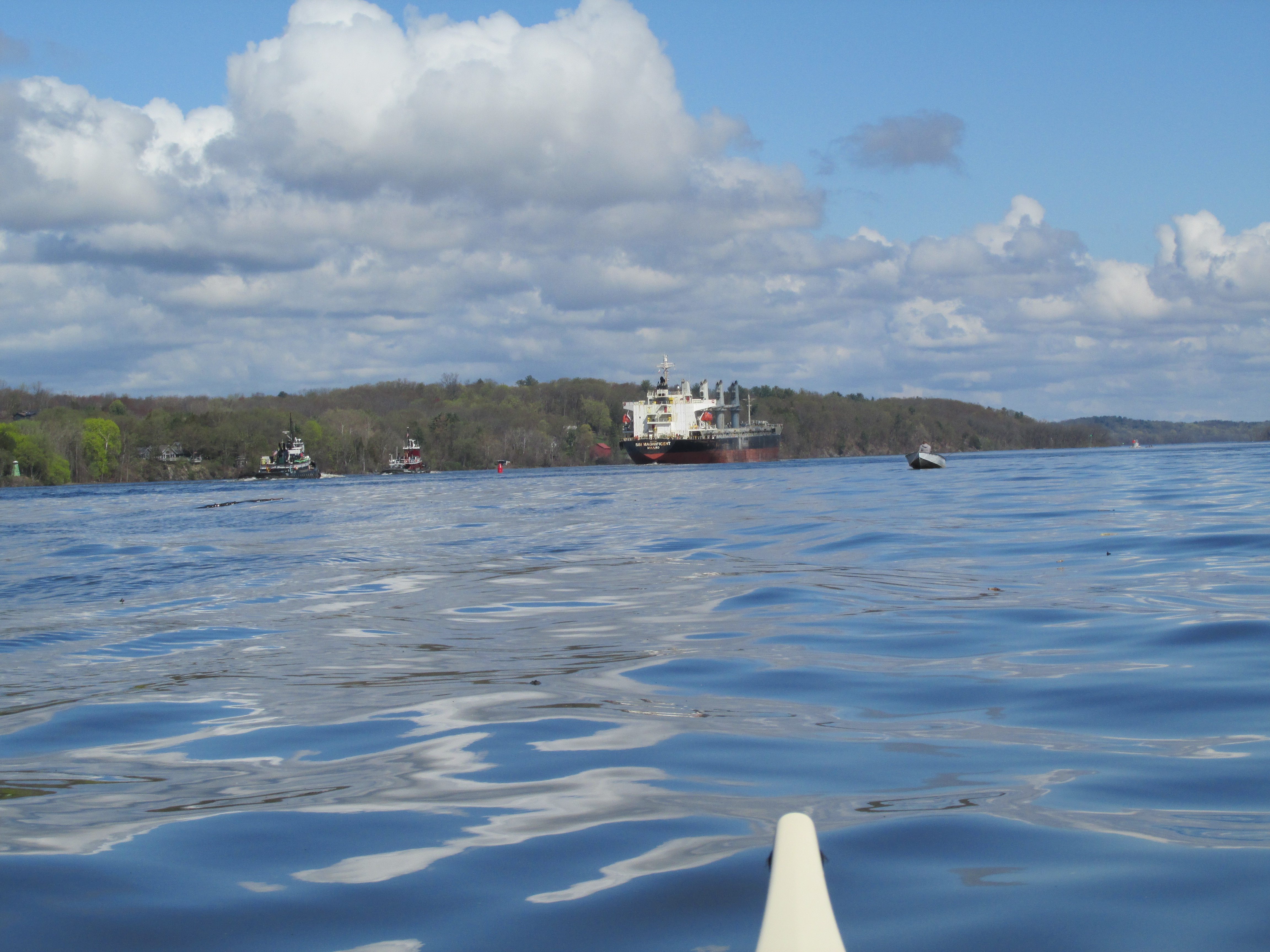
The Hudson River couldn't have looked better than it did this past Sunday afternoon as I watched the above pictured vessel SSI Magnificent and two trailing tugboats pass one of many small fishing boats out on the river. I'd been gifted with four days of idyllic weather that left me feeling as though I'd been transported to mid-summer. Three days above 80 degrees F. and the fourth a sweet 75 degrees F. All included plenty of sunshine. When I booked my trip two weeks earlier I selected the days offering the most favorable tides and left the weather to chance...thus serendipity.
Back in spring 2022 I visited the Mohawk Nation along their namesake river and came across mention of their often contentious relationship with the neighboring Mohican Nation which was said to have been centered on islands in the Hudson River below Albany, NY. Subsequently, this past winter I wiled away much of the time learning more about the Mohicans and the islands they lived on and around. Reading an article, The Mahicans, the Dutch, and the Schodack Islands in the 17th and 18th Centuries by Paul R. Huey, provided a wealth of information and planted the seed that eventually brought me to the region. In addition to paddling into the Mohican realm I was curious as to whether or not the Mohicans were the people who in 1609 are said to have welcomed the explorer Henry Hudson into their homes.
I believe this 1639 map by Joan Vinckeboons, Noort Rivier in Niew Neerlandt (retrieved from the Library of Congress) best shows how the area I focused on might have looked back in 1609 (the red markings are mine)...

Recently (2021) in an all-too-rare event the Mohican Nation was given back control of some of their ancestral land on Papscanee Island...
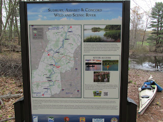
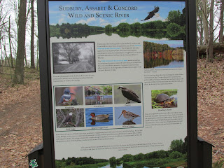
A kiosk at the Preserve explains...
Papscanee Island lies on the Hudson River's east side and is about four miles long. Today it's a peninsula due to railroad construction and the north end of the island having been filled in. After paddling to a spot on the island roughly opposite from Van Wies Point I walked a bit of the nature preserve's trails...
...and came across what looked to be a boiling stone...
...used in cooking. The stone is placed over a fire, heated, and then placed in a vessel filled with water.
Both the ground and water surface near the shore of the preserve's red-blazed trail were littered with a kind of catkin I'd never encountered before...
They were falling from trees at a pretty good pace. Many were also seen at Castleton-on-the-Hudson. I'm guessing they might be walnut tree catkins?
Looking upriver from Papscanee one can see what the island might have become had it not been protected from Industrial development...

The day before paddling to Papscanee I paddled to Schodack Island which is said to have been the actual center of the Mohican Nation...
...and where the Tribe's Council Fire is said to have burned for many generations. Schodack State Park occupies the upper end of the island where two high bridges cross the Hudson River...

The closer of the two is a railroad bridge named for Alfred H. Smith, once president of the New York Central RR, and the more distant is the Castleton Bridge carrying the New York Thruway...
Both Papscanee and Schodack islands are low-lying and, along with many other adjacent islands, were subject to springtime freshets which often left deposits of rich alluvial soil ideal for growing corn and squash. One description of Papscanee Island states "It's believed to be one of the longest continuously cultivated places in the Unite States". In addition to delivering fertile soil to the island almost every year the river also brought seemingly endless supplies of migratory fish.
The Mohican sachem Papsickene is said to have lived on the island...perhaps upon the island's highest hill (50') known to the Mohicans as Patquatheck "the big turnip". The hill location is at Staats Point where the Dutch owner Joan Staats built this mansion in 1696 which has continuously housed members of the Staats family to the present day...
Is it possible that it was Papsickene who paddled a canoe carrying Henry Hudson from the ship Half Moon to his island abode perhaps located near this spot in 1609? The reason I wonder is because I'd launched less than two miles away at Henry Hudson Park on the west side of the river in Bethlehem where there's a depiction of the possible encounter on this sign at the park's entrance...
...as well as this plaque at water's edge...
If I ran into Henry these days and he asked me for a good spot to land I'd recommend this park as being ideal. It has a great ramp for canoes and kayaks...
...along with a ramp for trailered boats, free parking, rest rooms (with soap and hot water), benches, picnic tables, and even trash receptacles. On the day I visited the park it was being enjoyed by many folks...some fishing for stripers and others just enjoying some time by the river.
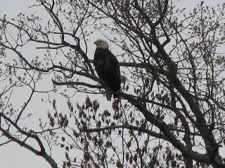
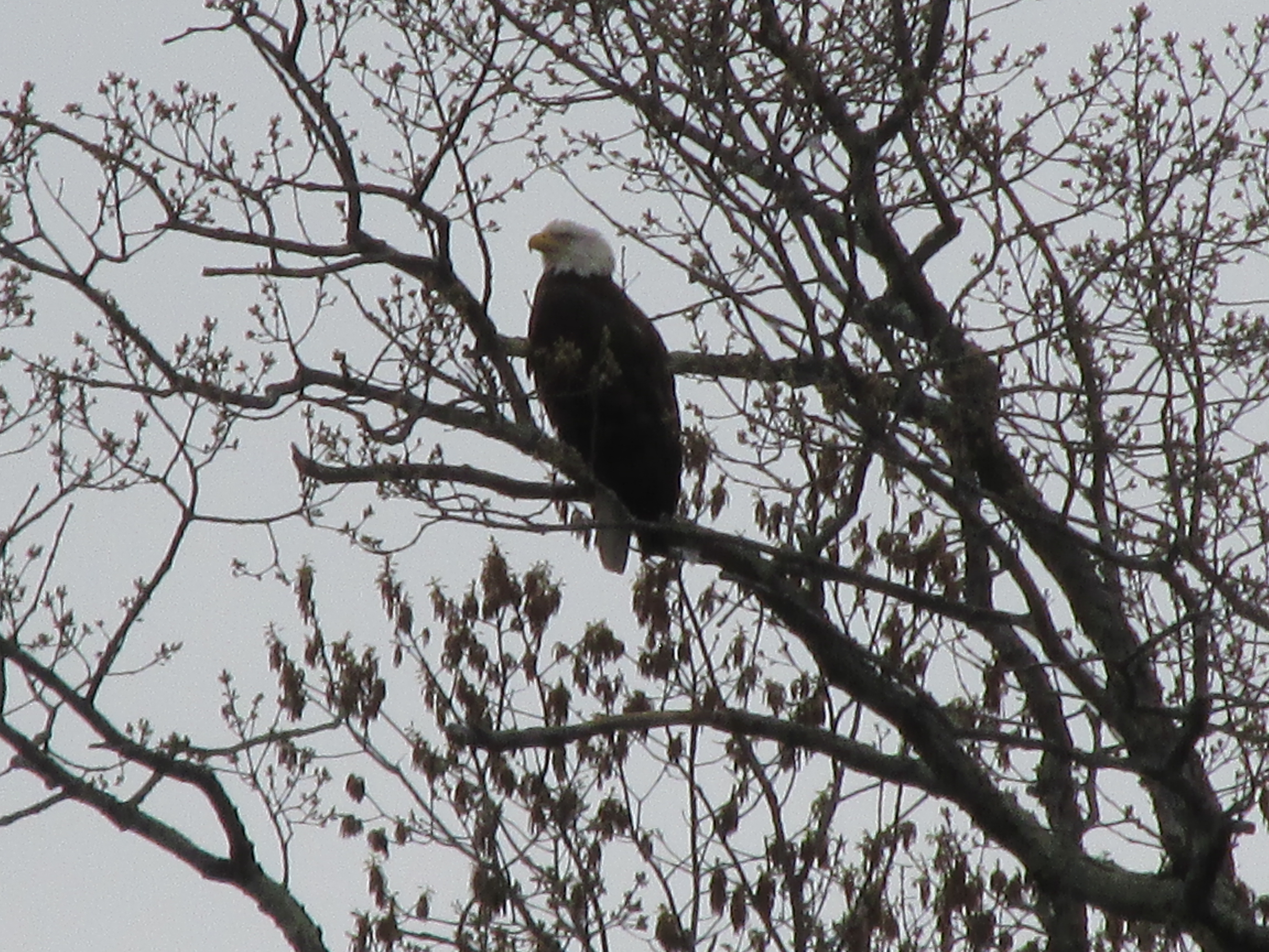
Other species keeping an eye out for fish included many eagles such as this one...
The area between Papscanee Island and Houghtaling Island to the south hosts numerous eagle nests...
...I saw three occupied nests and two unoccupied.
In preparation for my trip I stumbled upon the existence of two historical markers I wasn't previously aware of...both claiming visits by Henry Hudson. One was located downriver at Stockport Flats...
...and the other about six miles (or about two leagues) upriver from Stockport in present-day Stuyvesant which long ago was known as Kinderhook...

Both of the above historical markers were erected in 1932 by the New York dept. of Education and I'd think the historians of that time were certain enough of the locations before having the markers made and erected. However, today's historians can't seem to agree as to how far up the Hudson River Henry Hudson actually sailed, and at which locations he might have landed. Some say he stopped near Castleton while others believe he went to Albany or even further to Troy. Complicating things a bit is the fact that Henry Hudson dispatched 5 crewmen in the ship's small boat to explore depths further upriver. That group reported having gone another 25 to 30 miles beyond where the Half Moon stopped.
The Town of Stuyvesant appears to agree with the Kinderhook (now Stuyvesant) theory and thus motorists entering town are welcomed by this beautiful roadside sign...
It's too bad that the only written accounts of the Half Moon's sailing up the river were short on details that could have settled the matter. One account, Juet's Journal of Hudson's 1609 Voyage (1625), was written by Robert Juet who was one of the ship's crew. The other was Henry Hudson's own account which ultimately disappeared. However, before it vanished it was seen by Joannes de Laet, Director of the Dutch West India Company. De Laets included some of Hudson's account in his 1625
History of the New World excerpts of which were included in
Original Narratives of Early American History edited by J. Franklin Jameson. Laet states "In latitude 42 degrees 18 minutes the said Hudson landed." Laet next quotes Hudson: "I sailed to the shore, in one of their canoes with an old man, who was chief of a tribe, consisting of forty men and seventeen women; these I saw there in a house well constructed of oak bark, and circular in shape, with the appearance of having a vaulted ceiling..."
Speaking of landings, this floatplane was practicing landings to my west between Stuyvesant and the south end of Houghtaling Island...
...perhaps providing confirmation that Hudson did, in fact, land at nearby Kinderhook? :)
Other vessels encountered in the stretch of the river between Stockport Flats and Van Wies Point included the RTC 82...
...the Pearl Island...

...the aforementioned SSI Magnificent...

...the tug James Turecamo...

...and another tug, the Sarah D...

Oh yeah, in addition to the tugs was this small tub-floater...
...joined a little later by still another tub-floater...
Both of them bore numbers as perhaps they'd been in a duckie race.
One happily stumbled upon time-saver was a short portage allowing passage from Schodack Creek to the river just beyond the north tip of Houghtaling Island...
...with a clear, well marked trail, and made all the easier by being near the top of the tide...

The short-cut allowed me to reach Coeymans without having to backtrack a couple of miles down the creek.
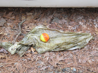
Some plastic trash rounded-up over the four days:
Stuyvesant to Coeymans...
Coeymans to Henry Hudson Park...
Henry Hudson Park to Papscanee Island...
Small amount from the Stockport Flats area...
My four days on the Hudson River proved to be just what I was looking for...three up-and-back paddles with the tide helping in both directions, and a leisurely Sunday morning paddle in the Stockport Middle Ground, Four Mile Point area to wrap things up. Strange to see such big vessels, good tidal flows, yet not a drop of salt water having to be rinsed from my gear. Apparently the saltwater only makes it up about 70 miles whereas I did my paddling between 115 to 135 miles upriver from the ocean. According to the NY Dept. of Conservation's
website "estuaries are among the most productive of Earth's ecosystems." The tidal nature of the river is reflected in it's Mohican name "Mahicantuck" said to mean "great waters in constant motion".
Some notable riverside structures included concrete curbing along much of the riverbank...
One of the more imposing structures I paddled past was this behemoth in Coeymans...
...possibly used in loading barges with cement.
Finally, late Sunday morning, after watching the two tugs and the SSI Magnificent motor northward towards Albany...
...I packed up my gear and prepared to head back to Massachusetts just as this AMTRAK train raced past Stockport Flats on its way north from New York City...
All I needed was to hear Billy Joel's "New York State of Mind".
Regarding the Half Moon's time on the Hudson River, Robert Juet states in his journal that one Englishman, John Colman, was killed by Native Americans on September 6, 1609 and eleven Native Americans were killed by the Half Moon's crew on the first two days of October the same year. Bad karma for any journey.
In reading Corey Sandler's book Henry Hudson Dreams and Obsession I'd learn that less than two years after the 1609 voyage up the Hudson River, Henry Hudson was set adrift in northern Canada's James Bay by a mutinous crew and never seen again. Robert Juet who is said to have taken part in the mutiny died on the way back to England.

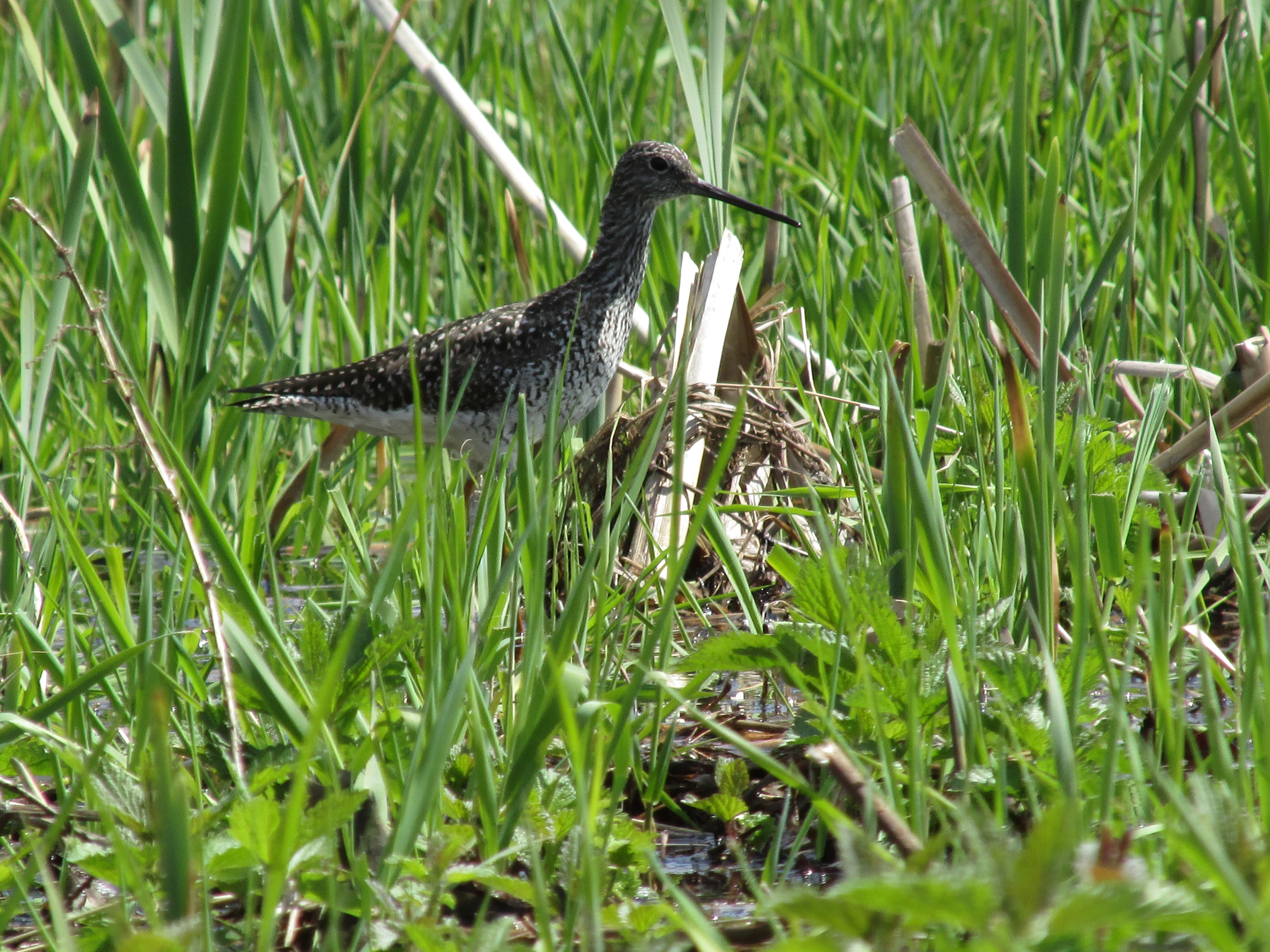
 ...and only briefly did a few of them emerge into view...
 I'm guessing these soon-to-be-ferns may be on their menu...


.JPG)