Thursday, June 23, 2022

A Causeway and Two Local Rivers

Over the past week or so I got out on the water twice in my boat and once on my bicycle.  That's right, out on the water by bicycle, or so it seemed as Mrs. Trashpaddler and I pedaled from terra firma in Colchester, VT out onto Lake Champlain via a 10' wide causeway which, after about 3 miles, brought us to a gap in the causeway called "The Cut" where a seasonal bike ferry operates.  Taking the bike ferry allows one to continue along the causeway to South Hero Island.  The causeway was built in 1901 by the Rutland Railroad and carried trains until 1961.  Tracks were torn-up in 1964 according to Wikepedia.  The ferry wasn't operating when we were there so we turned about and pedaled the arcing causeway back to Colchester... 

American elm trees appear along the sides of the causeway, and trail literature mentions how these elms escaped the ravages of Dutch elm disease. The trail known today as "The Island Line Rail Trail" was certainly one of the more unique rail trails we've had the pleasure to bicycle on.   

Last Saturday I paddled down the Concord River in Concord, MA from Egg Rock...


  ...passing under the Old North Bridge...
...and shortly thereafter Monument Street where I came across another 2 USPS mail crates enveloped in plastic trash bags...

Like the 3 mail crates found in the same section of river in late May, both of these crates were full...one with advertisements and the other with first-class mail.  Very strange.  The USPS has been notified, and is looking into the matter.

Further down the Concord a pileated woodpecker was encountered...

...and also a killdeer...

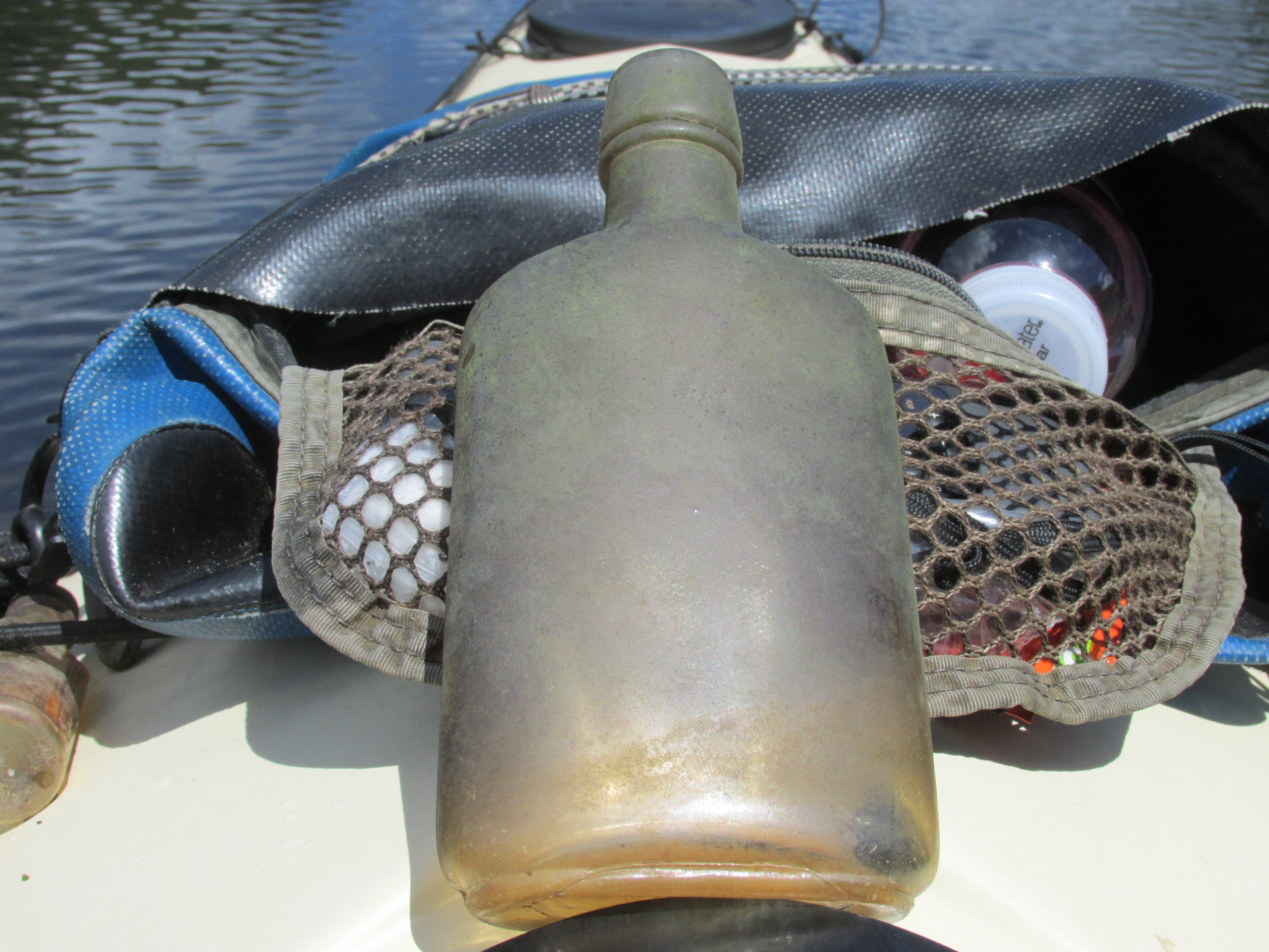
Trash gathered up along the way including the aforementioned mail crates...


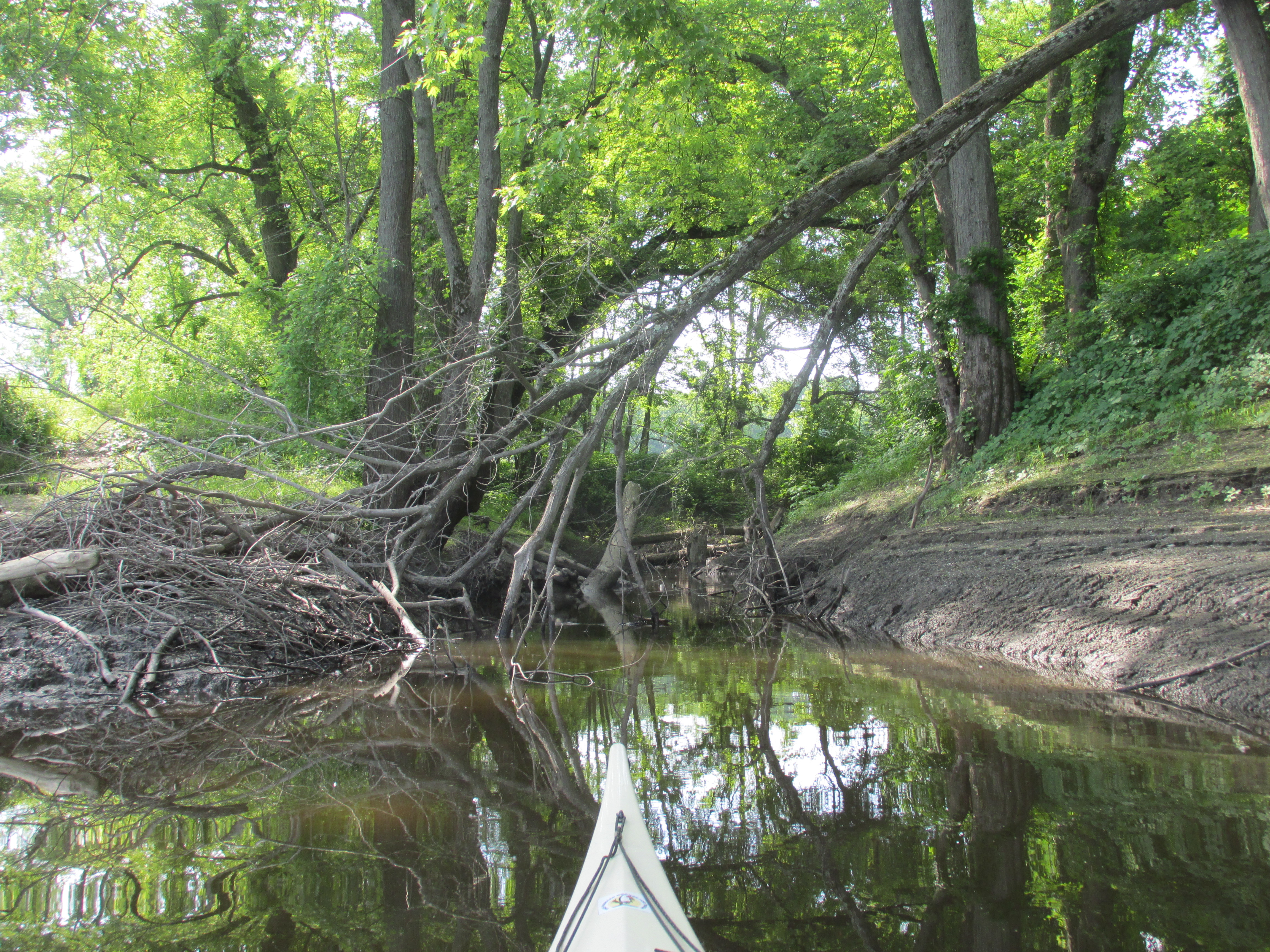
On Tuesday I celebrated the Summer Solstice with a paddle on the Nashua River upstream from Petapawag in Groton, MA...


Unfortunately someone had recently dumped what looked to be recycled cardboard and trash at the boat ramp...


A more positive development was seeing that all the tree limbs (acting as a strainer) on the upstream side of the Route/119/111 bridge had been removed...


Trash found out on the river...


Bring on summer!

Saturday, June 11, 2022

Assabet Eaglets Uptake


Paddled to the Assabet River eagle nest yesterday to check on the status of the two eaglets.  Both were present and accounted for in the nest.  One eaglet was intent on spreading its wings a bit and learning what they're for...


...finally achieving lift-off and a brief hover above the nest...


My guess is that this year's eaglets will fledge earlier than last year's pair which fledged in early July.

Came across this old and still corked half-pint bottle floating in the river...

...and couldn't help but think that when the cork was last pressed into the bottle, however many years ago, any thoughts of eagles in the area would have seemed far fetched. 

Wednesday, June 8, 2022

Concord River Down to the Dam


Closed out the first week of June with a paddle down the Concord River starting from the Bedford Boat Ramp (above photo).  It was a perfect day for paying a visit to the Faulkner Dam in North Billerica.  One of the more scenic spots along the way is the Fordway Bar just below the Pollard Street bridge... 

With the river at its present level and the current being slow, the rocks in the bar are easily avoided.

Beyond the bar is a millpond and Talbot Mills...
The mill tower's bell appears to be unmounted and resting on its floor...


Before leaving the dam area it appeared the river was looking back at me...


While paddling upriver back through the Fordway Bar I encountered this strange creature...
...believed to be a young Star-nosed Mole.  It was in almost constant motion and took to swimming at one point.  One of the stranger creatures I've ever encountered.
  
Later ran across this cormorant perched on a wire...
...which I would've thought difficult on account of their presumably webbed feet.

Very little in the way of trash...


On the previous Friday I paddled the Sudbury River from River Road in Wayland where repair work is still underway on the Route 27 bridge...

Near the bridge this killdeer or possibly a Wilson's Plover stood still for a photo...

Just before reaching the Route 20 bridge came across this cormorant cluster...
I'd imagine a gang this big would clean out the local fish population in short order.


Passed under a serene-looking Pelham Island Bridge...

Trash was also on the light side with what looked like bits insulating foam...

Happy to report the U.S. Postal Service took possession of the three mail crates recovered from the upper Concord River in late May.


Thursday, June 2, 2022

The Turn in the River


I closed out the month of May on the run (so to speak) from another of my less than favorite meteorological terms...a "Back Door Cold Front" (BDCF).  Only "Bombogenesis" and "Polar Vortex" come to mind as being even more undesirable. For Tuesday the weather forecasters had predicted the BDCF would head westward from the New England coast and eventually bring cool maritime air far inland thus extinguishing any feel of summer.  Therefore, an early morning drive 75 miles to the west brought me to the Connecticut River valley a good 5 hours ahead of the BDCF's predicted arrival.  I chose to re-visit a section of the Connecticut River once known as "The Turn in the River" and launched from Kellogg Hill Road in Hatfield, MA.  The boat launch in a wooded area was quiet with a couple of fishermen trying their luck from the gravel ramp.  After launching I headed upriver to where a big sweep to the east begins (above photo).  I had an 1895 topo map with me showing how things looked back then...
...as well as a more modern map (1941)...
Both maps were found at UNH's Dimond Library website.

The river's course has changed many times over the ensuing years.  One section of shoreline that didn't yield to the river was where these rock formations forced a turn to the west...


 Just upriver from the rock formations is where Russellville Brook enters from the northeast...

According to a Massachusetts Historical Commission Reconnaissance Survey for Hadley, in 1982 there was a Woodland Period Native American occupation near the brook's mouth.  After passing the brook and looking upriver the river swings back to the north with Wequamps aka Mt. Sugarloaf in the distance...


Went up as far as a small islet...


...where a pair of adult eagles were hanging out nearby...


Suspect they'd been dining earlier on this fish...


Several sandpipers were active on the islet...


The sun's glint off a piece of glass caught my eye and turned out to be a round piece of glass embossed with what looks like a ringed planet...
It looks almost like the 1950's era Oldsmobile trademark.  Possibly a glass lens for a light fixture?

Facing a building breeze from the northwest I turned about and headed downriver to where my 1895 map showed a ferry crossing between Hatfield and Hadley.  According to the map it reached the east side of the river just upriver from the mouth of Mill River (flowing from Lake Warner)...


 Paddled into the brook about 0.2 miles to where this crude bridge crosses the stream...

The 1895 map shows a bridge crossing the brook at about this location.  The bridge is constructed of steel and wood decking (with a winged traffic cop on duty)...
...and appears these days to receive ATV traffic...

Could this bridge have once been used by folks heading to and from the ferry?  Suppose it's possible.  It may also have been related to a former dam at this spot.

Around this time skies were clouding up a bit and the river was starting to get busy with power boats and jet-skis...a good time for me to head back to the boat launch.  Some trash gathered up along the way..

  
My car's thermometer showed 88 degrees F. as I left the site.  Drove north into Greenfield for some grub before heading home.  At 3 pm in Greenfield the same thermometer showed 91 degrees F.   An hour later and about 60 miles to the east car windows were closed and thermometer showed 68 degrees F.  Thanks to having gone west I'd escaped the BDCF and for the best part of the day enjoyed the feel of summer.  I'll take every small victory I can get.  Isn't it about time, though, for one of my favorite meteorological terms...the "Bermuda High" where we get a multi-day stretch of sunny and warm days?