I first encountered the Lower Poultney River in western Vermont back in 2016 when paddling Lake Champlain between Fort Ticonderoga and Whitehall, NY. I've been meaning to get back and see more of the Poultney ever since, and finally did so this past week with plans to explore more of the river between "The Elbow" and Carver Falls. Because the border dividing New York and Vermont follows the meandering course of the Poultney River, it was a bit disorienting to find myself paddling north for several hours and having Vermont to my left (west) and New York to my right (east). This map shows the Lower Poultney River and the two sections I paddled this past week...

On Tuesday I launched into the river from Coggman Bridge on County Road 10 where I couldn't find anything resembling a proper boat launch. Perhaps when the bridge was recently replaced a former boat launch was lost? Had to lower my boat by rope down the steep bank in order to gain access. Then headed upriver with hopes of reaching the foot of Carver Falls described by the above plan as "the highest major falls in Vermont composed of two large falls at the head of a limestone gorge which is one of the best examples of this kind of gorge in Vermont.".
Passing under Coggman Bridge shortly after launching... The water level was 2.2' according to the gage below Carver Falls and while shallow in places there was just enough depth to allow upriver progress. There were old tree stumps in the river channel...
 ...and places where the river appeared to have carved its way through sand...
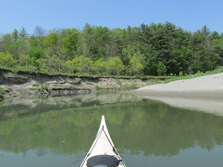
Wildflowers such as columbine and these buttercups (I think) were seen...


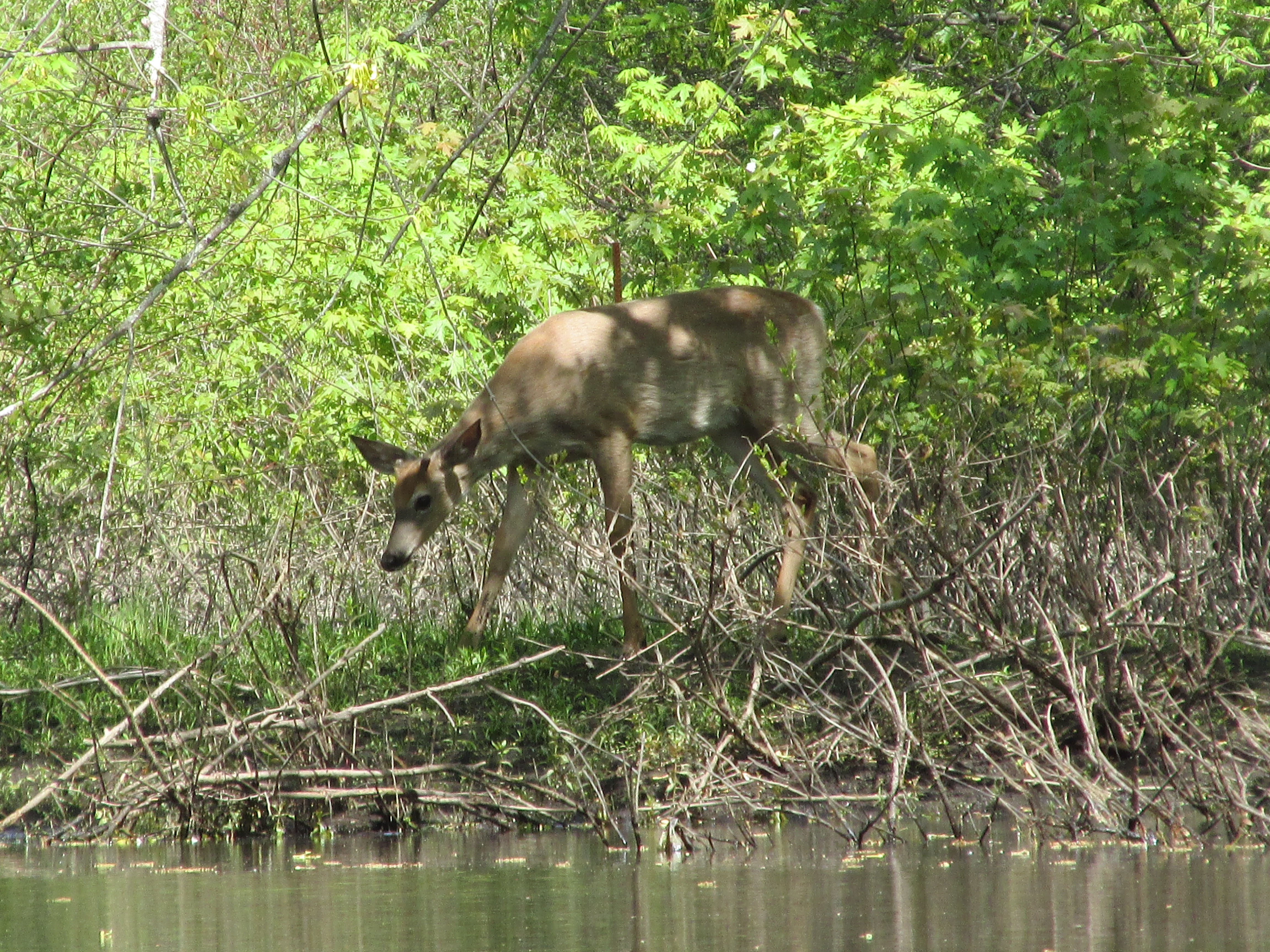
Some of the wildlife seen were this bedded-down white-tailed deer...


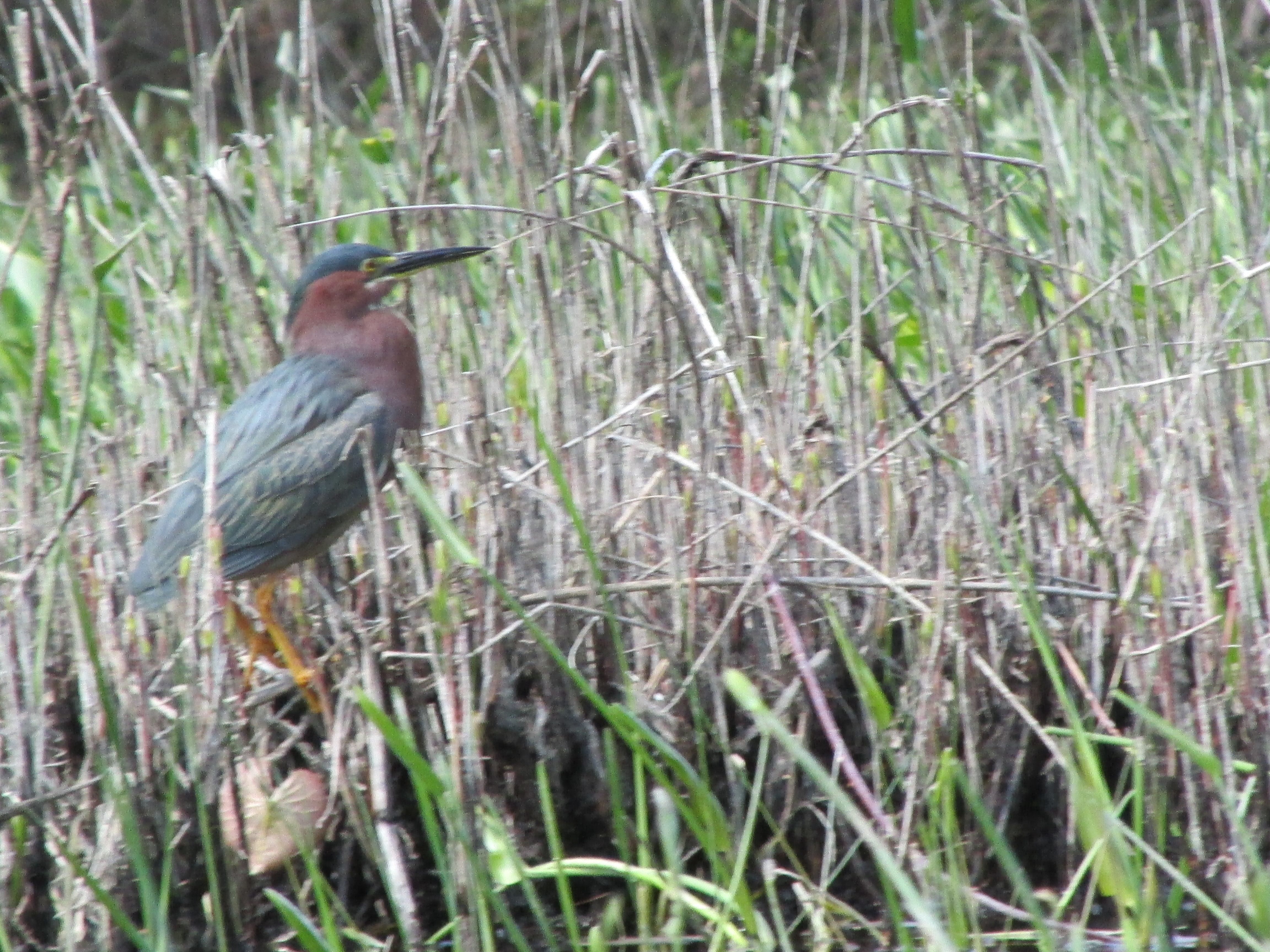
...and this mink with a fish he'd caught...

Upon seeing me he put the fish down and disappeared briefly before re-appearing to get a closer look...

...then it was back to his fish...

Eventually after 3.25 miles I ran out of navigable water before reaching the point where the falls could be seen. The only location reference point was this river gauging station...


.JPG)
.JPG)
This map shows the area and various hiking trails...

My first order of business there was to follow the portage trail to the downstream put-in (lower left in above photo) and see if, on the previous day, I was anywhere near it. The trail was steep and muddy in places...

...and when I reached the end-of-portage put-in I was relieved to see the very same gauging station I'd looked at the day before...

...providing me no small measure of satisfaction in having accomplished my goal. Then it was back up the trail to the falls. By the way, the whole portage trail from the upstream takeout to the downstream put-in is approximately a half mile with the first half fairly level and the second half steep and rugged.
Back closer to the falls I visited the riverside powerhouse built into the side of a steep gorge...

Photos on the kiosks show that back in 1930 someone else snapped a photo while standing near the same spot...

Another kiosk photo shows the powerhouse as seen from the river...

Then it was an easy paddle with the current back down to Coggman Bridge and a rope-drawn extraction of my boat.
Early the next day I launched near "The Elbow" as rain was predicted for mid-day. Before heading upriver a quick trip was taken down to Whitehall where I saw the only other boats I'd encounter on the water over the two days...

The sailboat may have just passed through Lock 12 of the Champlain Canal...

Nearby was one of many flags or signs seen in the Whitehall area depicting a Sasquatch-like creature with the word "Believe"...

Soon I was back at "The Elbow"...


According to an interesting video presentation titled Human History and Ecology of the Poultney River: How a Bay Became a River in Southern Lake Champlain by the Nature Conservancy's Paul Marangelo, this stretch of the Poultney was once navigable by 40-ton sloops almost as far upriver as Carver Falls until the river's course was drastically altered in 1783. The change in course resulted in large amounts of material being deposited downriver which greatly reduced the river's depth.
Proceeding in a northerly direction for several hours I had the high cliffs of Warner Hill in NY to my right...

...and a series of expansive marshes on my left in Vermont...

...counter-intuitive to this paddler.
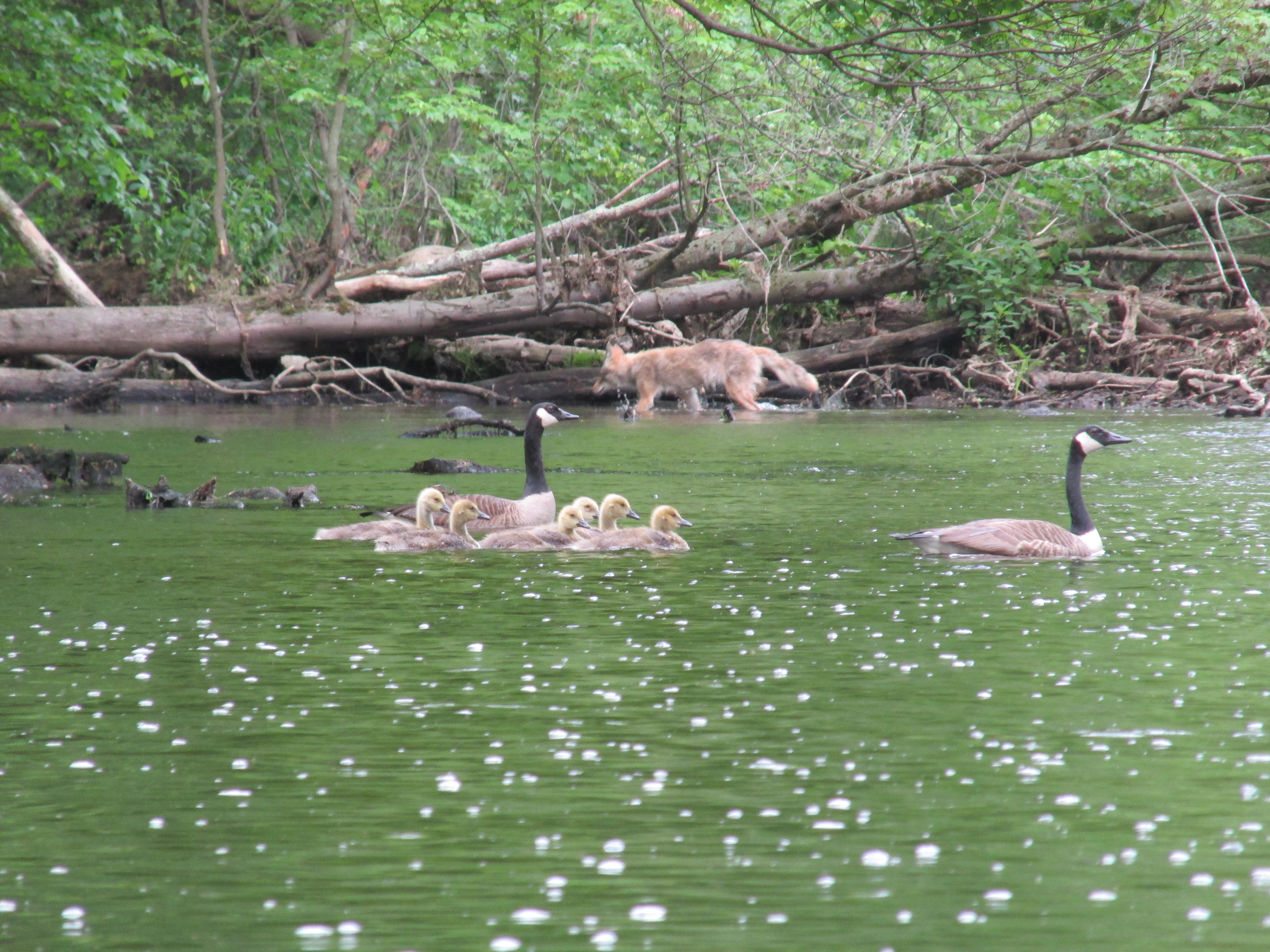
Wildlife seen on this stretch included numerous recently expanded wood duck families...


A few stately-looking trees (perhaps hickory) are seen in places...

With skies darkening from an approaching cold front I turned about near Reed Marsh and headed back to the takeout.
The area of New York state enveloped by the Poultney's northerly, westerly, and southerly deviation is very rural with numerous dairy farms. While navigating the County Roads 10, 11, and Abair Road early in the day several horse-drawn wagons were encountered that appeared to be hauling milk cans of fresh milk from Amish farms to a roadside creamery...

Seeing this horse-drawn wagon, patiently waiting with its tailgate down, allowed me to imagine I'd gone back to an earlier time...

Later, after getting back home, I was curious as to why there's so many images of a Sasquatch/Bigfoot creature around Whitehall and found there's been a long-standing belief in such creatures being in the area. According to newspaper accounts such as the Times Union there were several sightings on Abair Road...the road I drove each day on my way to the river.
Perhaps the creature was in some way responsible for this trash found on the Vermont side of the bridge at East Bay Road...

Hard to believe anyone could spend time fishing alongside a beautiful river and simply drop their trash where they stood...especially with this sign only a stone's throw away...

Trash from both days alongside and in the Poultney...

One sign that looked to have been posted last fall warned hunters of an EDT (epizootic hemorrhagic disease) outbreak among white-tailed deer in the area...

Hopefully, like Covid, EDT is on the decline.


.jpg)