Sunday, May 29, 2022

The Merrimack, Nashua, and Concord

Got out on three rivers this past week.  When combined, the rivers' names sound like they could've been used as the name of a regional railroad (at least to the ear of this railfan).  The Merrimack, Nashua, and Concord Railroad?  My week started with a Monday morning paddle on the Merrimack River between the Route 113 bridge in Tyngsborough, MA...


 ...and a point near Spit Brook Rd. in Nashua, NH.  As I crossed the state line into New Hampshire I encountered this Pan Am locomotive running light in the opposite direction having just entered Massachusetts...

With the sale of Pan Am Railways to CSX Transportation set to take effect next week odds are this locomotive (# 315?) probably won't be getting a badly-needed paint job anytime soon.

It was a great day to be on the Merrimack with hardly another boat in sight...


On Wednesday I stopped in at the Oxbow North boat launch at Hospital Rd. in Devens.  When visited earlier in the month I found the gate locked and a construction project underway   This time the gate was open and the recent work at the boat launch appeared to be complete.  There's now a wheelable pathway as an alternative to carrying one's boat down the stairs...

View from the river...

From the launch I paddled downriver...

...to the Ice House Dam at the Ayer/Shirley line and then upriver past Route 2...

The many sloughs of the Nashua looked inviting...

Yesterday I closed out the week on the Concord River in Concord, MA.  The water level at the Egg Rock inscription has dropped quite a bit...

The Concord was serene under a cloudy sky as I passed under the Monument Street bridge...

Below the bridge I encountered  a bit of a mystery.  There were three large trash bags at three different locations...
...and they were all on the east side of the river.
    
The contents of each bag were the same: a U.S. Postal Service crate...

...and several bundles of advertisements.  My guess is that someone is throwing these off of the Monument Street bridge perhaps rather than delivering them.  Sounds almost like something Kramer and Newman might have cooked up.

Wildlife over the week included this beaver skull on the Merrimack...

...and a Merrimack mushquash...

The Nashua had this old-timer who raised his eye just above the surface...

The Concord had this proud family of Canada geese...
...as well as this blue heron that showed me how big a fish he could swallow...


Monday's trash on the Merrimack was colorful...


Wednesday's trash on the Nashua included some of the usual suspects...
...60 nip bottles and 10 cigarette lighters.

Saturday's from the Concord...
...with the three US Postal Service mail crates.  Plan is to contact the USPS and see if they want the crates.


Saturday, May 21, 2022

More Eaglets for the Assabet


Got out on the Assabet River a couple of times this past week (Monday and Friday).  Friday's paddle started with foggy conditions (above) which later gave way to a beauty of a day...

On Monday, I got my first look at the Assabet River's newest eaglets...


Only four days later they appear to have grown significantly...


I suspect the fast growth is due to a steady diet of Canada geese goslings.  I watched one adult eagle stalk such goslings...
...from his perch directly above them...

Then yesterday these goslings in a meadow less than 200 yards from the nest faced the same danger...
For the eagle family it's like having a grocery store next door.

At another spot on the river I saw the work of a pileated woodpecker...
...which drew me close to the shore where the upper half of a glass bottle protruded from the river bank.  It was a 1935 half-pint bottle of Old Quaker whiskey...
Could the bottle have been stuck there all these years?  I can imagine the bottle's contents having been particularly enjoyed since folks had emerged from 13 years of Prohibition only 2 years before in 1933.  

Monday's trash...

 Friday's trash...


Sunday, May 15, 2022

Tully and Merrimack


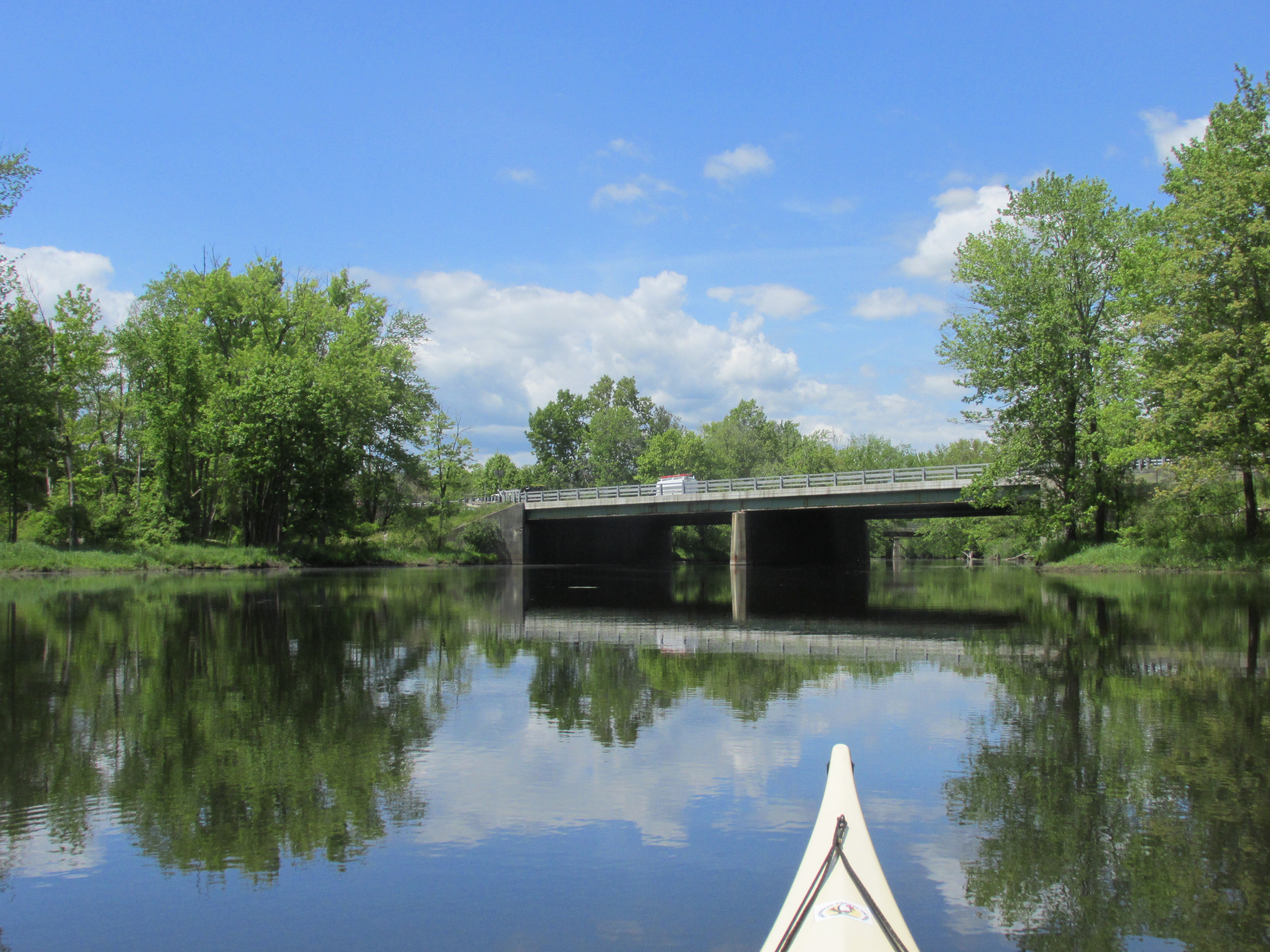
This past week we finally escaped the grip of a swirling low pressure system stuck off the mid-Atlantic coast.  Day after day it sent cool maritime air westward on gusty winds.  On Tuesday I escaped the reach of those winds by traveling to Royalston in north central Massachusetts.  Once there I launched into the Tully River's east branch and headed upriver to the north...

Jacob's Hill is to the river's east and provided a barrier to gusts from that direction.  Water levels were ideal for paddling over beaver dams and allowed me to reach the hiker/mountain bike trail bridge... 

Prior to the 1947 Tully Dam flood control project, present-day Warwick Road (Rt. 68) used to cross the river here.

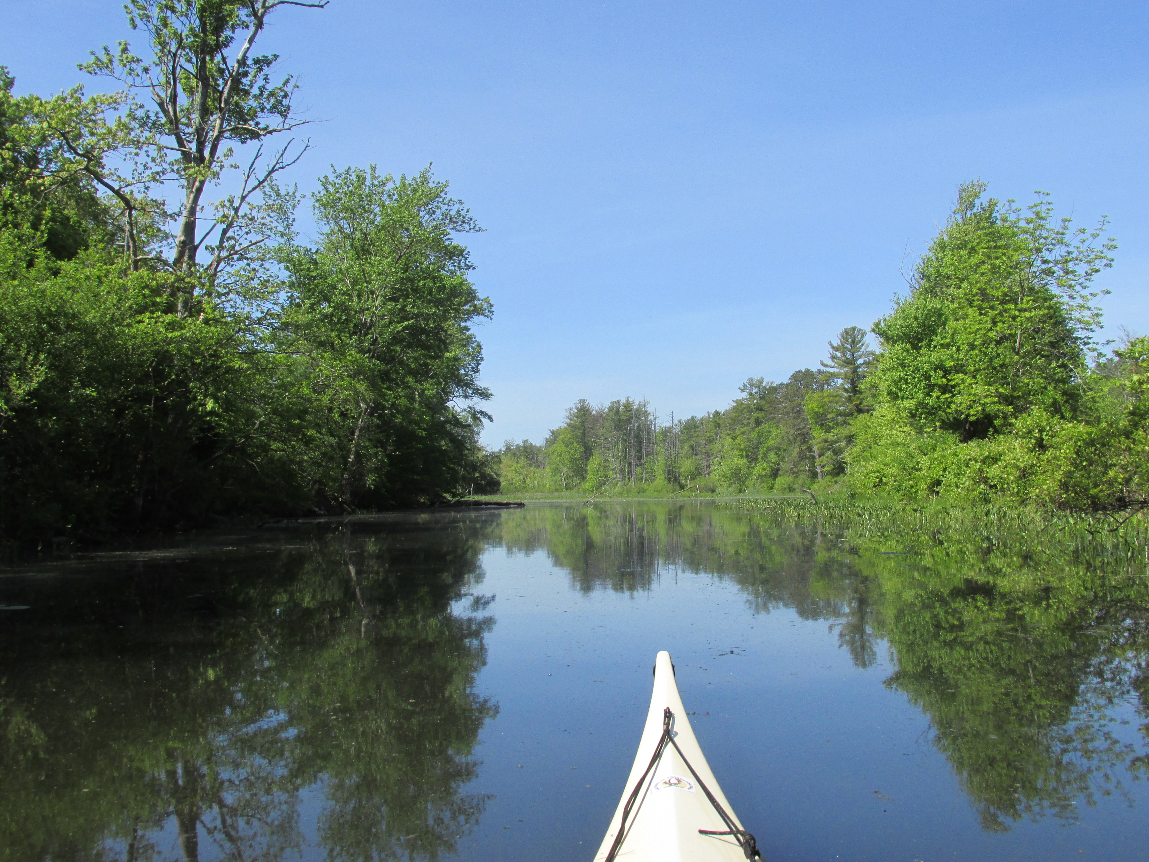
The view eastward along the abandoned road...

Just a short distance downstream is another stone bridge abutment which carried Davis Hill Road before the dam was built...

Passed these Pitcher plants preparing for another season...

The Tully is part of the Connecticut River watershed and its waters eventually reach Long Island Sound.

The little taste of summer found here came to an end as I drove eastward on Route 2 post-paddle.  Car windows that were rolled down were soon cranked up again once east of Fitchburg.


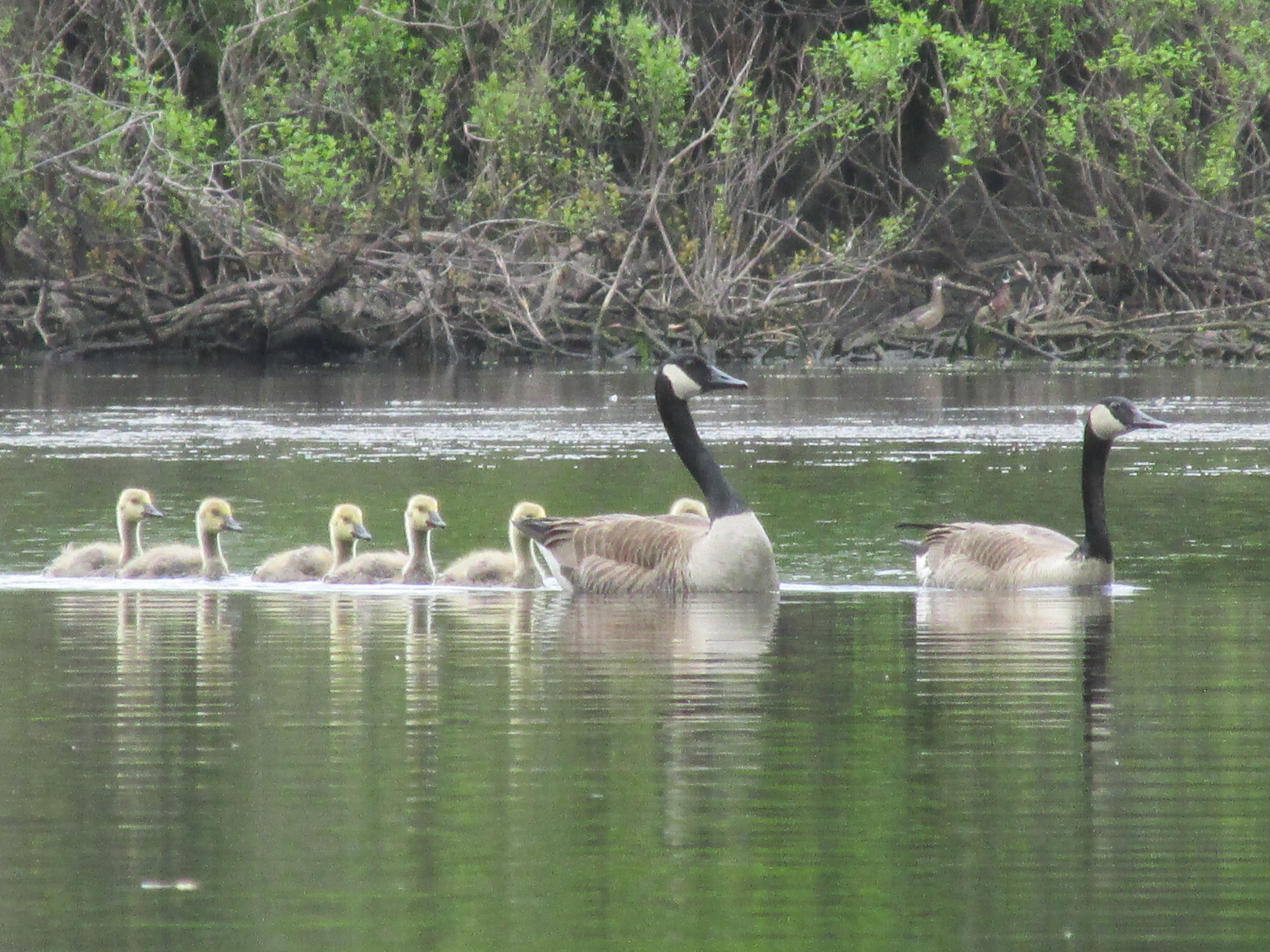
Later in the week on Friday came the real feel of summer.  After an early-morning launch into the Merrimack River in North Chelmsford I watched the last bits of fog retreat to the east...

The above view looks eastward towards the Atlantic Ocean where this river is headed.

Passed this turtle who'd already secured a primo spot for sun-basking...

Not sure if he's a painted turtle in camouflage or perhaps some other type of turtle.  Unlike most other painted turtles I encounter, this guy was all by himself.  Perhaps an old timer...like me.

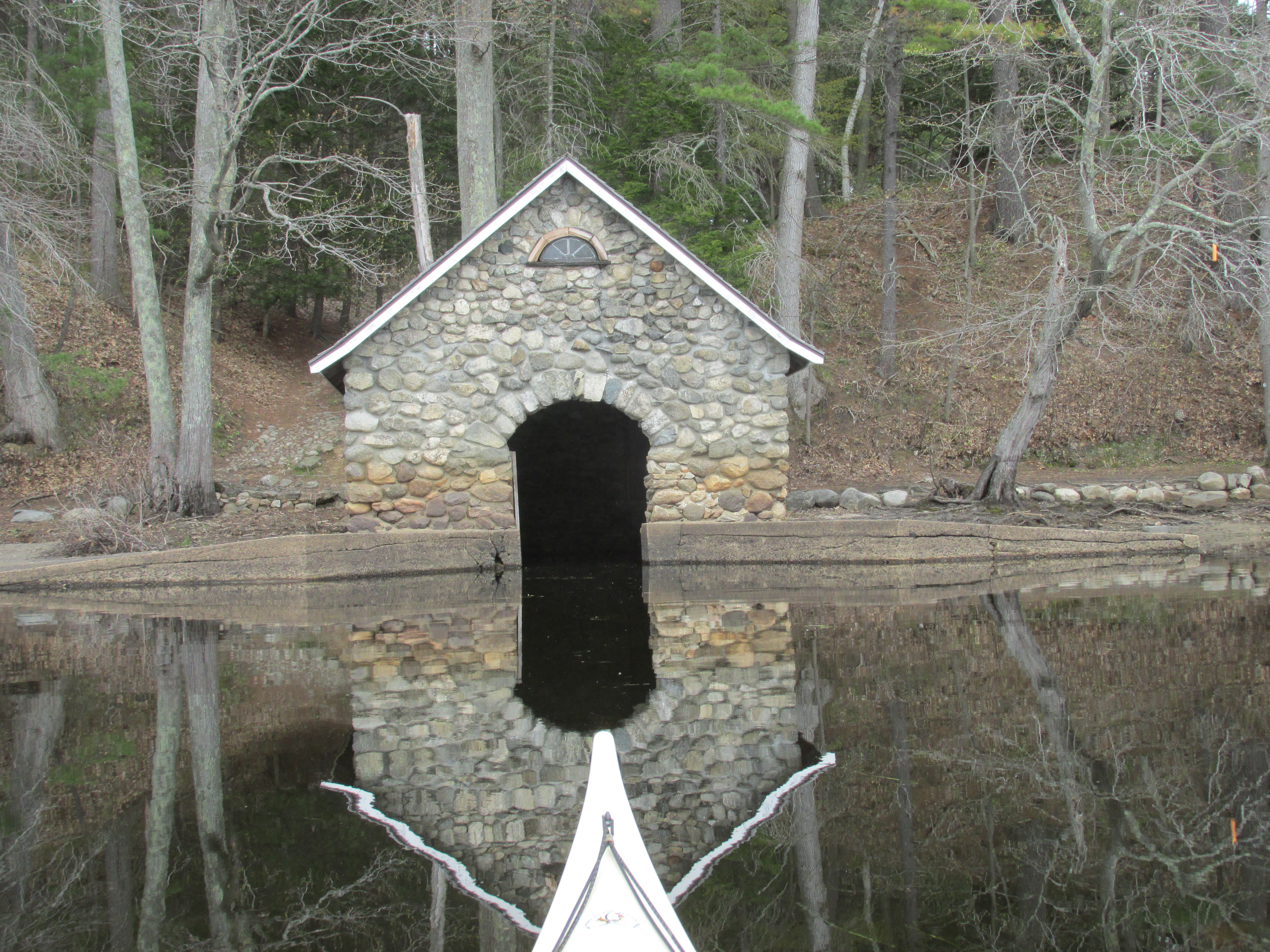
A fairly humble riverside hut built with materials readily available...


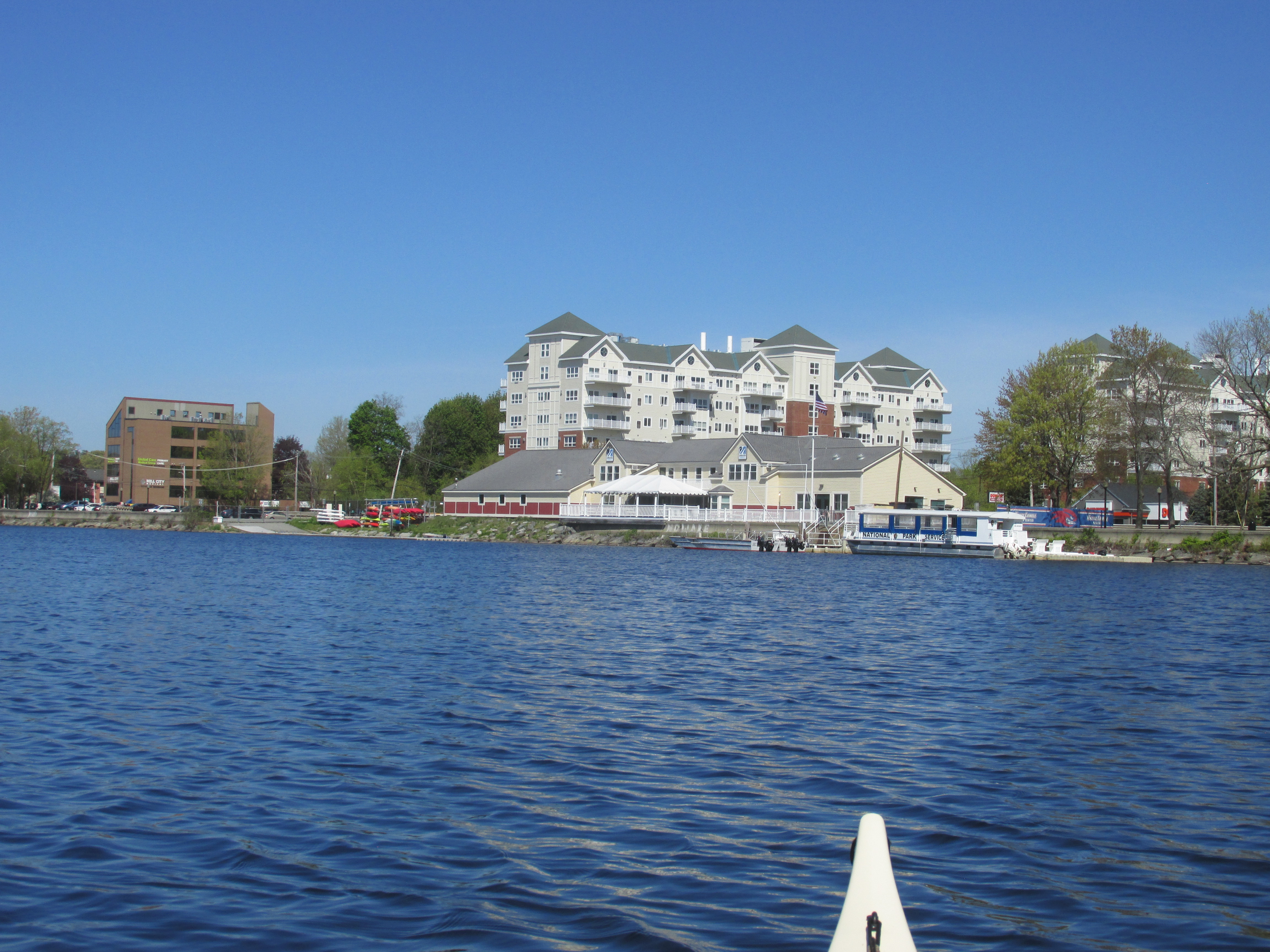
The UMASS Lowell Boat House was looking sharp in the morning sunshine...


On the opposite side of the river from the boat house I could make out the roof of the Swaminarayan Hindu Temple...

...which serves as a point of reference to where the Middlesex Canal long ago entered the river through a series of locks (about 500 feet east of the temple).

Heading upriver I passed the south end of Wickasee Island and paddled up the canal on the island's east side.  A brand new Island Road Bridge spans the canal...

Right next to the shiny new bridge is this 92 year old historical marker...
...thankfully preserved during the bridge's rebuilding.  The marker was one of several hundred created in 1930 on the tercentenary of the Massachusetts Bay Colony.  I wonder how differently these historical markers would read if revised for the colony's quadricentennial coming up 8 years from now.  Perhaps the sign should also mention how Wannalancet's family came to lose possession of their island and how desperately they tried to get it back.  Were the English faithful friends to them?

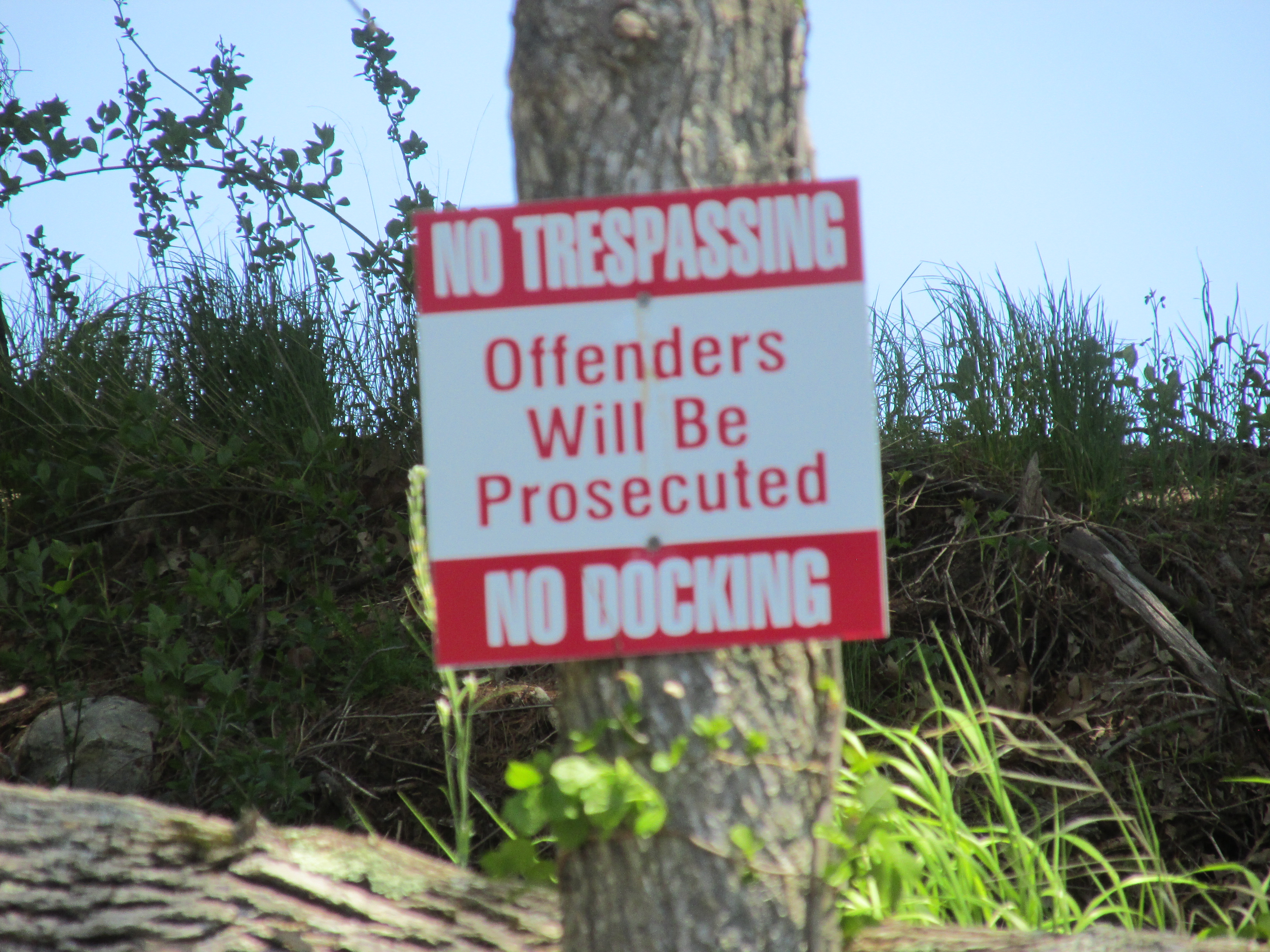
If Wannalancet were around today I suspect he'd be OK with the new bridge.  However, I tend to believe he'd be less than pleased with this sign (1 of 3) repelling boaters looking for a spot to exit their boats and rest a bit on what was once his island...
...and there are no docks there anyway!
  

Trash for the week included this reminder of the estimated 4 to 8 million Hooksett Disks which were accidentally released from a wastewater treatment plant 35 miles or so upriver back in 2011...


The silver dollar-sized plastic wafer disk joined a wide assortment of trash mostly of a plastic nature...

On the other hand, trash from the Tully River was almost non-existent...

...with a can of Miller High Life "The Champagne of Beers" serving as a reminder of the area's hilly elevation.


Monday, May 9, 2022

Slates to Boston

Paddled bits of the Nashua and Sudbury rivers this past week.  On Tuesday a planned paddle from Oxbow NWR North at Hospital Rd. in Devens, MA was switched to Oxbow South in Harvard, MA.  This was due to a locked gate at the Hospital Rd. site where a construction project is underway (perhaps to improve access for folks with limited mobility).  

Headed downriver to about where the old Shaker Bridge once crossed the river near Treasury Hill.  Along the way I paddled up a river-left tributary to the above pictured culvert and dam with water cascading down on its way to the river.  It was the second time I'd visited this spot, and both visits left me puzzled as to why the pond and stream aren't currently named on Google maps.  Some digging around on the internet led me to The History of the Town of Lancaster Massachusetts by Rev. Abijah P. Marvin written in 1879.  Marvin included in his book (page 428) a "Map of Lancaster" which shows a Cumbery Brook flowing to the Nashua River and also a number 28 at a point about three quarters of a mile upstream from the pictured waterfall.  The map's table shows 28 representing the location of Slate Rock Quarry.  A screen shot of Marvin's map showing the area...

 The slate quarry was first found by a Mr. Flagg about 1752 and over a 50-year period produced slate shingles the Smithsonian Institute in 1886 noted as being "suitable for roofing or other fine work".  Marvin notes that the slates from this quarry "once shingled the Hancock House on Beacon Street (taken down in 1863), the Old State House, and many other buildings in Boston".  An exact replica of the Hancock House was built in Ticonderoga, NY and gives some idea of how the slates from this quarry might have looked on the building's roof.  Marvin also states that the quarry "was sometimes called the Shaker Quarry, though never a part of their property.  Perhaps the name was given because the Shakers, in the latter part of the century (1790's), were employed to take them to Boston with great ox teams."  Shakers were members of a religious sect which broke away from Quakers in the mid-1700s in England.  They came to America in the late 1700s and established small agricultural communities where they practiced their faith while living and working a simple life in communal villages.  One thing that distinguished them from other religious sects, and perhaps led to their demise, was their disbelief in procreation.  Because the Lancaster and Shirley Shaker community was located not far from the Slate Rock Quarry, it's likely the Shakers would've passed it on their way to and from a neighboring Shaker community across the river in Harvard, MA.  It should be noted that the Slate Rock Quarry site is presently located within the Fort Devens South Post area and is off limits to civilians.  Current environmental reports refer to the brook as Slate Rock Brook and the pond above the dam as Slate Rock Pond.  Slate Rock Quarry is located very close to where the Union Turnpike passed through the northeast corner of Lancaster.  This 1897 map with my notations shows the locations of the Slate Rock Quarry, Slate Rock Pond, Union Turnpike, Shaker village, and Nashua River...

  
It seems plausible that the Shakers and their ox-drawn wagons loaded with slates may have followed that route on their way to Boston.  If so, they might have passed over the Sudbury River at Lee's Bridge in Lincoln, MA which is where I found myself paddling a few days later...


Though before leaving the Nashua River, I came across another well-built dam just north of Route 2...

Seeing an osprey perched above the pond...
...inspired me to walk around the dam and see the pond the beavers created...

Doing so got me my first tick-bite of 2022.  Note to self... "no more bushwacking".

On Friday I paddled a tranquil Sudbury River in Concord and Lincoln, MA...


Fairhaven Bay's little stone boathouse...

...invited a quick peek inside...


Plenty of red-winged blackbirds about...

...and a bald eagle...


 Trash recovered from the Nashua (including 113 nip bottles)...


Much of what is pictured above came from trash traps like this...


Boat was at capacity after 2 miles, yet a great deal more trash was seen along the way...

...including tires and propane tanks.

The Sudbury River had considerably less trash...


Often run across fishing line in the water, but rarely this much...


One encouraging sign on the Sudbury was an empty can of Leinenkugel's Summer Shandy.  Hope it bodes of warmer days ahead.