Friday, April 22, 2022

Earth Week Paddles


This Earth Week saw some paddling on more local waters which included the Concord River's Old North Bridge (above photo) on a bright and sunny Easter morning.  It was the day before the Patriot''s Day holiday. The Minuteman Statue at the west end of the bridge stood ever at the ready...

From the bridge I paddled about 2.5 miles upriver to the Col. James Barrett farmhouse alongside the Assabet River.  On that April morning the British soldiers went to Barrett's farm and searched for weapons...


Clouds soon filled-in giving the Assabet a moody look...


Yesterday I got out on the Nashua River from Oxbow NWR in Harvard, MA and paddled upriver crossing paths with this swimming snake...


Trash was plentiful, as usual, for this stretch of river...


Amongst the flotsam was this beer can named for nearby Mt. Wachusett...

...and these two critters glad to be pulled out...

Perhaps it's the shallow water and many sharp bends in this area that allows so much trash to accumulate...

This was picked up from a 1.5 mile section upriver from the boat launch...

Besides the water, soda, and beer bottles were 154 "nips" and 14 plastic cigarette lighters.

By comparison the week's earlier paddle on the Concord and Assabet rivers produced a much smaller and more typical amount of trash...

Happy Earth Day!


Tuesday, April 19, 2022

The Heart of Mohawk Country


The image on the snowplow told me I was getting close to the heart of Mohawk Country. I came across the plow in Fonda, NY last Tuesday on my last full day in the Mohawk River Valley.  It was near here that historians believe Van den Bogaert's 1634/35 expedition crossed the Mohawk River from the north  to the south side. Over the next 18 miles westward between present-day Fonda and Fort Plain his group either visited or passed by eight Mohawk villages.  He recorded the names of the villages (in order from east to west): Onekahoncka, Canawarode, Schatserosy, Canagere, Schanidisse, Osquage, Cawaoge, and Tenotoge.

I launched into the Mohawk across the road from the Fonda Fairgrounds and Speedway on the river's north shore from a spot close to where the 1779 General Clinton 200-batteaux fleet camped on their way from Schenectady to Canajoharie.

Once launched I headed upriver and avoided the strongest flow by hugging the north shore.  The north shore also provided protection from the day's gusty northwest winds.  The morning's earlier rain had stopped and skies were beginning to look more promising...


Stopped briefly at the mouth of Cayadutta Creek...

...and thought of how these waters had flowed past the Mohawk village Caughnawaga located about half a mile up the creek.

Continuing upriver I had for company a busy New York Thruway on the river's south side and an equally busy railroad on the north side.  My on-the-water companions included this pair of long-tailed ducks...
...as well as some common mergansers, a kingfisher, and a blue heron or two.

After paddling about 4.5 miles the movable dam and lock 13 at Yosts (hamlet in Randall, NY) came into view...
...with its closed lock gates located on the river's south side...


The hill sloping down to the river is called "Big Nose".   I'd arrived just in time to see Amtrak train 281 of the Empire Service making its way westward towards Utica...
The above photo shows the movable dam in the raised position just below what looks like a bridge to nowhere.
 
Further upriver (between Lock13 and Sprakers) was "Keator's Rift" which Jeptha Simms in 1845 described as "the greatest on the river, having a fall of ten feet" in The Navigators by Philip Lord Jr..  Lord says the following of Spraker's Tavern located at Keator's Rift: "There was perhaps no more strategically placed tavern in the Mohawk Valley, situated as it was at the head of the most dangerous rapid on the river.  Here boatmen bound downriver could fortify themselves for the run, and those lucky enough to make it up through Keator's Rift, could celebrate their success, or perhaps recover from disaster."  

Noting the much faster moving water near Lock 13 I turned about and rode the current, sometimes as fast as 7 mph...

 
...back down to Fonda.  Approaching the takeout near the Canal Maintenance facility I saw where all the buoys hang out...
...while the canal is shut down for the winter.

Post paddle I drove along Route 5S which paralleled the river to Canajoharie where I found two historical markers commemorating General Clinton's 20-mile portage between Canajoharie and Ostego Lake:
This one (that's seen better days) along a steeply inclined Rock Street...
...and a more elaborate bronze plaque on the grounds of the Arkell Museum...

The Arkell Museum and its classic Dutch Colonial lines...


Every year the General Clinton Canoe Regatta holds an event commemorating Clinton's subsequent journey between Cooperstown on Ostego Lake and Bainbridge, NY some 70 miles down the Susquehanna River to where he linked-up with General Sullivan's force.  Back in 2004 and 2005 a younger and stronger version of myself participated by paddling the 70 mile distance (fortunately in a downriver direction).  At that time I didn't appreciate how many obstacles Clinton and his men had surmounted before ever reaching Ostego Lake.

The Sullivan-Clinton Expedition brought destruction to the Iroquois tribes who were aligned with the British during the Revolutionary War.  

From Canajoharie I next drove further along Route 5S through Fort Plain and Sand Hill to the largest Mohawk village that Van den Bogaerts visited...

Bogaert and his fellow Dutchmen spent multiple days here both on their way to and from Oneida.  His journal entries provide a glimpse of two very different cultures interacting with each other.  On his return journey, perhaps eager to get back to Fort Orange asap, Van den Bogaerts went ahead solo.  When darkness fell and he was unable to start a fire he ended up spending the whole night pacing back and forth in order to avoid freezing to death (as Clint Eastwood said "A man's got to know his limitations").   Van den Bogaert also had difficulty understanding why the Mohawks were reluctant to carry all of his gear in addition to their own.  When traveling between villages he, his fellow Dutchmen, and the Mohawk guides would spend the night in what Van den Bogaert called "hunter's cabins".  According to notes attached to the journal these trail houses were said to have been "built in response to dreams". 

Thus ended my trip through the heart of Mohawk Country.  However, before leaving the valley I enjoyed supper at a Palatine Bridge restaurant with a commanding view of the valley.  While still in Palatine Bridge I encountered a horse and buggy at a traffic light on Route 5.  Heading back to my hotel in Amsterdam I stopped to visit Schoharie Crossing.  Here at the confluence of the Mohawk River and Schoharie Creek was located the Lower Village Tionontogen...

In 1712 the British built Fort Hunter adjacent to the village...

The Mohawks are said to have had three different clans to which tribe members belonged: the Bear, Turtle, and Wolf clans.  With Tionontogen being for Wolf Clan and Caughnawag being for the Turtle Clan, I'm guessing that Tenotoge may have been where the Bear Clan people lived.  
.
While at Schoharie Creek I also visited the remains of the aqueduct which once carried the Erie Canal over the creek.  Back in 1902  Howard Blackburn and his 25-foot sloop "Great Republic" traversed the Erie Canal en route to the Mississippi River. He and his somewhat famous sloop would've made the crossing here...
The view is looking west, the direction in which Blackburn and his boat traveled. I can almost picture Blackburn up on the towpath to the right pulling his sloop along the canal. In Joe Garland's book Lone Voyager Blackburn claims "I had to tow the boat forty miles myself before I could get anyone to take her in tow.  Then Captain Howard came along with two light boats.  He agreed to tow me to Buffalo for thirty dollars.  He carried a crew of three men besides himself and four mules."  Blackburn had sailed the "Great Republic" solo across the Atlantic Ocean the previous year...despite his having lost most of his fingers and toes earlier in his life.

In regards to the original people of the valley, it's encouraging to read of an ongoing effort to re-establish a Mohawk presence that had all but vanished in 1783.  The community is called Kanatsiohareke and since1993 its founders are working to once again cultivate corn and other agricultural produce alongside the Mohawk River.

In addition to some of the historical sources mentioned, two movies offering a glimpse of the Mohawk/Jesuit relationship are Black Robe 1991 and Mission of Fear 1966. 

Very little in the way of trash crossed my path over my time on the Mohawk...


Saturday, April 16, 2022

More Mohawk


On day two of my visit to the Mohawk River Valley I found that despite the recent heavy rains the Mohawk River water level was quite low with a fast current.  I'd later learn that in addition to closing down lock operations and removing navigational buoys for the winter, the NYS Canal System also lowers the water level by lifting the movable dams between Schenectady and Fort Plain.  This allows the river to return to a more natural state and prevents ice and debris from accumulating.  

I decided to launch from the Amsterdam Fishing Access Area on Quist Ave just to the city's east.  The recent flood left a mud-coated boat ramp...

Paddled upriver while hugging the river's east shoreline where the current wasn't as strong.  Kept an eye out for any sign of what was once called the "Painted Rocks".   I'd read about these pictographs in The Navigators, A Journal of Passage on the Inland Waterways of New York by Philip Lord Jr.  Lord includes this 1793 description of the pictographs by Jacob Lindley "This day we passed a rock projecting out of the bank of the river, whereon was painted, with great ingenuity, in red colours, a canoe with the representation of seven men in it, which is said to be done annually by Indians, coming several hundred miles for that purpose, in order to commemorate the slaughter of seven Indians, who went off from that neighborhood in some former wars, and were all destroyed."  The description had me wondering if the pictographs might possibly have been related to the 1669 battle between the Mohawks and the Algonquins which occurred about 7 miles further downriver at Kinquariones.  The Mohawks are said to have passed this spot while canoeing to the battle.  Passed this smooth faced boulder with some reddish tinted areas...

...and a little further upriver this ledge...

The ledge was near the freight house mentioned by one witness.  This view shows the ledge and the freight house to its left...
It may be the area where, long ago, the pictographs were located. 

I continued upriver passing Amsterdam's Riverlink Park not realizing at the time there was a full-sized replica of the "Painted Rocks" in the park.  I'd later learn that sculptor Alice Manzi created a representation of the "Painted Rocks" based on a painting by Rufus Grider.  Philip Lord Jr. includes several eyewitness descriptions of the pictographs in his book The Navigators.  Some such as Jacob Lindley (1793) and DeWitt Clinton (1810) described the pictograph as showing one canoe with seven men in it going off to a battle they're said to have never returned from.  Others described two canoes, each with two men, as well as twelve men on foot.  Grider's painting and Manzi's re-creation use the latter description.  However, because of the proximity to the Kinquariones battle site, I'm inclined to favor those describing a canoe with seven warriors heading off to battle.

Speaking of Riverlink Park, workers there were seen cleaning up debris from the recent flooding ...

The black rubber bumper on the wall perhaps show how much higher the water level is when the canal is in operation.

I next passed under the roadway bridge and approached the one for pedestrians...


Between the bridges, North Chuctanunda Creek tumbles down to the river...

Above this point the river's current was too strong so after taking a look at the movable dam at Lock 11...
...I turned about and headed downriver.

Found respite from the current at the south end of Davey Island...
 
Looking downriver on my way to the takeout I couldn't help but imagine the sight of 300 Mohawk warriors in canoes heading downriver to Kinquariones in 1669...
...whereas if here in 1779, I might have seen some of Gen. Clinton's 200 batteaux working their way upriver to Canajoharie.


Post paddle I drove approximately 11 miles west on Route 5 to the Mohawk village Caughnawanda near Fonda...


The palisaded village and its 12 longhouses are staked out...


To the rear of the above photo the terrain slopes steeply (about 40') down to Cayadutta Creek.  The site is approximately half a mile from the Mohawk River.  Walking around the village I was struck by the similarities to the village of Nanrantsouak alongside the Kennebec River in Madison, Maine.  Both villages were palisaded, on high ground, and accommodated a Jesuit chapel. 

Caughnawaga was the Mohawk village attacked by Wompatuck and his Algonquin warriors in August 1669.  When Wompatuck's attack failed he and his warriors retreated about 18 miles east to Wolf Hollow...

...to where the Mohawks ultimately found and defeated them.   The battle site is named Kinquariones for an earlier Algonquin village located nearby...


A look down the hollow...


The Massachusetts sachem Wompatuck never left this area as he fell in battle.  For his warriors that survived the journey home must have been miserable.  The Massachusetts Bay Colony Superintendent of Christian Indians, Daniel Gookin, said at the time "This was a severe stroke to these Indians, and they suffered much from chagrin on the way home."  Meanwhile the Mohawks and their leader Kryn celebrated a great victory.

Day three to follow.


Friday, April 15, 2022

Meeting the Mohawk


Planning a springtime paddling trip is one of the ways by which I get through the many cold and dark days of a New England winter.  My goal this winter was to find a new river with which to get acquainted.  So after deciding to follow the advice of Mr. Horace Greeley and  “Go West young man” I began looking in that direction for a waterway that had played a significant role in the lives of both Native Americans and Colonial Americans.  It didn’t take long to find one having a bearing of 280 degrees (wnw) from my home in eastern Massachusetts.  The first thing that piqued my interest in this waterway was coming across and reading a first-hand account of A Journey Into Mohawk and Oneida Country 1634 – 1635 believed to have been written by Harmen Meyndertsz Van den Bogaert.  This journal, not discovered until 1895, documents a 44-day wintertime trek undertaken by three employees of the Dutch West India Company in late 1634 and early 1635.  The purpose of the journey was to discover why the Mohawks had stopped trading their beaver pelts at Fort Orange (present-day Albany, NY).  Bogaert was a 23 year-old barber/surgeon and with him were fellow Dutchmen, Jeromus la Croex, Willem Tomassen, and 5 members of the Mohawk Tribe who served as guides.  Over the course of their journey they traveled mostly on foot from Fort Orange to an Oneida village located about 120 miles to the west near present-day Oneida, NY.   Their journey often required them to trudge through deep snow, endure frigid temperatures, and make several difficult river and stream crossings.  Much of their route followed the course of the Mohawk River.

The next thing of interest I came across online was mention of an epic battle said to have been fought in August 1669 between the Mohawks (Iroquois peoples) and Mahicans (Algonquin peoples).  The Iroquois and Algonquins were longtime enemies and their languages were unintelligible to each other. The battle’s location intrigued me because, having spent most of my life within and about the ancestral homelands of Algonquin peoples, I’d often seen mention of such a battle but never realized it had been fought alongside the Mohawk River.  A coalition of Algonquins led by the Massachusetts sachem Wompatuck (aka Josias Chikataubut) travelled to the Mohawk country seeking revenge against the Mohawks for their raid in Massachusetts earlier that year.  The Algonquins' multi-day attack on the Mohawk village, Caughnawaga, was repelled and Wompatuck’s force retreated about 18 miles east to a place called “Kinquariones” where they felt safe.  The Mohawk leader, Kryn, gathered warriors from adjacent villages until a force of 300 warriors canoed down the Mohawk in search of the retreating Algonquins.  Once they reached Kinquariones the Mohawks quietly maneuvered around the Algonquins during the night and attacked the next morning.   The Mohawks won the day with Wompatuck and many of his best warriors killed in the battle.  Accounts of this battle were found in the Schenectady Digital History Archive's History of the Mohawk Valley:Gateway to the West 1614 - 1925 Chapter 20:Battle of Kinquariones, 1669 edited by Nelson Greene, and Wompatuck News Vol. 1, No. 4 by Friends of Wompatuck State Park entitled Wompatuck Victim of Mohawk War by Jim Rose.      

This, in turn, was followed by my seeing mention of the 1779 Sullivan – Clinton Revolutionary War Expedition in which General James Clinton moved his 2,000-man army from Schenectady on the Mohawk River to Ostego Lake on the Susquehanna River.  This involved moving 208 batteaux loaded with three months provisions about 40 miles up the Mohawk River through the heart of Mohawk Country to Canajoharie where they then undertook a 20-mile portage to Ostego Lake.  The story of this expedition can be found in Schenectady Digital History Archive's History of the Mohawk Valley:Gateway to the West 164 - 1925 Chapter 67: 1779. Clinton's Overland Portage March from the Mohawk to Ostego Lake by John Fea.

Just in case these three expeditions into Mohawk Country weren’t enough to inspire my traveling to and paddling some of the Mohawk River's waters, I also stumbled upon an account of a 1793 voyage undertaken by three Frenchmen traveling in a batteaux from Schenectady to Oswego on Lake Ontario.  Their journal entries appear in The Navigators, A Journal of Passage on the Inland Waterways of New York by Philip Lord Jr.  They were traveling the river just as measures were being contemplated for making boat traffic on the Mohawk a bit easier.   In addition to that is the 1902 westward trip via the Erie Canal by famed Gloucester fisherman Howard Blackburn in his 25’ sloop Great Republic, the very boat in which he’d sailed solo across the Atlantic Ocean the previous year.  An account of Blackburn's passage is in Joseph Garland's book Lone Voyager.  Also worthy of mention is the fact that some very active railroad tracks run alongside the Mohawk River, and lastly that one of the towns I’d be visiting is named Fonda which brings to mind the movie Drums Along the Mohawk starring Henry Fonda.   What more could I ask for?

So now I had a destination for my springtime paddling/driving trip which would focus on a 40-mile stretch of the Mohawk River Valley between Schenectady, NY and Fort Plain, NY.   This map shows the area and some of the locations I planned to visit...


Day One: Mohawk/Hudson Confluence, Cohoes Falls, and Gateway Landing

This past Sunday morning I headed that way driving along the appropriately-named Mohawk Trail until reaching the eastern shore of the Hudson River where I stopped to explore the confluence of the Mohawk and Hudson rivers.  Launching from the Lansingburgh Boat Ramp in Troy, NY it soon became apparent that both the Hudson and Mohawk rivers were flowing fast and strong (opening photo looking up Mohawk near Peebles Island).  I'd later discover that on the previous Thursday the region had received three inches of rain.  Therefore, all of my subsequent paddles would be done in a up and back down fashion so as to allow the current to get me back to my starting point.   Some photos from the confluence area:

A riverway sign helps to guide folks boating up the Hudson River...


I went left entering the Mohawk River and paddled up to the lock gates at the entrance to the Erie Canal which has yet to open for 2022...


According to the New York State Canalway Guidebook the canal is open from May to October and allows boaters to go around the Mohawk River's Cohoes Falls which are not navigable.  The original Erie Canal known as "Clinton's Ditch" was dug between 1817 and 1825.  That canal was enlarged between 1836 and 1862 to accommodate larger vessels.  Between 1905 and 1918 the canal system was enlarged again with more of the Mohawk River being utilized with a system of locks and dams.   

Nearby is the old entrance to an earlier version of the Champlain Canal...


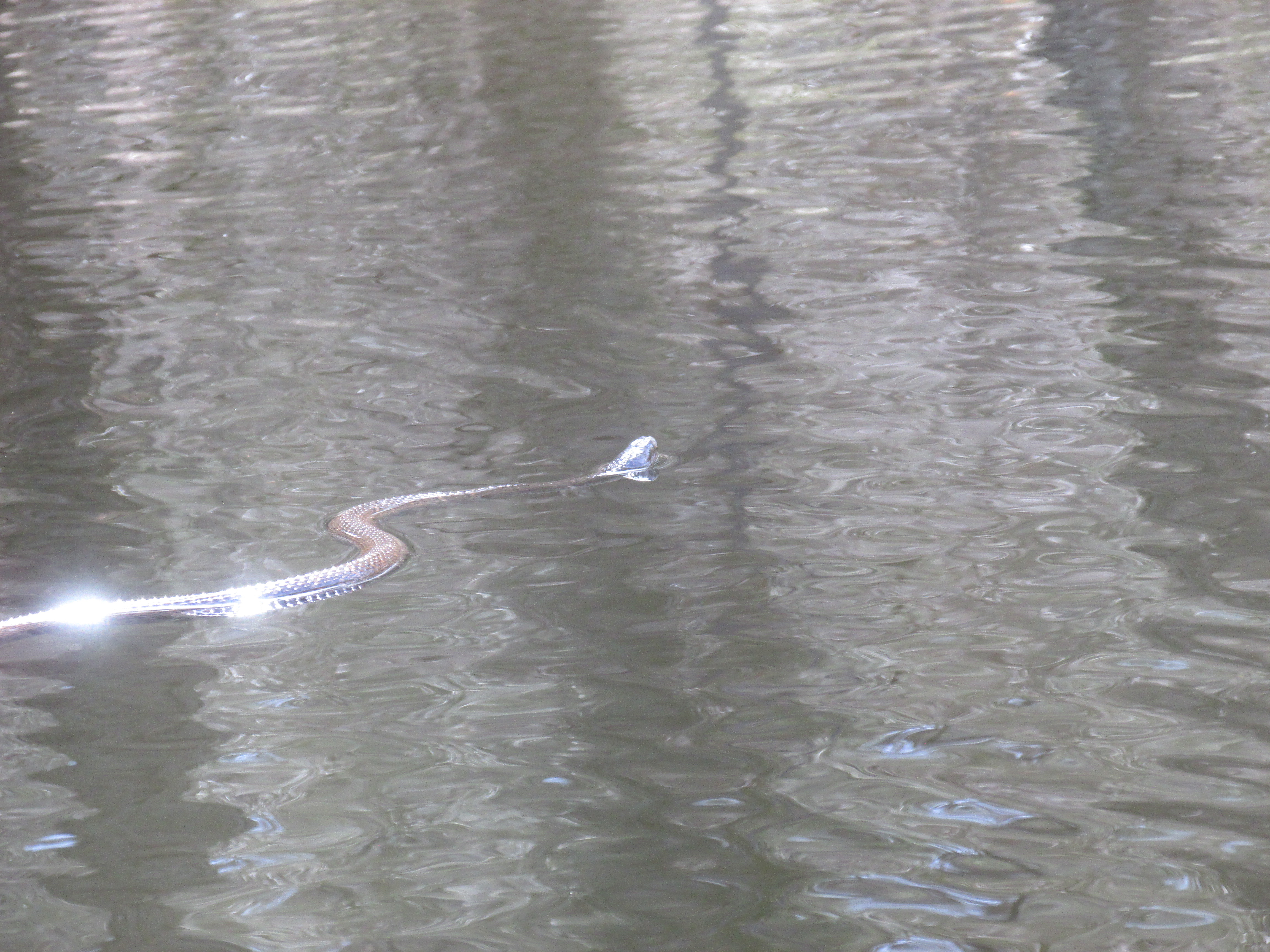
 I next paddled over to Peebles Island where a bald eagle greeted me...

...and an eagle nest was nearby...


I then returned to the Hudson before re-entering another outlet of the Mohawk between Peebles and Van Schaick islands.  Paddled up to Buttermilk Falls where further upriver travel looked less than promising...


Paddling back out of the Mohawk River provided this view towards its confluence with the Hudson...

The bridge seen in the photo connects Peebles Island (left) with Van Schaick Island (right).  

The Mohawk River is the largest tributary of the Hudson River and once below Cohoes Falls the river splits into 4 outlets that the Dutch called "sprouts" for the last 1.5 miles before entering the Hudson River.  

After landing back in Troy, I drove over to Cohoes Falls and was impressed by what I saw and heard...

The falls are said to be more than 900 feet across and the drop is 60 feet.  According to the USGS gauge, flow over the falls measured 224,400 gallons per second.  Two days earlier on Friday, measured flow had peaked at 561,000 gallons per second! Because the Falls Overlook Park was still closed for the season, spectators gathered at Craner Park to witness the action (the above photo was taken there).

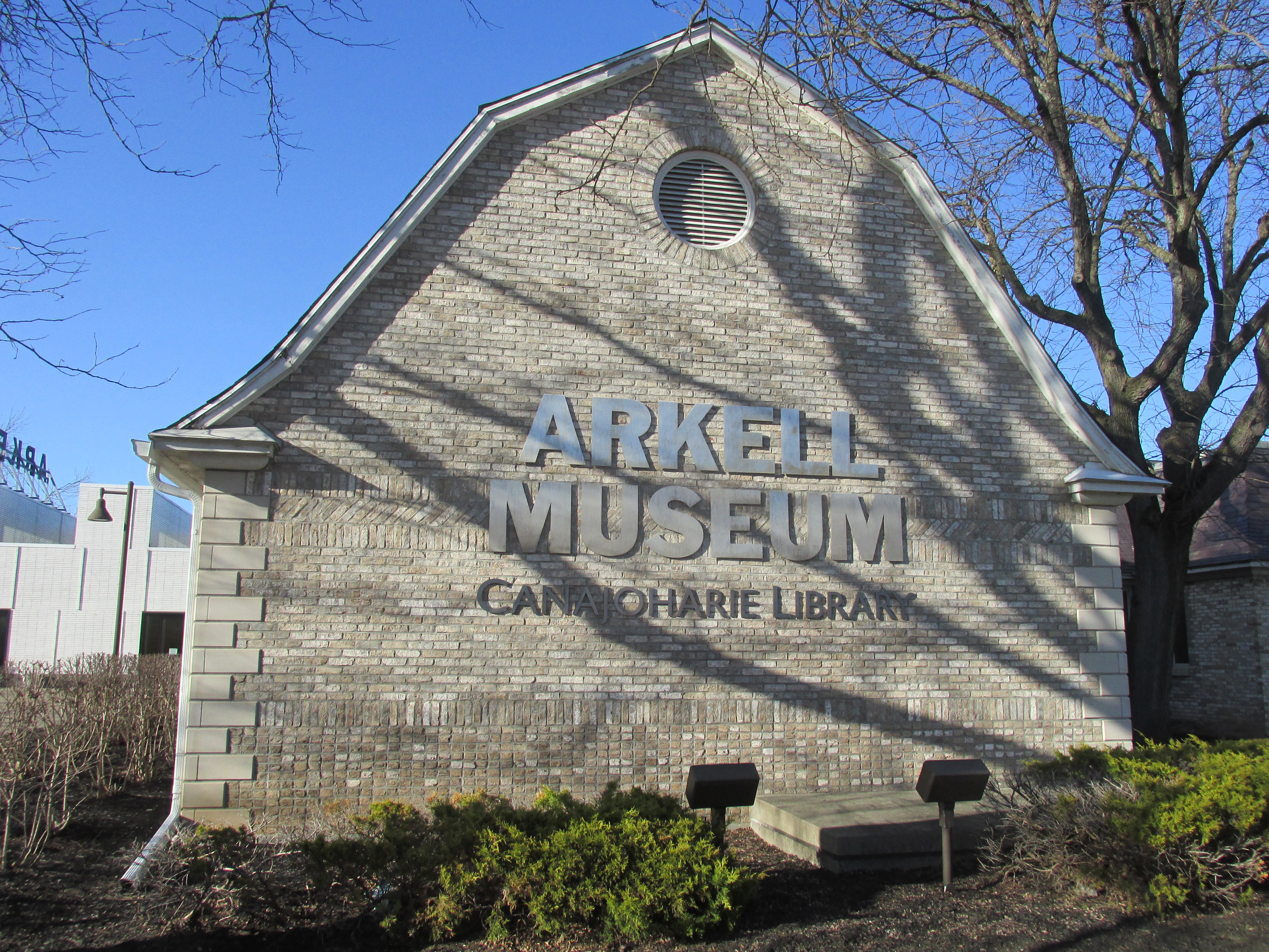
Next I drove to Schenectady's Gateway Landing which served as the point of embarkation for most upriver voyages on the Mohawk...

It's likely that the three expeditions mentioned earlier (Bogaerts 1634, General Clinton 1779, Desjardins/Pharoux in 1793) all passed through this general proximity.  The latter two expeditions traveled the Mohawk River prior to the building of the Erie Canal which opened in 1828 and both of them utilized batteaux which were flat-bottomed boats equipped with oars, poles, and a sail. Skilled boatmen were required to pole the batteaux up through the Mohawk's many rapids. 

One exhibit showed an artist's depiction of how the harbor may have looked in winter...

...while another exhibit shows a batteaux used in re-enacting Gen. Schuyler's 1792 upriver expedition...

 More info about the re-enactment...

Leaving Gateway Landing which recent flooding had left coated in mud, I drove another 17 miles westward to lodging in Amsterdam.

An after-supper visit to Amsterdam's Amtrak station showed a very busy CSX Railroad running train after train along the Mohawk River...
Freight trains in my neck of the woods don't move nearly as fast or as frequently.  However, that may change in the days ahead as it was recently announced that CSX Transportation will be purchasing New England's Pan Am Railway allowing CSX trains to run all the way to Mattawamkeag, Maine.
.  
 
Day Two to follow...