

...as well as a more modern map (1941)...

The river's course has changed many times over the ensuing years. One section of shoreline that didn't yield to the river was where these rock formations forced a turn to the west...

Just upriver from the rock formations is where Russellville Brook enters from the northeast...
According to a Massachusetts Historical Commission Reconnaissance Survey for Hadley, in 1982 there was a Woodland Period Native American occupation near the brook's mouth. After passing the brook and looking upriver the river swings back to the north with Wequamps aka Mt. Sugarloaf in the distance...

Went up as far as a small islet...

...where a pair of adult eagles were hanging out nearby...

Suspect they'd been dining earlier on this fish...

Several sandpipers were active on the islet...


Facing a building breeze from the northwest I turned about and headed downriver to where my 1895 map showed a ferry crossing between Hatfield and Hadley. According to the map it reached the east side of the river just upriver from the mouth of Mill River (flowing from Lake Warner)...

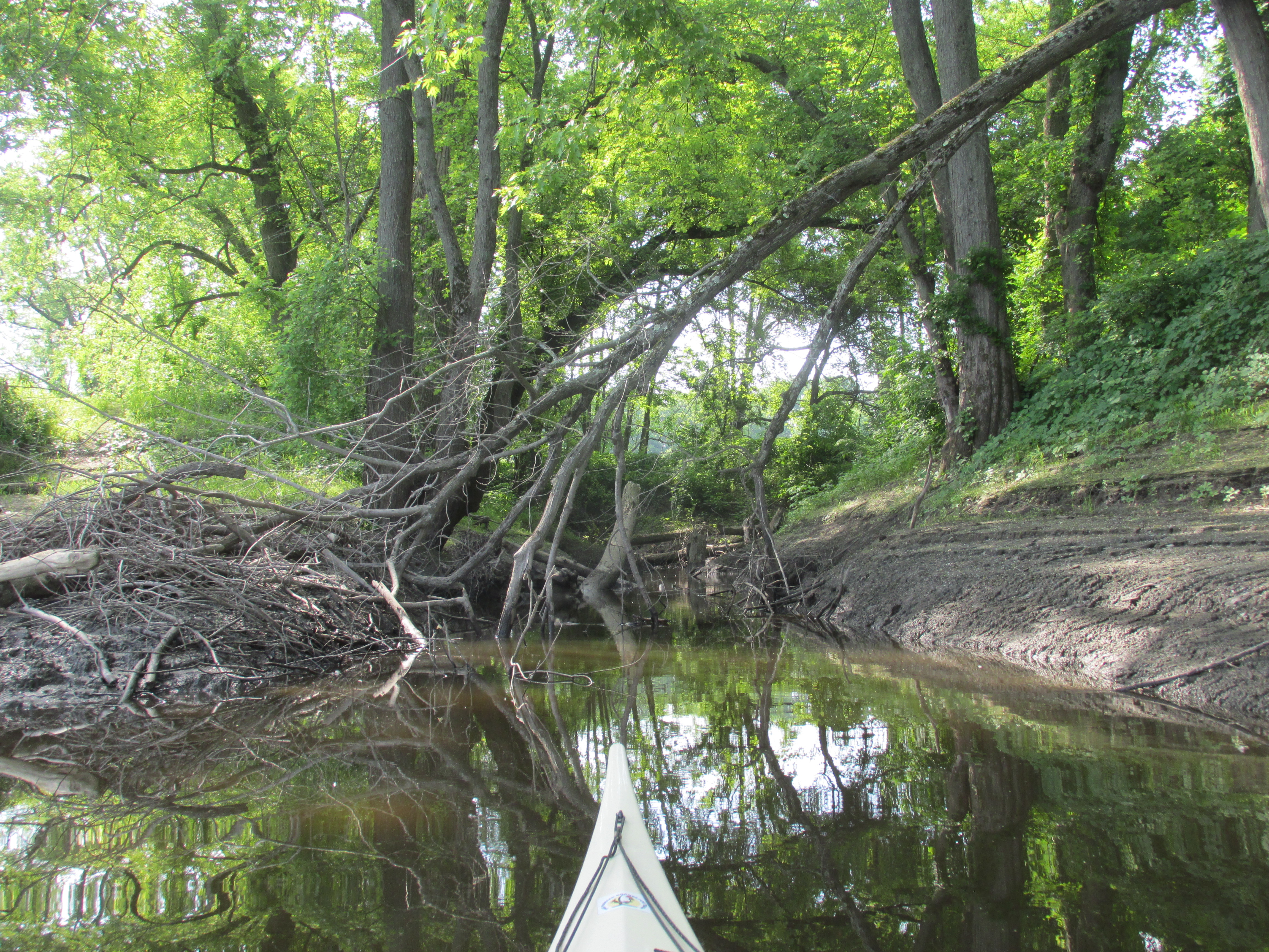
Paddled into the brook about 0.2 miles to where this crude bridge crosses the stream...

The 1895 map shows a bridge crossing the brook at about this location. The bridge is constructed of steel and wood decking (with a winged traffic cop on duty)...


Could this bridge have once been used by folks heading to and from the ferry? Suppose it's possible. It may also have been related to a former dam at this spot.
Around this time skies were clouding up a bit and the river was starting to get busy with power boats and jet-skis...a good time for me to head back to the boat launch. Some trash gathered up along the way..

My car's thermometer showed 88 degrees F. as I left the site. Drove north into Greenfield for some grub before heading home. At 3 pm in Greenfield the same thermometer showed 91 degrees F. An hour later and about 60 miles to the east car windows were closed and thermometer showed 68 degrees F. Thanks to having gone west I'd escaped the BDCF and for the best part of the day enjoyed the feel of summer. I'll take every small victory I can get. Isn't it about time, though, for one of my favorite meteorological terms...the "Bermuda High" where we get a multi-day stretch of sunny and warm days?
No comments:
Post a Comment