
The colonial era conflict known as King Philip's War had begun in late June 1675, and the Wampanoag leader Philip (aka Metacomet) and his Native American forces had left their ancestral home in Montaup (Bristol, RI) and taken refuge in the Pocasset Swamp within present day Fall River. They only had what they could carry and colonial militias were hot on their trail. Once in Pocasset they combined forces with Weetamoo sachem of the Pocasset area and widow of Philip's older brother Wamsutta (aka Alexander). When the militias tried taking the fight to Philip in the swamp they met with little success and subsequently withdrew deciding on a strategy of containment. This left Philip nearly encircled and his situation was desperate. He apparently decided his only hope was to escape undetected across the Taunton River and try to reach safe haven in the Nipmuck country to the north. Historical accounts differ as to how this was done and most go out of their way not to credit Philip with much of an accomplishment. What almost all accounts agree on is that Philip's forces, numbering in the hundreds, successfully made it across the river undetected in the middle of the night during the last days of July 1675. Some accounts have them using canoes, while others have them "wafting" on hastily constructed rafts. The location of the crossing is not very specific in historical records although many mention Mother's Brook and local sources mention the Mowry Path having been followed by Philip to its end at Winslow Point on the Taunton River.
One account in Biographies and Legends of the New England Indians (vol. II) by Leo Bonfanti mentions Philip's younger brother Sunconewhew giving his life while fighting a rear-guard action which kept the colonial militias from discovering the escape route.
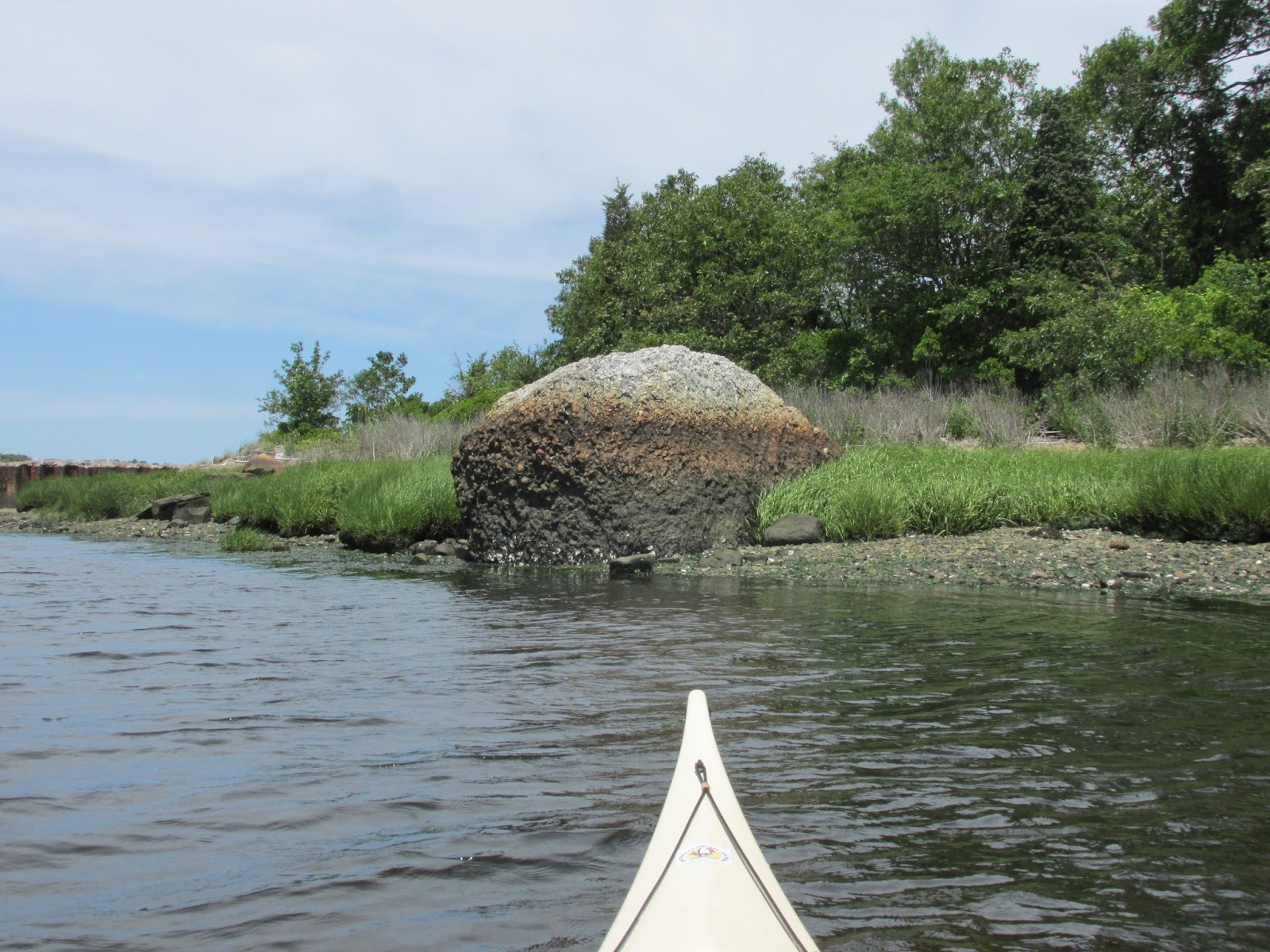
When I reached Winslow Point it was low tide and this large rock awaited me...

Adjacent to Winslow Point is what I believe to be Barnaby's Cove...


...with a wide trail running above...

On the other side of Barnaby's Point is where Mother's Brook enters...

Seeing the area first hand left me believing it logical that Philip's group could have easily waded across this very shallow cove to reach Barnaby's Point and then followed the shoreline to Winslow's Point where the bigger crossing commenced.
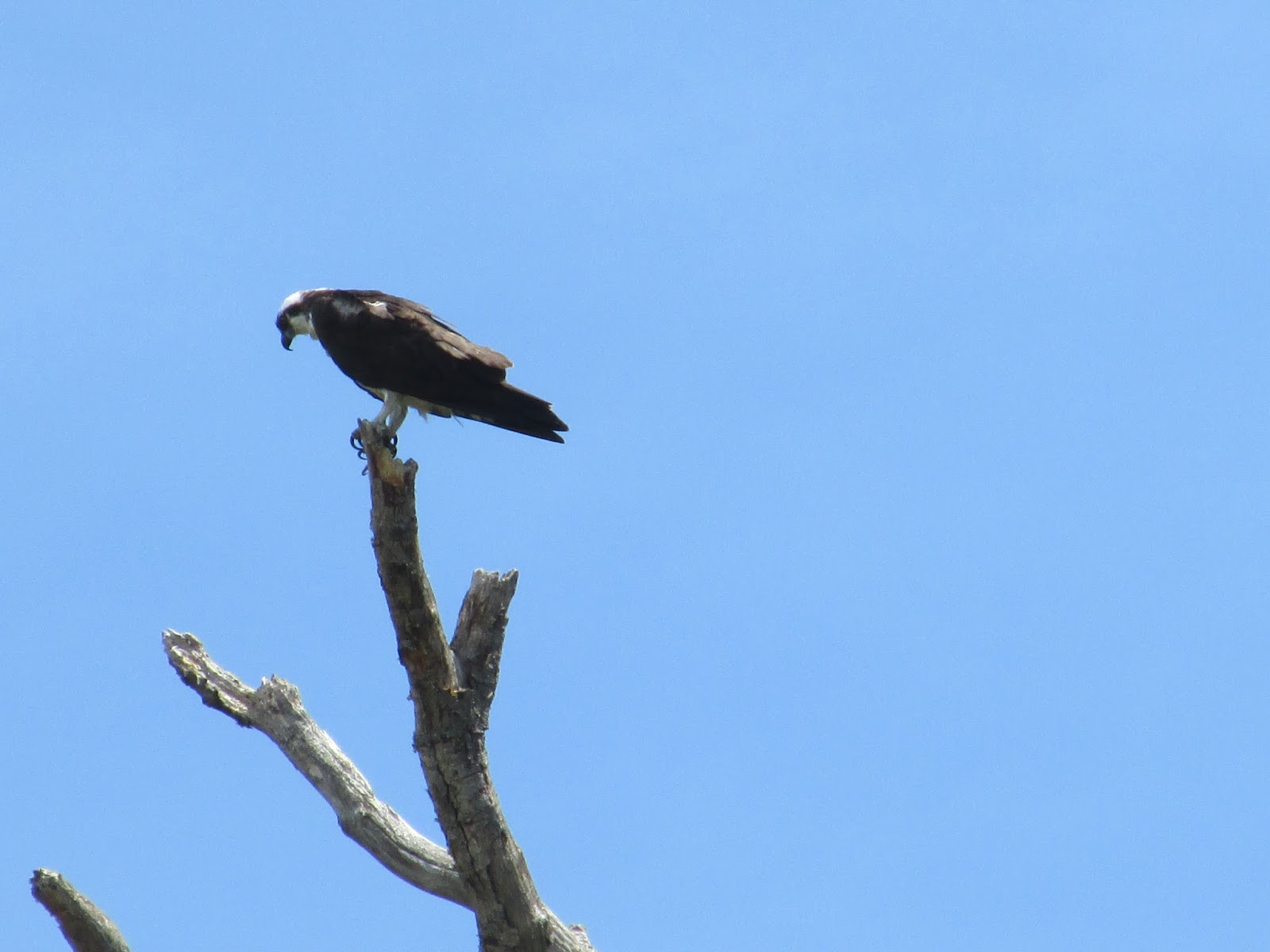
Railroad tracks running parallel to the river create a buffer to development along the immediate shoreline and on Saturday afternoon I found the area to be peaceful and serene...much to the liking of wildlife such as these...


Of course, by virtue of his successful escape across the Taunton River and his ultimately making it to Nipmuck Country, Philip lived to fight another day and his nemesis Josiah Winslow was said to be furious upon hearing the news. As a result King Philip's War would rage for another year. Could all of this have been avoided by negotiations between the two sides? At any rate, from this point on there was no turning back for Philip. Thirteen months later he returned to Montaup where he was shot dead by a fellow Wampanoag serving with the English forces and demonstrating, once again, the English mastery of "divide and conquer".
I continued following the river's east shore down to the Brightman Street Bridge...


The only artifacts found on Barnaby Point were these...

5 comments:
Another interesting tale fromKing Phillips War!
Ah, the taunton river is my local stomping ground. You should check out the upper taunton, it's a whole different area booming with wildlife and no houses to be seen. Pure tranquillity.
Hello Anonymous, I have paddled some of the upper Taunton in the area where the Nemasket flows in and did find it to be as you say. I look forward to seeing more of it.
I am a researcher working on pinpointing the location where some scientific clam specimens were collected, and yours is the only account detailing the location of Barnaby's Cove that I can find on the entire internet! Thank you so much for documenting your adventure. -a fellow Massachusetts resident
Thanks Anonymous, glad to hear info regarding Barnaby's Cove was helpful.
Post a Comment