I was able to get an early jump on this past weekend of splendiferous weather. Late Friday morning, with my boat, tent, and sleeping bag aboard, my car and I drifted down an un-crowded Route 395 which runs a little west of the Connecticut and Rhode Island border. Reaching Norwich, CT, a short foray was made into Rhode Island to the small town of Bradford on the Pawcatuck River. Having launched at the Bradford Fishing Access I was soon paddling upstream on this river's calm waters (photo at left).
Another kayaker had just exited the river and mentioned having enjoyed his hour or so paddle up to the rapids and back. I proceeded to do the same, and not another soul was seen until I'd reached Burdickville Road...
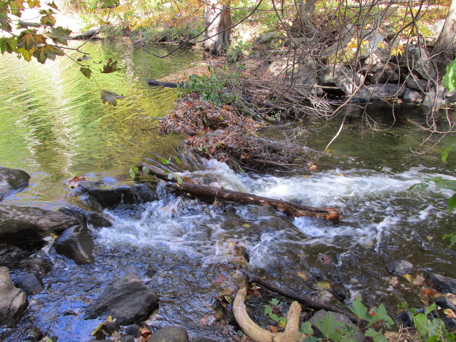
...where a guy was fishing from the bridge. The river gets very shallow here, and just above the bridge were the rapids the other kayaker had mentioned.
Along the way was this old medicine bottle...
...and this attractive camp site...
It's part of the Burlingame Mgmt. Area and had room for several tents.
This 3.5 stretch of river passes under the high speed rail line between Providence and New Haven at 2 locations. This was the more easterly of the 2 bridges...
The trains running through this area are electric powered and the sound they make is less a rumble and more a whoosh. Several were heard, but none seen.
Back at Bradford a small trash haul was beached...
...and I was off to the Mystic KOA in N. Stonington, CT with just enough daylight remaining to set up camp.
On Saturday morning the river Thames was explored starting from the Stoddard Hill Boat Launch in Gales Ferry, CT. Don't look for any signs to this boat launch, as there were none that I could find. It's close to Storybook Rd. and that's what helped me in locating it. As launch sites go, it's a nice one...
...though at high tide it might be difficult to fit under the low railroad bridge. Shortly, I passed under it and out into the Thames River, aka Mohegan River, aka Pequot River, aka Great River. Whatever its name, it's a tidal reach of some 15 miles from New London on Long Island Sound up to the confluence city of Norwich, CT. I paddled with the tide up the upper section of river and soon encountered Poquetanuck Cove entering from the NE. I passed on exploring the cove concerned the rising tide might prevent my getting back under the railroad bridge. Continuing upriver I reached the Route 2A bridge where the Mohegan Sun casino came into view...
After passing the casino, on the river's west side, I passed under another railroad trestle to gain access to Trading Cove (where Native Americans traded with Europeans)...
...and was rewarded with this view...
This peaceful cove was a haven for osprey...
...and egrets...
...and herons...
After experiencing this magical spot I turned around to see the majestic Mohegan Sun from this perspective...
Then it was back to the river and further upstream.
I passed the former American Thermos Bottle Company facility on the river's east side...
I've probably owned a thermos bottle or two made there. The facility closed sometime in the 1980s.
Shortly I reached the head of the Thames at Norwich's Chelsea Landing...
To my bow's left is the Yantic River and Holly Hock Island. To the right is the Shetucket River which I paddled into and up until running out of water near Greenville...
This was where a canal returned to the river (left) from a dam further upstream. The original riverbed was all rocks with little water to the right. This was my turnaround point. Approximately 2 miles further up the Shetucket is the location where Mohegan warriors captured the Narragansett sachem Miantonomo in 1643. A little further past that spot is where the Quinebaug River joins with the Shetucket.
In the shallow waters of the Shetucket large numbers of good-sized fish were seen. Some that I recognized were carp and striped bass. Others were unfamiliar to me, but several fishermen mentioned shad as a possibility.
Heading back down the Shetucket, this view of Norwich was enjoyed...
Back at Chelsea Landing I ascended the Yantic River a short way, passing the Norwich Harbor sign...
The sign notes the harbor as established in 1659. The Yantic flows to either side of Holly Hock Island where a marina and wastewater treatment facility are located. Near the island's upper end, I turned with the tide and began my trip back to Stoddard Hill. Along the way, I stopped in a cove where this old wreck lies aground...
My modest trash haul also aground...
I'd had perfect conditions for paddling the Thames and after returning to the KOA campground I enjoyed a second night of tenting in perfect conditions.
My newly acquired recyclables were welcomed into KOA's well equipped recycling program.
Day three called for an early start in order to meet up with Capt'n Dangerous and Ellen who were down from the Adirondacks. We were to meet in Old Lyme, CT at the Ferry Road Boat Launch on the Connecticut River. They found the location AOK. Me, not so much. What should have been straight forward somehow got me completely disoriented. Finally, I threw in the towel and entered the address into the GPS.
At any rate, we were soon launching into the mighty Connecticut River near the point where it empties into Long Island Sound...
We headed downriver towards Griswold Point, passing under the long bridge carrying Amtrak trains on the Northeast Corridor...
The bridge was down to allow this Amtrak train's passage...
It was still slack tide when we reached Griswold Point and looked across the river towards the lighthouses on the Old Saybrook side...
Once the incoming tide got started we explored the Back River behind Great Island...
...causing fiddler crabs to run and hide...
Once back on the river proper we proceeded upriver beyond the Rt. 95 bridge and Calves Island. With such incredible weather power boat traffic was increasing by the minute so we headed into Lord Creek where more tranquil waters were found...
On our way towards Lord Cove, near Goose Island, we encountered this immature eagle who'd also found serenity there...
There were small cliffs between Calves and Goose Island...
The skies above were busy with osprey, turkey vultures, and a few eagles.
A small bit of brackish trash...
Mylar balloons proving, once again, that what goes up must eventually come down.
I still can't believe just how great the weather was these past three days. For late September in New England it was like a dream come true.