
Sandwiched around this past week's Nor'easter I paddled two Massachusetts ponds: Fresh Pond in the Manomet section of Plymouth, MA the day before the storm and West Waushacum Pond (photo above) in Sterling, MA two days after the storm when its effects still lingered. Both ponds appear to have been favored by Native Americans.
Paddled Fresh Pond this past Wednesday under darkening skies...

The North and South Rivers Watershed Association's website describes Fresh Pond as "a 62-acre natural kettle hole pond with an average depth of 10 feet. It is fed by groundwater, as well as a small inlet from Warner Pond. It has an outlet to cranberry bogs and to Beaver Dam Brook". Beaver Dam Brook eventually reaches the ocean near White Horse Beach. Paddling the pond's circumference brought me to a park at the pond's south end with a small sandy beach...

To the west of the park was a small boat launch at the base of a steep slope. At the top of the slope and overlooking the pond was a Native American burial ground...


At one spot on the pond wisteria draped almost to the water...

Saturday was an extremely fickle day with dark clouds, white clouds, blue skies, and rain showers...all of which varied from minute to minute. Launched into West Waushacum Pond in Sterling, MA...

Mt. Wachusett was seen looming to the northwest...

There are 2 Washacum ponds: East Waushacum and West Waushacum. Long ago a village between the ponds served as the residence of Nashaway sachem Nashawhonan also known as "Sholan".
 A wide pathway runs along the pond's north shoreline from the nearby rail trail...


Because West Waushacum waters ultimately follow Waushacum Brook into the Wachusett Reservoir at the Stillwater Basin, activities are regulated by the Mass Dept. of Conservation and Recreation,,,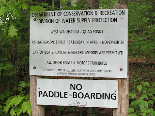
It was a good week trash-wise with small amounts encountered:

In the 1840s a railroad causeway was built dividing West Waushacum Pond. According to an article in the July 2015 Wachusett Greenways Newsletter, the Fitchburg and Worcester Railroad in 1879 built Waushacum Park Picnic Grounds at the pond's north end. The article mentions the park having a dance hall, bowling alley, merry-go-round, baseball diamond, and boats/canoes for rent. Patrons could arrive at the park by train or travel from the pond's south end via a steam-powered boat named "Sterling".
This stone work along the pond's north shore may have been part of a dock structure. Perhaps the vessel "Sterling" dropped folks off here...or possibly it's where boats were rented..


...perhaps leading to the park? The park is said to have closed down in 1916 after the Wachusett Reservoir was built and human activities within the watershed were restricted.
Continuing a little further brought me to where the present-day rail trail crosses over the passageway to the area of the pond cut-off by the railroad causeway. The cut-off portion is known as the "Quag" which I suspect is short for "quagmire"...

...referring to the large marshy area at the Quag's north end...

One of the Quag's tributaries, Connelly Brook, had this blue heron standing atop a submerged beaver dam...

Back on West Waushacum the pond's sole island was circled before reaching the takeout...


It was a good week trash-wise with small amounts encountered:
Fresh Pond had only this...

West Waushacum/Quag only this...

Hopefully fair weather will prevail for our Memorial Day.
No comments:
Post a Comment