Monday, April 20, 2015

Paddling Around Machimoodus

On Saturday, with temperatures near 75 degrees F, I found myself at the confluence of the Connecticut and Salmon rivers in the town of East Haddam, CT.  My plan was simple: paddle up the Salmon River to the dam at Leesville and back.

The boat launch (photo at left) is spacious with ample parking and toilet facilities.  Springtime water levels and the approaching high tide kept the cement ramps submerged for the most part.  Fishermen hoping to catch stripers stood along the shore.

Once launched, I entered the Salmon River and soon passed this osprey perched near its nest...

Shortly the wide expanse of Salmon River Cove was entered and Mount Tom loomed ahead...

The 314 foot high hill sits at the head of the cove and overlooks the confluence of the Salmon River (to the left) and the Moodus River (to the right).  I sensed it was a place of big mojo and would find out later that Mount Tom is/was the source of Machimoodus which is said to be a Native American Algonquian word meaning "place of bad noises".  Early colonial history mentions large gatherings of Native Americans on the hill where attendants believed the giant and sometimes malevolent spirit, Hobomock, was speaking to them.

Over the years the noises have been described as "slow thunder" or "breaking of rocks" by some.  However, my favorite description appeared in a 1901 article in Connecticut Magazine (Vol. 7) written by W. Harry Clemons: "A man who happened to be on this hill during one of the "noises" described the sound as like that of rocks falling into immense caverns beneath his feet and bounding and rebounding as they fell". 

Near a trail at the base of the hill on the Salmon River side, I came upon what appeared to be two gravesites side by side...

Since the area remained fairly quiet, I continued up the Salmon passing a mostly submerged island where Pine Brook enters from the left...

Reaching a highway overpass, and tiring a bit, I thought about turning around when two kayakers heading downriver informed me the dam was only another 500 yards upriver.  So I continued to where this island kept the dam from my view...

  Once around it, the Leesville Dam appeared...

Plaques there explain the dam's history and its role in the recently scaled-back Atlantic salmon restoration project...

It's too bad efforts to restore the salmon didn't meet with more success.  Guess it's like the old Humpty Dumpty ditty:  "All the King's horses and all the King's men couldn't put Humpty Dumpty back together again." 

In earlier times this must have been a beautiful spot for folks to reap the bounty of  migratory fish runs.

This view above the dam shows the concrete fingers of the ice control structure...

Floating trash scooped up along the way...

Once back at the Salmon River Ramp, I headed off to the nearby Markham Meadows Campground...
...where I'd link up with Adirondack Pirate Paddlers Capt'n Dangerous (Paul) and Starbuck (Tom) from New York State with plans for a joint Sunday paddle on the Connecticut River.  Of the three of us Tom had the best accommodations, his new "teardrop" camper...


Sweet!

Tuesday, April 14, 2015

Squannacook's Black Rock

I'd been wanting to visit Black Rock (photo at left) on the Squannacook River in Townsend for quite awhile.  Thanks to some time off, good water levels in the river, and this afternoon's pleasant weather, I made it happen.

 
I launched between Adam's Dam and the Route 119 bridge which involved sliding my boat down the riverbank from the parking area above...

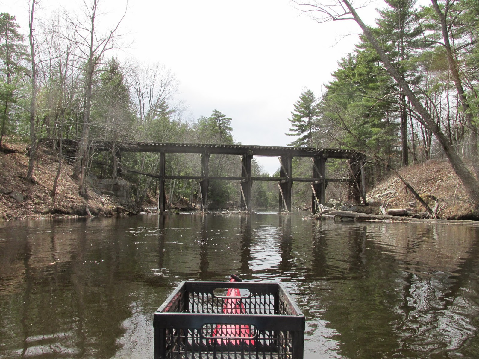
I checked out the long abandoned Peterboro and Shirley Railroad trestle between my launch spot and the dam...
...before turning about and paddling upstream the approximately half mile to Black Rock...


Arriving there I stumbled upon this submerged old horseshoe...
...which will hopefully bring me some luck.

The blackened underside of the rock speaks to the many fires stoked by visitors over the eons...

The view down to my boat from the rock's topside speaks to its majesty...

This rock face below Black Rock would have made a great spot for a petroglyph...


Following my visit to the rock I continued upriver until encountering a couple of canoeists getting in a downriver run in preparation for what they told me will be a canoe and kayak race this upcoming Saturday 4/18.  The race is hosted by the Townsend Lions Club and this will be its 32nd year.

Continuing further upriver found more and more obstructions in the form of downed trees which persuaded me to turn about and ride the current back to my takeout location.

I was struck by how clean and clear the water was.  It reminded me of the Nissitissit  and Swift rivers.
The Squannacook is said to be one of Massachusett's better trout streams.

As usual, though, trash of a plastic nature was found lurking behind many of the snags...


Sunday, April 12, 2015

A Splendid Sunday Morn'

Rather than layin' low with the Sunday paper and a cup of coffee this morning, I chose to get up early and launch into the Assabet River at Magazu's Landing in Stow.  The morning was truly splendid...best we've seen around these parts in a very long time.


One of the first things encountered was yet another empty mouthwash bottle near some emerging new growth...

Mute swans were practicing landings and take-offs...

This northern pike (?) was floating lifeless...

Ducks were everywhere and included this ring-necked pair...
...and this female hooded merganser without a mate...

The tallest white pine tree provided the best seat in the house...

Out enjoying a morning stroll along the river were these four white-tailed deer...

The high water levels allowed access to a fair amount of trash...
...including another six mouthwash bottles.

Someone had recently cut back much of the brush and added this trash receptacle next to the sampling shed...
Hopefully folks will put it to good use.


Friday, April 10, 2015

Paddling into Pantry Brook

Having grown tired of waiting for good weather, I decided to launch my boat into the nice 'n high Sudbury River at Sherman's Bridge.  My only goal was to see if the entrance to the  Pantry Brook Wildlife Management Area was navigable given the higher than usual water level.  It was easily accessed with about 6 inches of water over the steel beams(photo at left). 

The staff gauge at the sheet-piling barrier...


The day was yet another in a long string of cloudy days and unseasonably cool temperatures.  Fortunately, winds were light.

For ducks, it must have been an ideal day for there were plenty hanging out in the PBWMA.  There were mallards, wood ducks, hooded mergansers, buffleheads, and ring-necked ducks.  In addition were Canada geese, mute swans, and many red-winged blackbirds...


Also present were musquashes and this fast swimming beaver...

Thanks to the high water I was able to penetrate the brook/marsh until there was no clear channel...
This was about half a mile from the brook's mouth.  Would've needed an air boat to go any further.

On my way back up the Sudbury River, this yellow bird caught my eye near Weir Hill...
Closest thing I find in my guide book is a Palm Warbler?

Upstream of Sherman's Bridge the view southward revealed the diminished visibility...
 
 
Head room under Sherman's Bridge was at a premium...
 
 
Will it ever be sunny and warm...on the same day?
 
Trash encountered along the way...


Sunday, April 5, 2015

Where Many Paths Converge

It was nice visiting with family on this Easter Sunday, and even  nicer having their residence adjacent to a boat launch into the Blackstone River.  That provided this paddler some time to explore a bit of the river during the intermission between dinner and desert.

After launching a little upstream of the Rolling Dam, I paddled up to the Triad Bridges in Millville (opening photo).  At this locale multiple transportation paths once converged:  Level one is the Blackstone River which once also served as part of the Blackstone Canal;  Level two is the Providence and Worcester Railroad, a still active railroad (iron truss on left behind another);  Level three is the former New York and New England Railroad, no longer active and now part of the Southern New England Trunkline Trail (in front of and to the right of the P and W); and finally level four which is the unfulfilled dream railroad, Southern New England Railway (tall concrete bridge abutment to right of NY and NE).  This railroad was never completed though substantial grading and stonework was done in Massachusetts between Palmer and Blackstone.  Had it been finished, it would have been a grand sight to see its trains cross high above the Blackstone River and the two other railroads.  Imagine a paddler lucky enough to see three trains converge at this spot at the same time.  Ah, what might have been.
One possible reason for the Southern New England Railway not having been completed may have been because its visionary, Charles Melville Hays, perished aboard the Titanic. 

A little further upriver I visited the Millville Lock, said to be the best remaining lock from the long gone Blackstone Canal.  The river's water level was sufficient for me to paddle into the lock from the river...

The slots in the stonework are probably where the wooden gates would have allowed me to enter and then close behind me...
Since the lock tender was nowhere to be found, I turned about and headed back downriver.

On my way I came upon what looked to be where two beavers had held a recent competition...

Aside from a pair of common mergansers, a pair of Canada geese, and a blue heron, I had the river all to myself.

Before reaching the boat takeout at the dam, I veered into the channel carrying the water it diverts and shortly was stopped by a bridge construction project at Route 122...

The Rolling Dam from upstream...

View of water below the dam entering the Blackstone Gorge (no waterway for this old man)...

Trash refugees from today's short foray...

Wednesday, April 1, 2015

April at Last

Believe it or not this (photo at left) was the least snowy of the two boat launches near the Route 119 bridge over the Nashua River in Groton/Pepperell.  I'd first checked the Petapawag launch in Groton, but found the access road had snow too deep for my car to handle.

So I launched on the Pepperell side of the bridge.  Getting my boat to the water was made all the easier by just sliding it on the snow...
 
April is in front of my boat's bow and March is to its stern (I hope).  I was very happy to turn the page on my calendar this morning as the past three months were way too long, cold, and snowy for my taste.

Because April arrived in a fairly breezy fashion I paddled upriver on the Nashua letting the tree-lined banks blunt the wind...


Where Robinson Brook enters the river...

 I stopped to admire this well engineered beaver deceiver...
...located on the other side of an old railroad grade which once led to Pepperell and Brookline, NH...
One hundred years ago freight trains came down this grade carrying ice cut from Brookline's Potanipo Lake bound for Boston.  The line ran 14 miles to Squannacook Junction where it connected with the Peterborough and Shirley Branch in order to reach Ayer and points to the east.  The ice trains stopped in the 1930's, though some freight service to Pepperell continued until 1942.

In a letter to the Groton Herald, Paul Funch explained the history of this long gone railroad and its proximity to the historic Fitch's Bridge site...
 
My upriver journey ended a little above the Route 225 bridge and, after turning about, the current brought me downriver swiftly and before I knew it Route 119 loomed ahead...

I got off the river just before it started to get crowded...(seriously) with multi-crewed shells and coach containing power boats from the Groton School boathouse.  Amazing to see how fast those shells cut through the water. 

Trash found on the upstream side of snags along the way...

Oh yeah, fittingly with this being April Fool's Day, one of my brand-new Mukluk boots leaked on its maiden voyage.