Recently explored the stretch of the Merrimack River between Hunts Falls in Lowell, MA and the Great Stone Dam in Lawrence, MA (2 days last week and one day this week). I don't know why, but for some reason I've rarely visited this section of the Merrimack River despite it being within 30 miles of my home . Back in 2013 I did launch informally from behind a parking lot in Methuen, MA and paddled up to Pine Island and back but never returned to see more.
I ultimately decided to paddle the approximately 8.5 mile distance between Hunts Falls and the Great Stone Dam by doing two up/back and one down/up paddle. I utilized two boat launches: one an informal launch off of Route 110 in Dracut about 3 miles downriver from Hunts falls, and the other the Riverside Boat Launch in Methuen which provides dedicated parking, a ramp and dock. While I actually started with the middle section then the upper and lower sections, I present them here in sequential order downriver from Hunts Falls. The above photo shows the view downriver from below Duck Islands.
This map shows the first section from Hunts Falls down to the informal boat launch...
The informal boat launch I started from....

...and this very upright fellow I passed enroute to Hunts Falls...
Once at the base of Hunts Falls...
...I found myself about 2000' from the Hunts Falls Bridge which was just around the bend and out of view. Another 500' beyond the bridge is the confluence of the Concord and Merrimack rivers. The land I could see was, long ago, reserved for the Wamesit people and was comprised of 2,500 acres on the east side of the Concord River and 1,500 acres on the west side of the Concord.
Just below Hunts Falls and on the north side of the river is the Greater Lowell Regional Wastewater Treatment Facility. On the opposite side is what appears to be a combined sewer outfall facility...
All the storm release gates were closed and dry which is one benefit of our drought conditions this summer. Just downstream ample quantities of ducks were enjoying the river around the appropriately-named Duck Islands...
The shallow pool below the islands looks to be a favorite spot for shore-fishermen. Sadly, they didn't pack out what they brought in and left a considerable pile of trash on the shore...
My trip back downriver included one tree that broke ranks and decided to change color early...
On the river's south side I came across this crewless and derelict Matchbox vessel. Despite its rough condition it was still afloat and seaworthy...
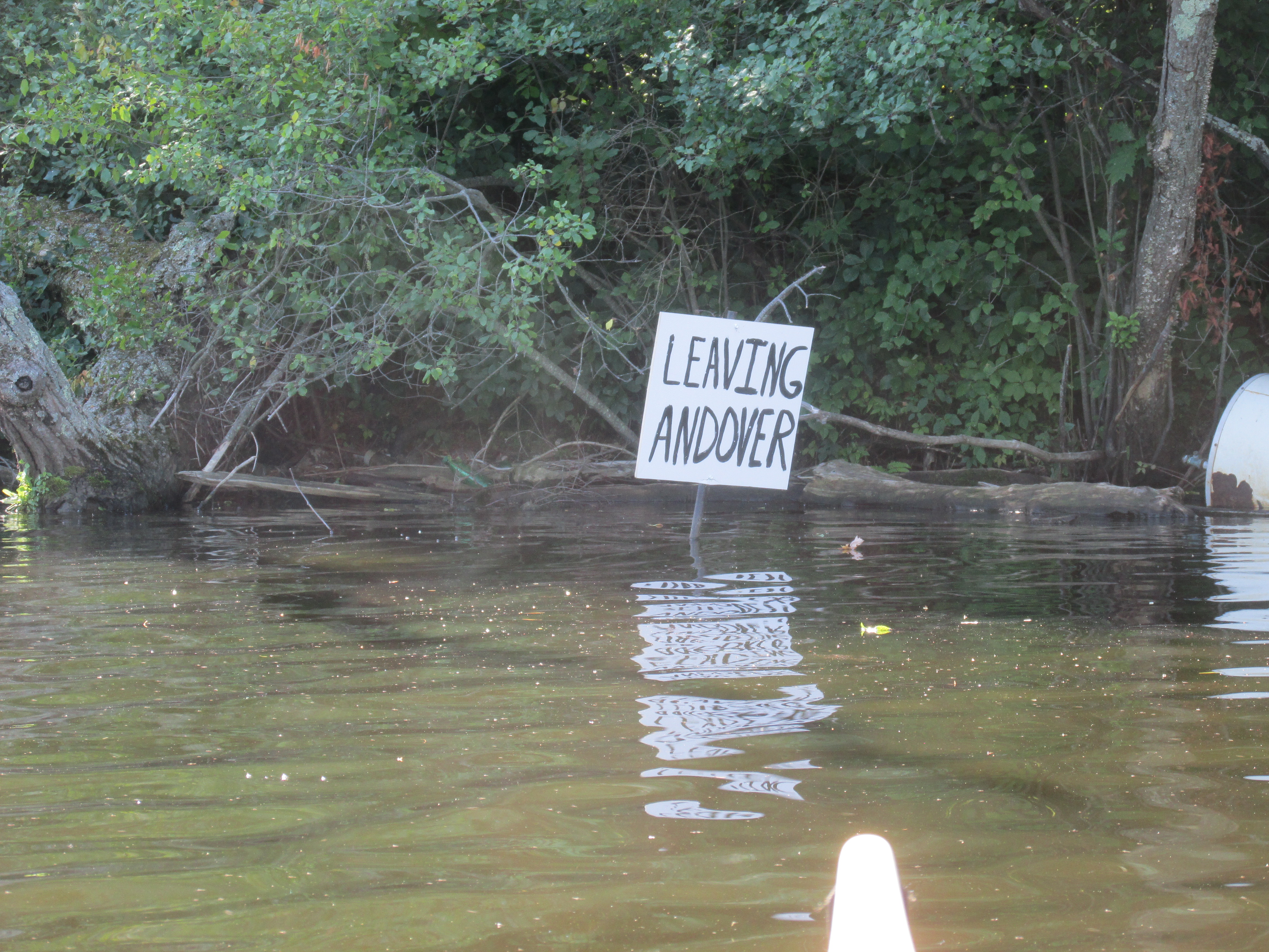
Next along the same shady side of the river was this sign welcoming me to Andover...

On a different day I resumed my downriver journey having launched from the Riverside Boat Launch in Methuen...
Pine Island...

The mouth of Fish Brook near the Deer Jump Reservation...
One of many orange booms I encountered...
...which may be used for capturing flotsam. If so, they were all free of any accumulation.
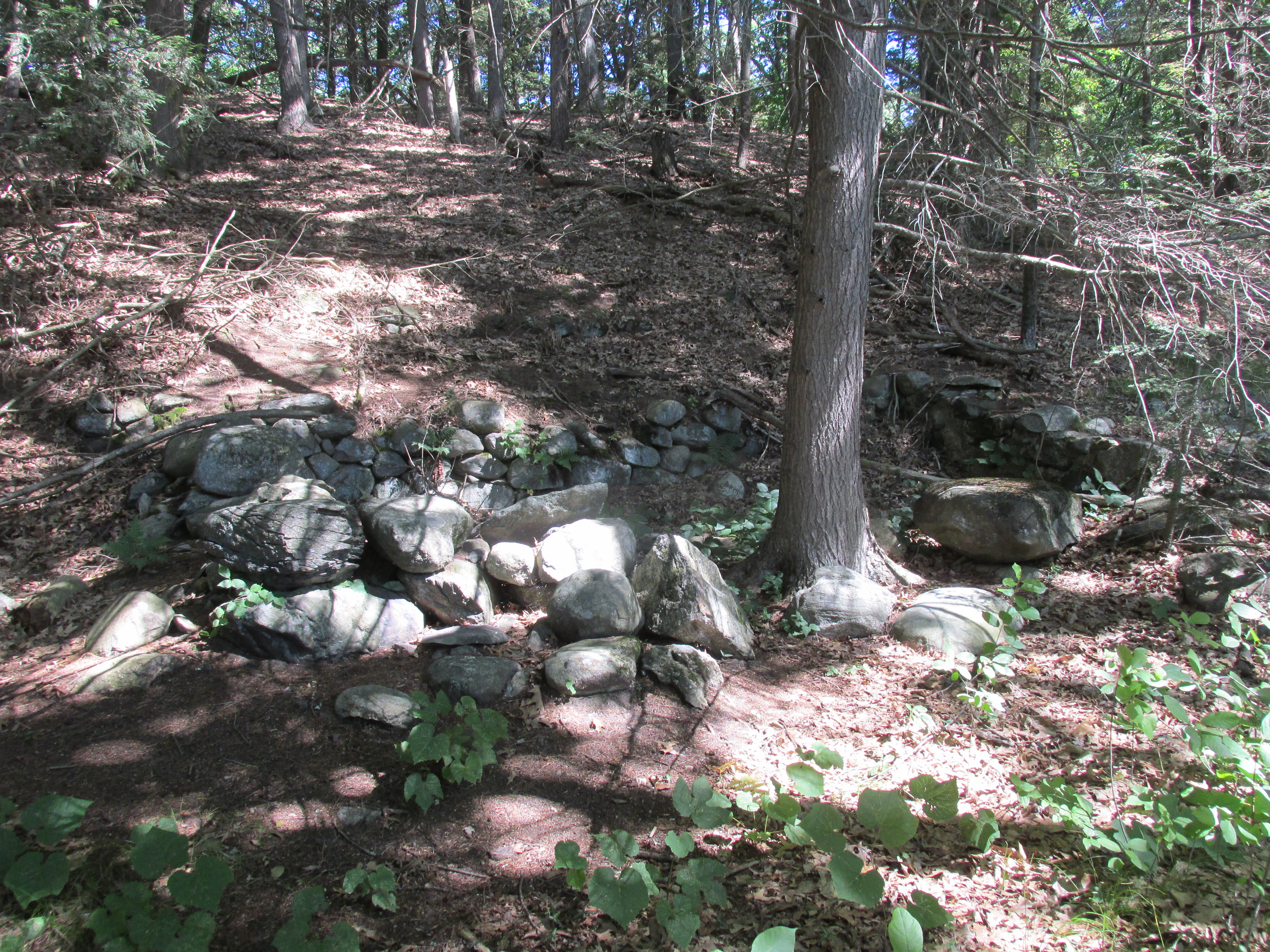
Next I reached the Shattuck Farm Site and walked to one of the lower terraces closest to the river...
According to Barbara E. Luedtke in her 1985 book
The Camp at the Bend in the River: Prehistory at the Shattuck Farm Site "Shattuck Farm (in Andover) is one of the most famous prehistoric sites in the lower Merrimack....". "The location has been in virtually continuous use for at least 8,000 years...". Luedtke speculates that one reason for folks using the site was its proximity to Peters Falls which she believed may have been where the Route 93 bridge is located today. The falls would have provided good fishing and the land at the site was well drained and dry. When the Shattuck Farm was developed for an office park in the 1970's the Town of Andover placed a several mile-long strip of land along the river into a conservation easement thus preserving it from development. There is a continuous trail running alongside the river. I passed under one of the trail's bridges to access a secluded wetland...
A kiosk near the bridge provided a map of the trail system...
The section showing the Shattuck Farm site...

The Shattuck Farm site is across the river from the Riverside Boat Launch in Methuen. This photo shows the proximity of Ivy Island (on right) and the Rt.93 bridge to the Riverside Launch...
Yesterday I paddled the stretch from Riverside Boat Launch down to the Great Stone Dam...
After passing under the Route 93 Bridge I looked back to where Barbara Luedtke surmised Peters Falls may have been located before the Great Stone Dam raised the river's level here by 8 to 10 feet...
Luedtke mentioned that Ivy Island may be the small island once said to have been located near the top of the falls.
Few buildings remain along the river's south side. This one looked to have had a utilitarian river-related purpose...
Just beyond the abandoned building I left Andover...
Upon entering Lawrence a sizable marsh opens to the south...
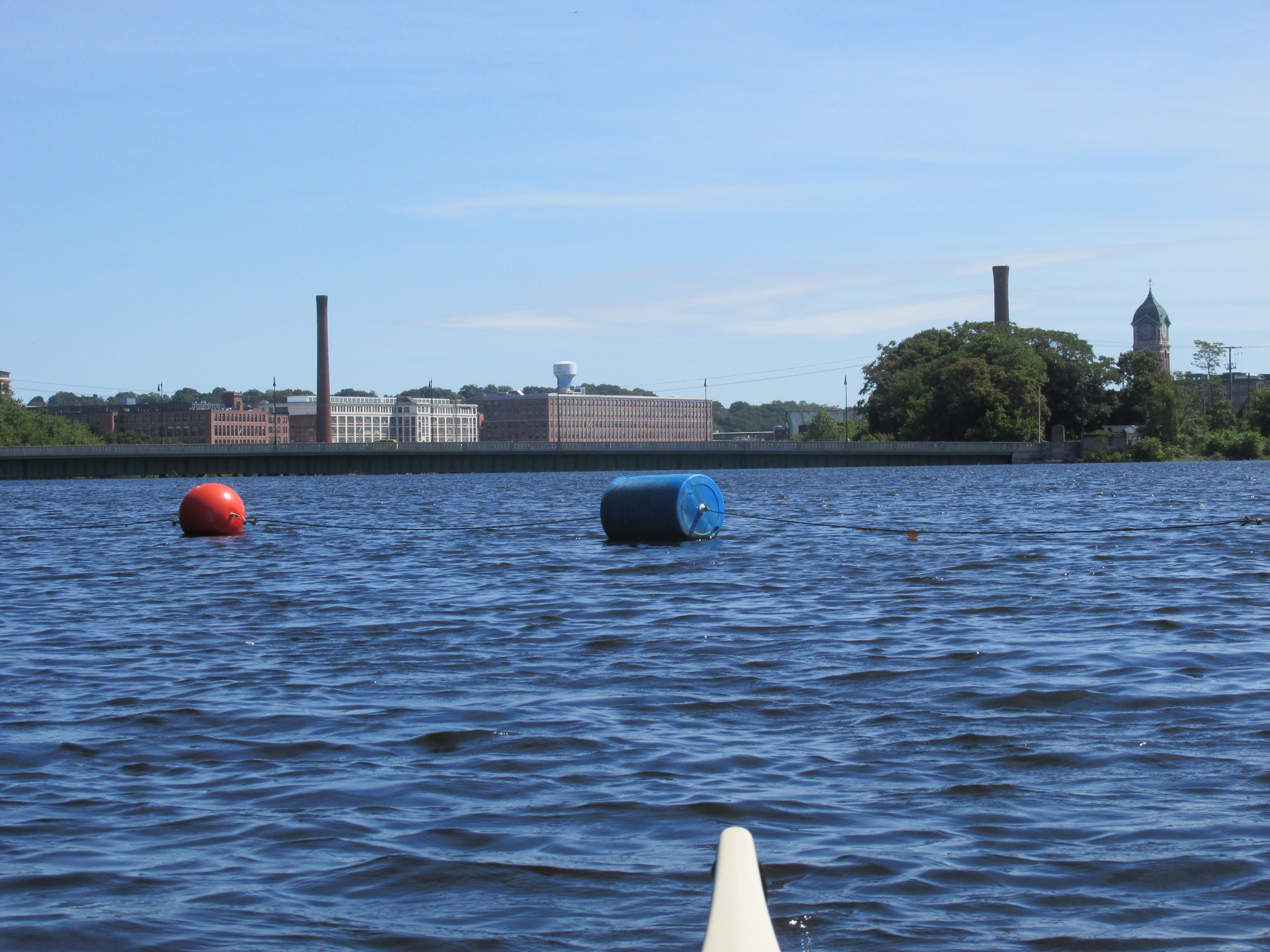
Approaching the dam the river was busy thanks to Greater Lawrence Community Boating with youngsters enjoying sailing in a busy breeze out of the north...

View over the Great Stone Dam with the Broadway/O'Leary Bridge just beyond the dam...
The most distinctive mill structure in view was the Ayer Mill Clock Tower...
...which now sits above a New Balance facility.
The Great Stone Dam is said to have been the longest (900') dam of its type in the world when it was built. Barbara Luedtke wrote "The dam at Lawrence, begun in 1845 and finished in 1848 was an engineering marvel for its time, but the quality of the engineering did not extend to its fishway, which was a dismal failure. Therefore, 1848 also marks the end of the famous fishery on the Merrimack."
On my way back upriver an osprey was seen transporting his next meal...
My trash haul for Monday...
Thursday's...
Yesterday's...
The trash I encountered was mostly in the nooks and crannies hard by the shore where only a small vessel such as a canoe or kayak could get to it.
Sandwiched between my Merrimack paddles, were visits to the Assabet in Stow, MA and the Sudbury River in Lincoln, MA.
On the Assabet River last Wednesday I found the eagles nest now completely gone...
Despite the nest not being there, a recently fledged eaglet was still hanging perhaps in hopes of getting a food delivery from his parents...
Some trash from the Assabet...
Last Friday on the Sudbury River I paddled with my granddaughter...
...who saw her first-ever bald eagle on the river's Fairhaven Bay in Concord...


.JPG)


.JPG)