Yesterday's paddle had to fit the bill. To do so it needed to be a 3 mile stretch of flat water with as few signs of civilization as possible, and ideally have some historical significance.
After moving my cursor around the Google map screen, more than a little like using a ouija board, the cursor ended up on the location of Menameset in the towns of Barre and Hardwick, MA.
Menameset is a Native American (Nipmuc) word and refers to an area where 3 Nipmuc (Quabaug) villages were located alongside what is presently called the Ware River. At one point during King Philip's War (1676), these 3 villages housed an estimated 2,000 Native Americans (Nipmucs, Wampanoags, and Narragansetts)
I'd paddled the same stretch once before, back on 3/28/2012, and hoped to take another, hopefully closer, look at some possible village locations. Clues to these locations were taken from Josiah Howard Temple's History of North Brookfield, MA: Preceded by an Account of Old Quabaug.
Starting at Wheelwright Road (Rt. 32) in Barre Plains, I paddled down to the Wheelwright Dam and back. This map shows the area (click to enlarge).
This tree near the put-in was a favorite for mushrooms...
The first, or most upriver village is believed to be about half a mile below the present MassCentral Railroad bridge(formerly Boston & Albany branch) and on the river's east side...
There is a slough there between areas of high ground...
At the upstream end of the slough, where there's a steep slope, is this stone structure...
...probably just the remains of an old stonewall, but to me it looked like a stone path and I used it as such to get up and down the slope. The stone structure actually started under the riverbank...
Heading further downriver I encountered several turkey vultures wiling away the day in the same tree. They seemed to take turns drying their wings...
Better seen from afar...
...and hopefully never circling above me.
Additionally a hawk, osprey, blue heron, belted kingfisher, and numerous wood ducks were seen.
A meadow between the villages filled with goldenrod...
...and these strange blue flowers which I'd never seen before...
...I've since learned they're "Blind Gentian" also called "Bitter Root" for the medicinal values of the root.
What looks to be an old abandoned railroad (perhaps the Central Mass) grade runs parallel to the river's east side...
Part of this grade passes through a small airport and perhaps was incorporated into its runway. The middle Manemeset village is believed to have been located between the river and said runway.
The lower Manemeset village is believed to have been just a little ways downstream of the dam at Wheelwright...
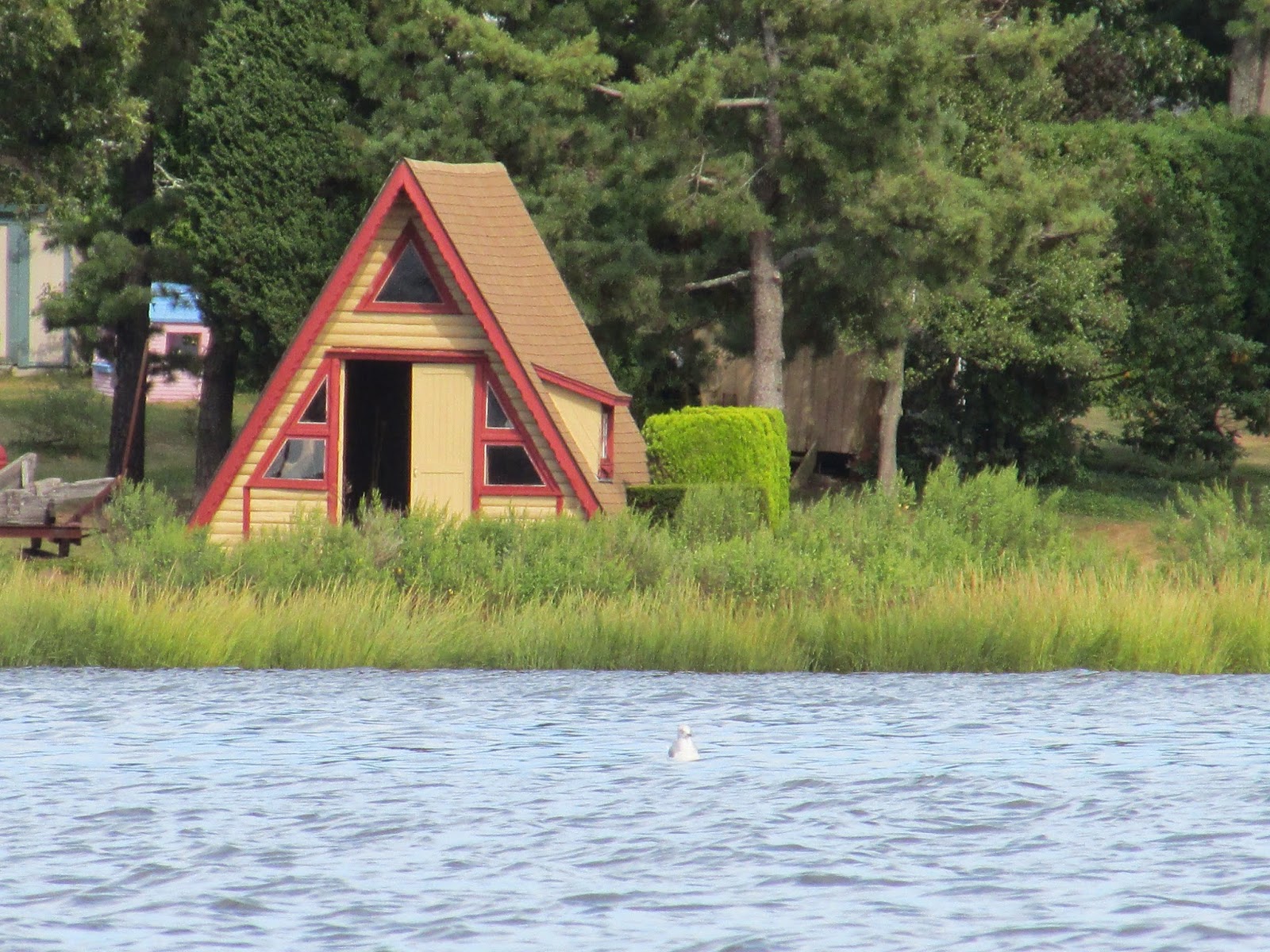
The mill, formerly the Ware River Paper Co., was built in 1866 and operated until 1973. What's left of it is in a sad state. This small shack is typical...
This turtle probably had some stories, but he wasn't talking...
Today's trash haul...
There were 43 recyclable containers (16 redeemable) and 14 pieces of miscellaneous rubbish such as an old white-wall tire and the plastic tub.
But wait, there's more...
The 3 jugs were attached to fishing line and a hook.
YTD total = 4320
Other than a small plane towing an even smaller plane into the skies above the airport, I saw not another soul. The only dwellings seen were right at the launch site and some at the small village in Wheelwright. It was an ideal spot for my down and back paddle.
Sunday, September 14, 2014
Monday, September 8, 2014
A Fair Day for Fairhaven Bay
Earlier plans for launching at Little Farms Road in Framingham were scratched upon finding way too little water.
At Pantry Brook the low levels revealed multiple beaver dams between the sheet piling and the river...
At today's levels it's hard to imagine having paddled over the sheet piling this past spring.
The only bridge passed under today...
Shortly after the bridge, Fairhaven Bay was reached...
...and its small island...
...where lunch was enjoyed while trying to decipher these patterns in twig and stone ...
Two fairly old bottles were liberated from the muck today...
The one on the left is a 1-pint Bostonia Beverages registered soda bottle. It was pretty rugged and had probably been filled and refilled many times at their plant in Natick...possibly dates from the 1930s.
The bottle on the right is a whiskey bottle embossed on the bottom with Warren F. Witherell Co. Boston and may date from around 1917.
The rest of today's small haul...
There were 18 recyclable containers (6 redeemable) and 12 pieces of miscellaneous rubbish.
YTD = 4263
Oldest piece found today may have been the wrought iron oar lock. Perhaps it came off of Henry David's boat???
Saturday, September 6, 2014
Freed from the Merrimack's Mud
Because today was the first Saturday of the month it meant Denise Hurt and the New Hampshire Appalachian Mountain Club Paddlers must be fixin' to do a trash patrol on a river somewhere. They were, and today's river would be the Merrimack in Nashua, NH.
Therefore Mrs. Trashpaddler and I headed north to Nashua's Greeley Park boat launch where we joined up with 15 other paddlers for a September trash patrol that felt more like July with 90 degree temps and wicked humidity.
Because there were so many of us, we split into two groups with one going north while the other went south. We were with the southbound group and almost immediately encountered numerous objects embedded in the mud at water's edge. Soon loaded boats were shuttling tires back to the boat ramp. Debra and Paul improvised a bit in loading techniques...
Mrs. Trashpaddler used a balanced approach...
George recovered an old fan which would have been great if there was someplace to plug it in...
Janice headed back with a loaded crate...
Ron and his canoe conveyed several loads...
Freeboard to my aft was at a premium...
Both contingents reconvened at the boat ramp and gathered 'round the day's haul...
If I recall correctly there were 107 recyclable containers, approx. 200 pieces of miscellaneous rubbish which included 2 chairs, 2 bicycles, 2 computers, and 13 tires...all collected in a little over 2 hours.
One odd find was this long toothed beaver's skull recovered by someone in the northbound group...
With everything sorted and stored, sandwiches were enjoyed courtesy of Subway.
Did I say it was a scorcha?
Therefore Mrs. Trashpaddler and I headed north to Nashua's Greeley Park boat launch where we joined up with 15 other paddlers for a September trash patrol that felt more like July with 90 degree temps and wicked humidity.
Because there were so many of us, we split into two groups with one going north while the other went south. We were with the southbound group and almost immediately encountered numerous objects embedded in the mud at water's edge. Soon loaded boats were shuttling tires back to the boat ramp. Debra and Paul improvised a bit in loading techniques...
Mrs. Trashpaddler used a balanced approach...
George recovered an old fan which would have been great if there was someplace to plug it in...
Janice headed back with a loaded crate...
Ron and his canoe conveyed several loads...
Freeboard to my aft was at a premium...
Both contingents reconvened at the boat ramp and gathered 'round the day's haul...
If I recall correctly there were 107 recyclable containers, approx. 200 pieces of miscellaneous rubbish which included 2 chairs, 2 bicycles, 2 computers, and 13 tires...all collected in a little over 2 hours.
One odd find was this long toothed beaver's skull recovered by someone in the northbound group...
With everything sorted and stored, sandwiches were enjoyed courtesy of Subway.
Did I say it was a scorcha?
Thursday, September 4, 2014
Assonet to Dighton Rock
I'd last visited Dighton Rock in June of 2012 when I paddled there from Weir Park in Taunton only to find the doors to the museum locked. Yesterday I paddled to the Dighton Rock Museum (at left) from the village of Assonet (in Freetown, MA) and arrived to find that the door was open. Well actually a park employee was just locking it but graciously allowed me some additional time.
I'd launched at Hathaway Park and paddled the Assonet River through Assonet Bay to its confluence with the Taunton River at Conspiracy Island...
Some say the island is named for secret plotting that may have occurred here prior to the outbreak of King Philip's War.
Numerous jellyfish such as this one were seen along the way...
Once in the Taunton River, I traveled with the incoming tide to my destination, the museum that houses Dighton Rock. After signing the register I checked out some of the informational wall boards ...
Finally, in the rear of the building is the encased rock...
The photo shows the upper right section where I could make out what appears to be a thunder bird and a couple of faces. Other images along with some kind of text cover the rock's face.
Now the images will swirl around inside my head and, with some beneficial fermentation, the mystery should soon be solved.
On my return trip back to Assonet, I couldn't resist the temptation to enter into Broad Cove. Up to this point trash of any kind had been very scarce. However, this changed when I beached my boat where the Old Colony Railroad tracks between Taunton and Fall River, long ago, crossed the cove's mouth...
These days the area looks to be frequented by shore fishermen, and their refuse was not so well hidden amidst the shrubbery...
There were also these 3 Mylar balloons which can't be blamed on fishing...
At Conspiracy Island I hung a left and ascended the Assonet River with the last of the flooding tide. This allowed me to reach and pass under the approximately 200 year old Elm Street Bridge...
A closer look at the bridge's construction...
At the head of tidewater, just past the bridge, I looked up at the Assonet River's fresh water cascading down from the dam...
Shortly I was back at Hathaway Park and reflecting on a pleasant day spent messing about on the water. Ospreys, gulls, and cormorants were plentiful. Aside from the trash collected at Broad Cove, the shorelines of both rivers were relatively spotless.
Favorite abode seen...
As to the meaning of the inscriptions on Dighton Rock, I believe the local Native Americans created a multi-lingual message to their visitors: "We hope you enjoyed your visit. Please have a safe trip home".
I'd launched at Hathaway Park and paddled the Assonet River through Assonet Bay to its confluence with the Taunton River at Conspiracy Island...
Some say the island is named for secret plotting that may have occurred here prior to the outbreak of King Philip's War.
Numerous jellyfish such as this one were seen along the way...
Once in the Taunton River, I traveled with the incoming tide to my destination, the museum that houses Dighton Rock. After signing the register I checked out some of the informational wall boards ...
Finally, in the rear of the building is the encased rock...
The photo shows the upper right section where I could make out what appears to be a thunder bird and a couple of faces. Other images along with some kind of text cover the rock's face.
Now the images will swirl around inside my head and, with some beneficial fermentation, the mystery should soon be solved.
On my return trip back to Assonet, I couldn't resist the temptation to enter into Broad Cove. Up to this point trash of any kind had been very scarce. However, this changed when I beached my boat where the Old Colony Railroad tracks between Taunton and Fall River, long ago, crossed the cove's mouth...
These days the area looks to be frequented by shore fishermen, and their refuse was not so well hidden amidst the shrubbery...
There were also these 3 Mylar balloons which can't be blamed on fishing...
At Conspiracy Island I hung a left and ascended the Assonet River with the last of the flooding tide. This allowed me to reach and pass under the approximately 200 year old Elm Street Bridge...
A closer look at the bridge's construction...
At the head of tidewater, just past the bridge, I looked up at the Assonet River's fresh water cascading down from the dam...
Shortly I was back at Hathaway Park and reflecting on a pleasant day spent messing about on the water. Ospreys, gulls, and cormorants were plentiful. Aside from the trash collected at Broad Cove, the shorelines of both rivers were relatively spotless.
Favorite abode seen...
As to the meaning of the inscriptions on Dighton Rock, I believe the local Native Americans created a multi-lingual message to their visitors: "We hope you enjoyed your visit. Please have a safe trip home".
Monday, September 1, 2014
Assabet's Dwindling Summer Days
The first piece of trash encountered this morning on the Assabet River served to remind me that even though it is now September, summer ain't over yet. The lobster pictured on the can (at left) has the right idea. Sit back in the sun with a cold one! It's rare that a piece of trash inspires me to make a purchase but in this case, with today's 85 degree temperatures, I may make an exception.
I'd launched at Magazu's Landing in Stow and traveled the river up to Gleasondale and down to Ice House Landing.
At Fort Meadow Brook I pushed through some high grass to gain entry...
Electing not to head further into the brook I turned about and caught this bee visiting a water-lily...
This egret enjoyed some elevation...
..and these planes patrolled the skies over Crow Island...
On the river a kayaker was fly-fishing...
Several other kayak fishermen were seen today.
Near Ice House Landing the access to Thanksgiving Pond had been closed off, once again, by beavers...
I'd launched at Magazu's Landing in Stow and traveled the river up to Gleasondale and down to Ice House Landing.
At Fort Meadow Brook I pushed through some high grass to gain entry...
Electing not to head further into the brook I turned about and caught this bee visiting a water-lily...
This egret enjoyed some elevation...
..and these planes patrolled the skies over Crow Island...
On the river a kayaker was fly-fishing...
Several other kayak fishermen were seen today.
Near Ice House Landing the access to Thanksgiving Pond had been closed off, once again, by beavers...
Between Sudbury Rd. and Ice House Landing there were many stagnant sections of the river where aquatic plants restricted passage...
At Russell's Bridge I saw this guy who apparently asked his barber to keep it below the ears...
Today's trash haul...
There were 36 recyclable containers (20 redeemable) and 21 pieces of miscellaneous rubbish such as a newspaper delivery box and a plastic structure of some kind. YTD = 4195
Subscribe to:
Posts (Atom)